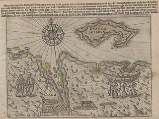
Kislaya Guba

Last updated
Kislaya Guba map Kislaya Guba map.png
Kislaya Guba map

Kislaya Guba (meaning sour bay in Russian) is a fjord on the Kola Peninsula near Murmansk, Russia. The fjord is connected to the Barents Sea to the north and is primarily known as the site of the experimental tidal power project, Kislaya Guba Tidal Power Station. [1]

Russian language East Slavic language

Russian is an East Slavic language, which is official in the Russian Federation, Belarus, Kazakhstan and Kyrgyzstan, as well as being widely used throughout Eastern Europe, the Baltic states, the Caucasus and Central Asia. It was the de facto language of the Soviet Union until its dissolution on 25 December 1991. Although nearly three decades have passed since the breakup of the Soviet Union, Russian is used in official capacity or in public life in all the post-Soviet nation-states, as well as in Israel and Mongolia.

Fjord A long, narrow inlet with steep sides or cliffs, created by glacial activity

Geologically, a fjord or fiord is a long, narrow inlet with steep sides or cliffs, created by a glacier. There are many fjords on the coasts of Alaska, Antarctica, British Columbia, Chile, Greenland, the Faroe Islands, Iceland, Kamchatka, the Kerguelen Islands, New Zealand, Norway, Novaya Zemlya, Labrador, Nunavut, Newfoundland, Quebec, Scotland, South Georgia Island, and Washington state. Norway's coastline is estimated at 29,000 kilometres (18,000 mi) with nearly 1,200 fjords, but only 2,500 kilometres (1,600 mi) when fjords are excluded.

Kola Peninsula peninsula in the northwest of Russia

The Kola Peninsula is a peninsula in the far northwest of Russia. Constituting the bulk of the territory of Murmansk Oblast, it lies almost completely inside the Arctic Circle and is bordered by the Barents Sea in the north and the White Sea in the east and southeast. The city of Murmansk is the most populous human settlement on the peninsula, with a population of over 300,000 as of the 2010 Census.

Kislaya Guba Kislaya Guba tidal power station-2011-0929.jPeG.jpg
Kislaya Guba

See also

Related Research Articles

Royal Swedish Academy of Music

The Royal Swedish Academy of Music or Kungliga Musikaliska Akademien, founded in 1771 by King Gustav III, is one of the Royal Academies in Sweden. The Academy is an independent organization, which acts to promote the artistic, scientific, educational and cultural development of music.

Guba may refer to:

Batu Tiga Komuter station railway station

The Batu Tiga Komuter station is a KTM Komuter train station located in Batu Tiga, Selangor, Malaysia and served by the Port Klang Line.

Mityushikha Bay

Mityushikha Bay is a bay on Severny Island in Novaya Zemlya, Russia. Nuclear tests were conducted in 1961 in the area of the bay.

Zimne Doły Village in Lower Silesian, Poland

Zimne Doły is a village in the administrative district of Gmina Strzelin, within Strzelin County, Lower Silesian Voivodeship, in south-western Poland. Prior to 1945 it was in Germany.

Madaoua Department Department in Tahoua Region, Niger

Madaoua is a department of the Tahoua Region in Niger. Its capital lies at the city of Madaoua. As of 2011, the department had a total population of 443,902 people.

Kola Bay bay

Kola Bay or Murmansk Fjord is a 57-km-long fjord of the Barents Sea that cuts into the northern part of the Kola Peninsula. It is up to 7 km wide and has a depth of 200 to 300 metres. The Tuloma and Kola Rivers discharge into the bay.

RusHydro

RusHydro is a Russian hydroelectricity company. As of early 2012 it has a capacity of 34.9 gigawatts. It is the world's second-largest hydroelectric power producer and is the country's largest power-generating company and the largest successor to RAO UES. The conglomerate, which is partly government-owned, underwent a major consolidation beginning in July, 2007. The head of the company is Yevgeny Dod. Its head office is in Obruchevsky District, South-Western Administrative Okrug, Moscow.

Abdallı Place in Oghuz, Azerbaijan

Abdallı is a village in the Oghuz Rayon of Azerbaijan. The village forms part of the municipality of Xaçmaz.

Czarnica Village in Pomeranian, Poland

Czarnica is a village in Gmina Miastko, Bytów County, Pomeranian Voivodeship, in northern Poland, on the border with West Pomeranian Voivodeship. It lies approximately 23 kilometres (14 mi) south-west of Bytów and 100 km (62 mi) south-west of Gdańsk.

Vaida Bay

Vaida Bay is a body of water on the northwestern coast of the Kola Peninsula, Murmansk Oblast, Russia.

Ledce is a village and municipality in Mladá Boleslav District in the Central Bohemian Region of the Czech Republic.

Kourfeye is a village and rural commune in Niger.

Kislaya Guba Tidal Power Station

The Kislaya Guba Tidal Power Station is an experimental project in Kislaya Guba, Russia.

Stara Brezovica Village in Pčinja District, Serbia

Stara Brezovica is a village in the municipality of Vranje, Serbia. According to the 2002 census, the village has a population of 89 people.

Tidal barrage dam-like structure used to capture the energy from masses of water

A tidal barrage is a dam-like structure used to capture the energy from masses of water moving in and out of a bay or river due to tidal forces.

Renewable energy in Russia Russias renewable energy sources

Renewable energy in Russia mainly consists of hydroelectric energy. The country is the sixth largest producer of renewable energy in the world, although it is 56th when hydroelectric energy is not taken into account. Some 179 TWh of Russia's energy production comes from renewable energy sources, out of a total economically feasible potential of 1823 TWh. 16% of Russia's electricity is generated from hydropower, and less than 1% is generated from all other renewable energy sources combined. Roughly 68% of Russia's electricity is generated from thermal power and 16% from nuclear power.

Bolshaya Volokovaya

Bolshaya Volokovaya is a fjord on the northwestern coast of the Kola Peninsula, Murmansk Oblast, Russia.

Malaya Volokovaya is a fjord on the northwestern coast of the Kola Peninsula, Murmansk Oblast, Russia.

References

Coordinates: 69°22′34″N33°04′33″E / 69.37611°N 33.07583°E / 69.37611; 33.07583

Geographic coordinate system Coordinate system

A geographic coordinate system is a coordinate system that enables every location on Earth to be specified by a set of numbers, letters or symbols. The coordinates are often chosen such that one of the numbers represents a vertical position and two or three of the numbers represent a horizontal position; alternatively, a geographic position may be expressed in a combined three-dimensional Cartesian vector. A common choice of coordinates is latitude, longitude and elevation. To specify a location on a plane requires a map projection.