
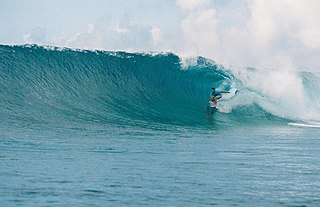
Kitti, also written as Kiti, is one of the twelve administrative divisions of the Micronesian state of Pohnpei. It is located in the southwest of the island of Pohnpei, to the south of Mount Nanlaud.
Kitti, also written as Kiti, is one of the twelve administrative divisions of the Micronesian state of Pohnpei. It is located in the southwest of the island of Pohnpei, to the south of Mount Nanlaud.
Pohnpei State Department of Education operates public schools: [1]
Kitti has a tropical rainforest climate (Af) with very heavy rainfall year-round.
| Climate data for Kitti | |||||||||||||
|---|---|---|---|---|---|---|---|---|---|---|---|---|---|
| Month | Jan | Feb | Mar | Apr | May | Jun | Jul | Aug | Sep | Oct | Nov | Dec | Year |
| Mean daily maximum °C (°F) | 29.4 (85.0) | 29.8 (85.6) | 30.1 (86.2) | 29.8 (85.7) | 30.3 (86.6) | 29.9 (85.9) | 29.6 (85.3) | 29.6 (85.2) | 29.7 (85.4) | 29.9 (85.9) | 30.2 (86.4) | 29.6 (85.3) | 29.8 (85.7) |
| Daily mean °C (°F) | 26.5 (79.7) | 26.8 (80.2) | 26.8 (80.3) | 26.8 (80.2) | 27.1 (80.8) | 26.8 (80.2) | 26.3 (79.3) | 26.3 (79.4) | 26.4 (79.6) | 26.6 (79.8) | 26.8 (80.3) | 26.6 (79.8) | 26.7 (80.0) |
| Mean daily minimum °C (°F) | 23.6 (74.4) | 23.8 (74.8) | 23.6 (74.5) | 23.7 (74.7) | 23.9 (75.0) | 23.6 (74.5) | 22.9 (73.3) | 23.1 (73.6) | 23.2 (73.8) | 23.2 (73.7) | 23.4 (74.2) | 23.5 (74.3) | 23.5 (74.2) |
| Average rainfall mm (inches) | 441.5 (17.380) | 331.5 (13.050) | 378.5 (14.900) | 504.2 (19.850) | 493.3 (19.420) | 496.1 (19.530) | 501.4 (19.740) | 556.3 (21.900) | 517.1 (20.360) | 544.1 (21.420) | 420.1 (16.540) | 411.0 (16.180) | 5,595.1 (220.27) |
| Source: [2] (rainfall) | |||||||||||||
The Federated States of Micronesia, or simply Micronesia, is an island country in Micronesia, a subregion of Oceania. The federation consists of four states—from west to east, Yap, Chuuk, Pohnpei and Kosrae—that are spread across the western Pacific. Together, the states comprise around 607 islands that cover a longitudinal distance of almost 2,700 km (1,700 mi) just north of the equator. They lie northeast of Indonesia and Papua New Guinea, south of Guam and the Marianas, west of Nauru and the Marshall Islands, east of Palau and the Philippines, about 2,900 km (1,800 mi) north of eastern Australia, 3,400 km (2,100 mi) southeast of Japan, and some 4,000 km (2,485 mi) southwest of the main islands of the Hawaiian Islands.

Geography of the Federated States of Micronesia (FSM), a country located in the western Pacific Ocean, and in the Micronesia cultural and ecological sub-region of Oceania. While its total land area is very small at 702 km2 (271 sq mi), it has the 14th largest exclusive economic zone at 2,996,419 km2 (1,156,924 sq mi).
The Trust Territory of the Pacific Islands (TTPI) was a United Nations trust territory in Micronesia administered by the United States from 1947 to 1994. The Imperial Japanese South Seas Mandate had been seized by the US during the Pacific War, as Japan had occupied the territory since the League of Nations gave Japan mandate over the area after World War I. However, in the 1930s, Japan left the League of Nations, and then invaded additional lands. During World War II, military control of the islands was disputed, but by the end of the war the islands had come under control of the Allies. The Trust Territory of the Pacific was created to administer the islands as part of the United States, while still under the auspices of the United Nations. Most of the island groups in the territory became independent states, with some degree of ties kept with the United States: the Federated States of Micronesia, Marshall Islands and Palau are today independent states in a Compact of Free Association with the US, while the Northern Mariana Islands remain under US jurisdiction, as an unincorporated territory and commonwealth.

Pohnpei is an island of the Senyavin Islands which are part of the larger Caroline Islands group. It belongs to Pohnpei State, one of the four states in the Federated States of Micronesia (FSM). Major population centers on Pohnpei include Palikir, the FSM's capital, and Kolonia, the capital of Pohnpei State. Pohnpei Island is the largest with an area of 334 km2 (129 sq mi), and a highest point of 782 m (2,566 ft), the most populous with 36,832 people, and the most developed single island in the FSM.
Palikir is the capital city of the Federated States of Micronesia located in the western Pacific Ocean. A town of slightly under 5,000 residents, it is part of the larger Sokehs municipality, which had a population of 6,647 as of 2010, out of the nation's total population of 106,487. It is situated on the northwest side of Pohnpei island, a high volcanic island surrounded by a fringing coral reef. Nearby to the northeast is the island's largest settlement, the coastal town of Kolonia. It was declared the capital of Micronesia in 1989.

Pohnpei State is one of the four states of the Federated States of Micronesia (FSM). The other states are, from east to west, Kosrae State, Chuuk State, and Yap State. The state's main island is Pohnpei.
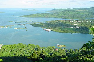
Kolonia is a coastal town and the capital of Pohnpei State in the Federated States of Micronesia (FSM). It's not to be confused with the far smaller Colonia, the capital of the State of Yap. It was also the former FSM capital before being replaced by Palikir in 1989, located nearby to the southwest in the municipality of Sokehs. It has 6,074 people.
The College of Micronesia-FSM (COM-FSM) is a public community college in the Federated States of Micronesia. It began operation in 1963 as the Micronesian Teacher Education Center.

Nett also written as Net, is one of the administrative divisions of Pohnpei State, Federated States of Micronesia.

The Federated States of Micronesia's National Police is the small national police force of the Federated States of Micronesia and is a division of the FSM Department of Justice.
Madolenihmw is one of the administrative divisions of the Micronesian island of Pohnpei. It is located in the central east of the island, to the east of Mount Nahna Laud and south of Mount Kapwuriso. The coast of Madolenihmw includes a large bay which contains the island of Temwen, famous for its Nan Madol ruins.
U, also written Uh, is one of the administrative divisions of Pohnpei State, Federated States of Micronesia. U bears the shortest place name in the Federated States of Micronesia, and one of the shortest in the world.
Oroluk was one of the administrative divisions of Pohnpei State, Federated States of Micronesia. In 1985, it became part of Sokehs Municipality.

Sapwuahfik, formerly Ngatik, or the Raven Islands is a 110-square-kilometer (42 sq mi) atoll of the Federated States of Micronesia. It is a village and municipality of roughly 430 people on a land area of 1.5 square kilometers (0.58 sq mi) in the state of Pohnpei.
Sokehs is a village and municipality on the main island in the state of Pohnpei, Federated States of Micronesia.
Uhsapw is a small island off the south coast of Pohnpei in the Federated States of Micronesia. It lies near Enipein Pah in southern Kitti Municipality. It is covered in greenery, with a small landing point on its western shore.
Pohnpei State Department of Education (PDOE) is an agency of Pohnpei State, Federated States of Micronesia that operates public schools.
Bailey Olter High School, formerly Pohnpei Island Central School (PICS), and Pacific Islands Central School, is a senior high school in Kolonia, Pohnpei Island, Pohnpei State, Federated States of Micronesia. As of 2018 the school, operated by the Pohnpei State Department of Education, has about 1,500 students, making it the state's largest high school. Its service area includes Kolonia, Nett, Sokehs, and U.
Madolenihmw High School is a senior high school in Pohnlangas, Madolenihmw, Pohnpei Island, Pohnpei State, Federated States of Micronesia. As of 2018 the school, operated by the Pohnpei State Department of Education, has about 400 students.
Nanpei Memorial High School, also known as Kitti High School, is a senior high school in Kitti, Pohnpei Island, Pohnpei State, Federated States of Micronesia. As of 2018, the school, operated by the Pohnpei State Department of Education, has about 600 students.
6°50′30″N158°12′30″E / 6.84167°N 158.20833°E
| | This Federated States of Micronesia location article is a stub. You can help Wikipedia by expanding it. |