Kleinschmalkalden

Last updated
Kleinschmalkalden
village
Zentraler Dorfplatz von Kleinschmalkalden mit Brunnen.JPG
Village square and well
FS Kleinschmalkalden.png
Kleinschmalkalden in Floh-Seligenthal
Thuringia location map.svg
Red pog.svg
Kleinschmalkalden
Kleinschmalkalden in Thuringia
Coordinates: 50°47′N10°28′E / 50.783°N 10.467°E / 50.783; 10.467 Coordinates: 50°47′N10°28′E / 50.783°N 10.467°E / 50.783; 10.467
Country Germany
Federal state Thuringia
District Schmalkalden-Meiningen
Municipality Floh-Seligenthal
first recorded1378
merged1 February 2006 [1]
Elevation500 m (1,600 ft)
Population
 (2006) [3]
  Totalapprox. 1,500
Time zone UTC1 (CET)
  Summer (DST) UTC2 (CEST)
Post code
98593
Area code 036849
Website www.kleinschmalkalden.de (unofficial)

Kleinschmalkalden is a village on the southern slope of the Thuringian Forest in Landkreis Schmalkalden-Meiningen of Thuringia, Germany. In 2006 it joined the neighbouring municipality Floh-Seligenthal.

Contents

Geography

The village is situated high in the valley of Schmalkalde river which passes through the centre of the village. For several hundred years, until the end of the Second World War, the river also formed a political boundary creating two distinct villages separated by only a few metres of water. Population, as of 2006, is about 1500 persons. The Rennsteig passes about 5 km (3.1 mi) north of the village.

Kleinschmalkalden is located on road L 1026 between Schmalkalden and Friedrichroda, road L 1127 towards Ruhla via Brotterode branches off in the centre of the village. The former railway line between Schmalkalden and Brotterode is now a cycle path.

History

A smithy on the site of the village was first mentioned in 1378. The part west of Schmalkalde river was recorded in 1465 as a village. It belonged to Amt Brotterode in the lordship of Schmalkalden which was an exclave of the Landgraviate of Hesse-Kassel. In 1866 this village came to Prussia. [4] Another settlement formed east of the river after 1500. [5] It was part of Amt Tenneberg in the duchy of Saxe-Gotha and came to the Free State of Thuringia in 1920. The partition of the village is the reason why there are two evangelical churches, the Hessian and the Gothaic church.

A railway line from Schmalkalden was opened on 6 November 1892. It was extended to Brotterode on 19 December 1898. Kleinschmalkalden station became a double terminus. Passenger traffic from Kleinschmalkalden to Brotterode ceased in 1964. Most of this branch was lifted in 1970, but rebuilt in 1984 for freight traffic. Passenger traffic between Schmalkalden and Kleinschmalkalden ceased on 30 November 1996, the complete line was lifted in 2002. [6] [7]

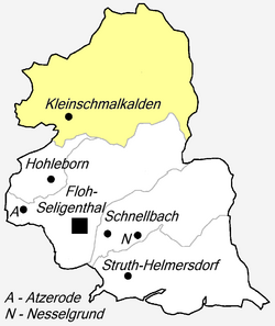
The two villages were administratively merged on 1 October 1945, and the combined centre was renamed Pappenheim after Ludwig Pappenheim (1887–1934), a social democrat, politician, and founder of the Schmalkalden newspaper Volksstimme, who was killed in KZ Neusustrum. On 27 July 1990 the name of the village was reverted to Kleinschmalkalden. In 1994 it entered an administrative cooperation with the neighbouring town Brotterode, [8] before joining the municipality Floh-Seligenthal in 2006. [1]

Sights

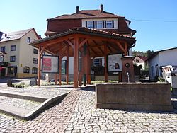
The village is the home of the world's largest cow bell manufactured by the local firm Venter Glocken. The cowbell is 3.28 m (10.8 ft) and weighs 920 kg (2,030 lb). [9]

The older Hessian church was built in 1719, replacing a wooden church of 1570. The Gothaic church was built in 1854. Until then, the inhabitants of the smaller and poorer Gothaic part of the village had to attend the church in the Hessian part, and had to contribute to its maintenance which they could hardly afford. [5]

Economy

Mining was the principal occupation in Kleinschmalkalden until the 17th century, accompanied by ironmaking and charcoal burning. After its decline, the manufacture of metal ware, bellows, and baskets in particular developed. Later, basket making gave way to cigar-making and leather processing. [4] Due to the steep slopes of the surrounding countryside, agriculture played only a minor role. Currently, cow bells, tools, and other metal goods are made in Kleinschmalkalden, and staghorn is processed. A business park has not been established. [5]

The village was a recognised Luftkurort and carried the designation Kurort until its merger with Floh-Seligenthal. The joint municipality is also recognised as a recreation locality. [10]

Education

A schoolhouse was built for the Gothaic part of the village in 1661. [5] Later, the village possessed a Volksschule [11] and a vocational school. [12] A Polytechnic Secondary School existed during the times of the GDR. [13] Nowadays, children from Kleinschmalkalden attend school in Floh. [14]

Related Research Articles

<span class="mw-page-title-main">Thuringia</span> State in Germany

Thuringia, officially the Free State of Thuringia, is a state of central Germany, covering 16,171 square kilometres (6,244 sq mi), the sixth smallest of the sixteen German states. It has a population of about 2.1 million.

<span class="mw-page-title-main">Weimar</span> Town in Thuringia, Germany

Weimar is a city in the state of Thuringia, Germany. It is located in Central Germany between Erfurt in the west and Jena in the east, approximately 80 kilometres southwest of Leipzig, 170 kilometres north of Nuremberg and 170 kilometres west of Dresden. Together with the neighbour cities Erfurt and Jena, it forms the central metropolitan area of Thuringia, with approximately 500,000 inhabitants. The city itself has a population of 65,000. Weimar is well known because of its large cultural heritage and its importance in German history.

<span class="mw-page-title-main">Thuringian Forest</span> Mountain range in the German state of Thuringia

The Thuringian Forest, is a mountain range in the southern parts of the German state of Thuringia, running northwest to southeast. Skirting from its southerly source in foothills to a gorge on its north-west side is the Werra valley. On the other side of the Forest is an upper outcrop of the North German Plain, the Thuringian Basin, which includes the city Erfurt. The south and south-east continuation of the range is the highland often called the Thuringian-Vogtlandian Slate Mountains.

<span class="mw-page-title-main">Saalfeld</span> Town in Thuringia, Germany

Saalfeld is a town in Germany, capital of the Saalfeld-Rudolstadt district of Thuringia. It is best known internationally as the ancestral seat of the Saxe-Coburg and Gotha branch of the Saxon House of Wettin.

<span class="mw-page-title-main">Apolda</span> Town in Thuringia, Germany

Apolda is a town in central Thuringia, Germany, the capital of the Weimarer Land district. It is situated in the center of the triangle Weimar–Jena–Naumburg near the river Ilm, c. 15 kilometres east by north from Weimar. Apolda station lies on the Halle–Bebra railway, which is part of the main line from Berlin to Frankfurt.

<span class="mw-page-title-main">Oberhof, Germany</span> Town in Thuringia, Germany

Oberhof is a town in the Schmalkalden-Meiningen district of Thuringia, Germany. Located in the Thuringian Forest mountain range, it is a winter sports center and health resort. With 1,625 inhabitants, it is visited by 144,000 tourists every year (2016). The town obtained its official city status in 1985.

<span class="mw-page-title-main">Ilmenau</span> Town in Thuringia, Germany

Ilmenau is a town in Thuringia, central Germany. It is the largest town within the Ilm district with a population of 38,600, while the district capital is Arnstadt. Ilmenau is located approximately 33 km south of Erfurt and 135 km north of Nuremberg within the Ilm valley at the northern edge of the Thuringian Forest at an elevation of 500 metres.

<span class="mw-page-title-main">Gladenbach</span> Town in Hesse, Germany

Gladenbach [German pronunciation: [ˈɡlaːdn̩ˌbax](listen)] is a town in Hesse, Germany, in the west of Marburg-Biedenkopf district.

<span class="mw-page-title-main">Barchfeld</span> Ortsteil of Barchfeld-Immelborn in Thuringia, Germany

Barchfeld is a village and a former municipality in the Wartburgkreis district of Thuringia, Germany. Since 31 December 2012, it is part of the municipality Barchfeld-Immelborn.

<span class="mw-page-title-main">Ludwigsau</span> Municipality in Hesse, Germany

Ludwigsau is a community in Hersfeld-Rotenburg district in northeastern Hesse, Germany. With an area of 112 km² it is Hesse's biggest community by land area.

<span class="mw-page-title-main">Alkersleben</span> Municipality in Thuringia, Germany

Alkersleben is a municipality in the Ilm-Kreis district in Thuringia, Germany. The municipality is a member of the collective municipality Riechheimer Berg.

<span class="mw-page-title-main">Selbitz (river)</span> River in Germany

The Selbitz is a river of Bavaria and Thuringia, Germany.

<span class="mw-page-title-main">Thuringian states</span> Several federal states within the German Reich

The Thuringian states refers to the following German federal states within the German Reich:

<span class="mw-page-title-main">Rennsteig</span> Long-distance trail in Germany

The Rennsteig is a ridge walk as well as an historical boundary path in the Thuringian Forest, Thuringian Highland and Franconian Forest in Central Germany. The long-distance trail runs for about 170 km from Eisenach and the Werra valley in the northwest to Blankenstein and the Selbitz river in the southeast.

<span class="mw-page-title-main">Ebertswiese</span>

The Ebertswiese, is a boggy area of grassland in the Thuringian Forest in central Germany. It has been a nature conservation area since 1936 and is a recreation area in the municipality of Floh-Seligenthal on the Rennsteig trail. The River Spitter has its source within the reserve.

The Bebra–Baunatal-Guntershausen railway is a two-track, electrified main line in the German state of Hesse, connecting Kassel with Bebra and Gerstungen on the border with Thuringia, as well as with Bad Karlshafen (formerly) and Warburg on the border with Westphalia. It was originally part of the Friedrich-Wilhelms-Nordbahn, which was completed in 1849. It was one of the first railway lines in the Electorate of Hesse and in Germany.

<i>Dreiherrenstein</i>

A Dreiherrenstein or Dreiherrnstein is the topographic name of a historical tripoint, especially in the German-speaking lands of central Europe, i.e. a place where the border of three princely territories met, together with any enclosures or border fortifications. The word means literally "Three Lords' Stone".

<span class="mw-page-title-main">Brandleite Tunnel</span>

Brandleite Tunnel is a single-bore, double-tracked railway tunnel between the stations of Gehlberg and Oberhof in Thuringia. It leads the Neudietendorf–Ritschenhausen railway beneath the Brandleite massif, a part of the ridge of the Thuringian Forest that reaches a height of 897 m a.s.l. in this area. The tunnel is mostly straight, only at the Oberhof end the tracks curve slightly towards the south. With a length of 3,039 m (9,970 ft) it is the longest railway tunnel in Thuringia, and was the longest in the network of Deutsche Reichsbahn in the GDR. The maximum rock cover amounts to 237 m (778 ft).

<span class="mw-page-title-main">Plaue–Themar railway</span> Railway line in Germany

The Plaue–Themar railway is a 62 kilometre-long, single-track, non-electrified, standard-gauge branch-line in the Thuringian Forest in Germany. The Stützerbach–Schleusingerneundorf section was built as the first Prussian rack railway between 1879 and 1904 and connects the Erfurt–Schweinfurt railway in the north via the towns of Plaue, Ilmenau, Schleusingen and Themar with the Eisenach–Lichtenfels railway in the south.

References

  1. 1 2 Gebietsänderungen vom 01.01. bis 31.12.2006, Statistisches Bundesamt
  2. Average. Varies between 450 m and 550 m.
  3. 1 2 "Herzlich willkommen" . Retrieved 2016-07-08.
  4. 1 2 "Geschichtliches" . Retrieved 2016-07-08.
  5. 1 2 3 4 "Aus der Geschichte Kleinschmalkaldens". Erholungsort Floh-Seligenthal. Retrieved 2016-07-08.
  6. "Schmalkalden - Brotterode" . Retrieved 2016-07-08.
  7. M. Schmidt, G. Thilmann (1997). Der Mommelsteinblitz. Freiburg.
  8. "Thüringer Verordnung über die Bildung der Verwaltungsgemeinschaft "Rennsteig"". 11 April 1994.
  9. "Die größte Kuhglocke der Welt" . Retrieved 2016-07-08.
  10. "Erholungsort Floh-Seligenthal" . Retrieved 2016-07-08.
  11. Thüringisches Hauptstaatsarchiv Weimar: Volksschule in Kleinschmalkalden. Record No. B1322
  12. Thüringisches Hauptstaatsarchiv Weimar: Volksschule in Kleinschmalkalden. Record No. B3895
  13. Stadt- und Kreisarchiv Schmalkalden: Polytechnische Oberschule Pappenheim. Archive records.
  14. "Schulen". Gemeinde Floh-Seligenthal. Retrieved 2016-07-08.