Related Research Articles

The Mulde is a river in Saxony and Saxony-Anhalt, Germany. It is a left tributary of the Elbe and is 124 kilometres (77 mi) long.

The Zwickauer Mulde is a river in Saxony, Germany. It is the left tributary of the Mulde and 166 km (103 mi) in length.

Döbeln is a former district in the Free State of Saxony, Germany. It was bounded by the districts of Torgau-Oschatz, Riesa-Großenhain, Meißen, Mittweida and Muldentalkreis.

Freiberg is a former district in the Free State of Saxony, Germany. It was bounded by the district of Mittlerer Erzgebirgskreis, the city of Chemnitz, the districts of Mittweida, Meißen and Weißeritzkreis, and by the Czech Republic.

Freiberg is a university and former mining town in the Free State of Saxony, Germany. It is a so-called Große Kreisstadt and the administrative centre of Mittelsachsen district.

The Muldentalkreis is a former district in the Free State of Saxony, Germany. It was bounded by the districts
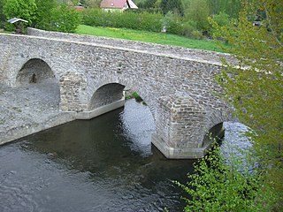
The Freiberger Mulde is the right-hand, 124-kilometre-long (77 mi) headstream of the river Mulde, whose catchment covers an area of 2,981 km2 (1,151 sq mi) in the Czech Republic and Germany in central Saxony. It has a volumetric flow of 35.3 m3/s (1,250 cu ft/s) which is greater than that of the other headstream, the Zwickauer Mulde who flow is about 26.4 m3/s (930 cu ft/s), which is nevertheless the longer stream.

Großschirma is a town in the district of Mittelsachsen, in the Free State of Saxony, Germany. It is situated 7 km northwest of Freiberg. It was formed from the administrative union of the village of Großschirma and the town of Siebenlehn, including their districts, on 1 September 2003.

The Zschopau is a river in Saxony, Germany, left tributary of the Freiberger Mulde. Its source is in the Erzgebirge, on the slopes of the Fichtelberg, near the border with the Czech Republic. It flows north through the towns Schlettau, Wolkenstein, Zschopau, Flöha, Frankenberg, Mittweida and Waldheim. It joins the Freiberger Mulde in the village Schweta, west of Döbeln.

A tub boat lift is a type of boat lift designed to lift tub boats between different elevations of a canal. Tub boats are small boats used to transport coal and other minerals, sometimes working singly, sometimes in long trains. A tub boat lift lifts the boat out of the water. Most other types of boat lift such as locks or inclined planes are designed to move the boat afloat in some kind of water-filled tank, and, apart from maximum dimensions, are not restricted in the type of craft transported. Tub boat lifts and tub boats are designed to work together as a system. A given lift will only be able to lift boats designed for the lift.
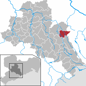
Halsbrücke is a municipality and village in the district of Mittelsachsen, in Saxony, Germany. It is situated just north of Freiberg, on the banks of the Freiberger Mulde river.
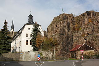
Rechenberg-Bienenmühle is a municipality in the district of Mittelsachsen, in Saxony, Germany.
Mittelsachsen is a district (Kreis) in the Free State of Saxony, Germany.
The Revierwasserlaufanstalt Freiberg or RWA Freiberg, was a historical water management system that delivered driving water to the Freiberg mines in the time of the German Electorate and later Kingdom of Saxony. Today the system is used to supply drinking and industrial water and is operated by the Saxony State Reservoir Office.
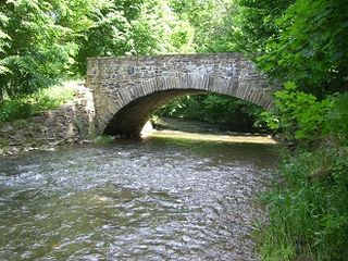
The Bobritzsch is a river of Saxony, Germany. It is a right tributary of the Freiberger Mulde with a length of about 38 km (24 mi). Its Gewässerkennzahl is 5422.
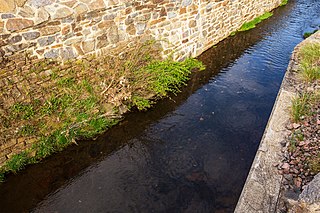
The Münzbach is a river of Saxony, Germany. It is a left tributary of the Freiberger Mulde, which it joins near Freiberg.

The Neugrabenflöße, was a roughly 18 km long Kunstgraben dating to the 17th century. It enabled the rafting of timber for the mining and smelting industries in the Ore Mountains of eastern Germany. It ran from the River Flöha near Fleyh (Fláje) to the Freiberger Mulde near Clausnitz in the Ore Mountains.

The Central Saxon Hills, is a region of Hügelland with indistinct boundaries in the centre of the German state of Saxony.

Siebenlehn is a district of the town Großschirma in Landkreis Mittelsachsen. Until 2003 it was a separate town. Upon fusion with the neighbouring rural municipality Großschirma on 1 September 2003, the town privileges were transferred to the joint municipality.
References
- ↑ Landesamt für Umwelt und Geologie des Freistaates Sachsen: Gewässergütebericht 2003. Dresden 2004, p. 37; (pdf)