
Vester Voldgade is a street in Copenhagen, Denmark which runs from Jarmers Plads to the waterfront between Frederiksholms Kanal and Langebro, passing the City Hall Square on the way.

Kronprinsessegade is a street in central Copenhagen, Denmark. Noted for its Neoclassical houses, it extends from Gothersgade and runs along the southern boundary of Rosenborg Castle Garden, passing Sølvgade and the Nyboder district of old naval barracks before finally joining Øster Voldgade close to Østerport Station. The David Collection, a museum which displays a large collection of Islamic art as well as Danish and European fine and applied arts, is based at No. 30.

Borgergade is a street in central Copenhagen, Denmark. It runs from Gothersgade to Store Kongensgade. As one of relatively few streets in central Copenhagen, the street, in its western part, is dominated by modern buildings. The eastern part passes through the Nyboder district.

Dronningegården is a Modernist residential complex in central Copenhagen, Denmark, consisting of four L-shaped buildings defining an urban space around the intersection of Adelgade and Dronningens Tværgade. Designed by Kay Fisker in collaboration with C. F. Møller and Svenn Eske Kristensen, it was built between 1943 and 1958, during the transition from Traditionalism to Modernism, as a notable example of Nordic Functionalism.

Gammel Mønt is a street in central Copenhagen, Denmark, located one block west of Gothersgade and Rosenborg Castle Garden.

Dronningens Tværgade is a street in central Copenhagen, Denmark, which runs from Bredgade to Rosenborg Castle Garden. The street originally formed a link between the King's Garden and the Queen's Garden. With the Odd Fellows Mansion on Bredgade and the central pavilions of the east fringe of the castle garden located at each their end, the street has axial qualities. These are accentuated by the Dronningegården Estate, a Functionalist housing complex from the 1940s, which forms an urban space around the intersection with Adelgade.
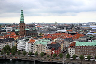
Ved Stranden is a canal side public space and street which runs along a short section of the Zealand side of Slotsholmen Canal in central Copenhagen, Denmark. It begins at Holmens Kanal, opposite the Church of Holmen, and runs west along the canal for one and a half blocks before widening into a small, triangular space adjacent to Højbro Bridge and Højbro Plads. The name of the street refers to Gammel Strand, 'Old Beach', which it formed part of until 1961.

Sølvgade is a street in central Copenhagen, Denmark, extending north-west from Borgergade to The Lakes where Fredens Bro connects it to Fredensgade. The section from Kronprinsessegade to Øster Voldgade follows the walled north-eastern margin of Rosenborg Castle Garden and the next section, from Øster Voldgade to the intersection with Farimagsgade, named Sølvtorvet although it is little more than a busy street junction, separates Copenhagen Botanical Garden from Østre Anlæg.

Ny Kongensgade is a street in central Copenhagen, Denmark, connecting Frederiksholm Canal to H. C. Andersens Boulevard. In the opposite direction, The Prince's Bridge connects the street to Tøjhusgade on Slotsholmen.

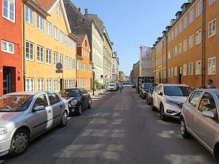
Adelgade is a street in central Copenhagen, Denmark. It runs from Gothersgade in the south to Sankt Pauls Plads with St. Paul's Church in the north. The first half of the street is dominated by modern buildings while its last section passes through the Nyboder district.
Dyrkøb is a street in the Old Town of Copenhagen, Denmark. It runs along the south side of Church of Our Lady, linking Nørregade in the west with Fiolstræde in the east. Kunstnerkollegiet, a dormitory from 1815 designed by Christian Frederik Hansen, is located at the corner with Fiolstræde.

Kronprinsensgade is a street in the Old Town of Copenhagen, Denmark. It links the major shopping street Købmagergade in the west with Pilestræde in the east. The street is known for A.C. Perch's Rea Store.

Rigensgade is a street in central Copenhagen, Denmark. It links Sølvgade in the west with Øster Voldgade in the east. An underpass for pedestrians link the beginning of the street with Rosenborg Castle Gardens on the other side of Sølvgade. Notable buildings include the former Garrison Hospital. and the Methodist Jerusalem's Church.

Ny Adelgade is a street in the Old Town of Copenhagen, Denmark. It runs from Kongens Nytorv in the east to Grønnegade in the west.

Asylgade is a street in the Old Town of Copenhagen, Denmark. It runs from Vingårdstræde in the north to Laksegade in the south.
Fredericiagade is a street in central Copenhagen, Denmark. It runs from Amaliegade in the south to Rigensgade in the north.

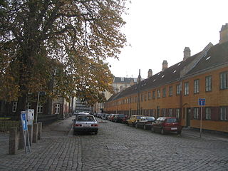
Olfert Fischers Gade is a street in the Nyboder Quarter of central Copenhagen, Denmark and is named after the naval officer Olfert Fischer who commanded the Danish fleet in the Battle of Copenhagen in 1801. It runs from Store Kongensgade in the east to Rigensgade in the west, intersecting the streets Borgergade, Adelgade/Sankt Pauls Plads, Gammelvagt and Kronprinsessegade on the way. The street is closed to through traffic on the west side of Borgergade.
Sankt Pauls Gade is a street in the Nyboder Quarters of central Copenhagen, Denmark. The street passes St. Paul's Church from which it takes its name. The space in front of the church is called Sankt Pauls Plads.

Gernersgade is a street in the Nyboder Quarter of central Copenhagen, Denmark. It runs from Store Kongensgade in the southeast to Rigensgade in the northwest and is closed to through traffic at Sankt Pauls Plads.

Winterfeldts Stiftelse is a charitable housing complex located at Klerkegade 25-29 in central Copenhagen, Denmark.

