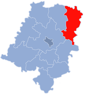
Gmina Lasowice Wielkie, German Gemeinde Gross Lassowitz is a rural gmina in Kluczbork County, Opole Voivodeship, in south-western Poland. Its seat is the village of Lasowice Wielkie, which lies approximately 13 kilometres (8 mi) south of Kluczbork and 31 km (19 mi) north-east of the regional capital Opole.

Bąków is a village in the administrative district of Gmina Grodków, within Brzeg County, Opole Voivodeship, in south-western Poland. It lies approximately 11 kilometres (7 mi) north-west of Grodków, 18 km (11 mi) south-west of Brzeg, and 48 km (30 mi) west of the regional capital Opole.

Morów is a village in the administrative district of Gmina Nysa, within Nysa County, Opole Voivodeship, in south-western Poland. It lies approximately 8 kilometres (5 mi) south-west of Nysa and 54 km (34 mi) south-west of the regional capital Opole.

Kolonia Łomnicka is a village in the administrative district of Gmina Olesno, within Olesno County, Opole Voivodeship, in south-western Poland. It lies approximately 10 kilometres (6 mi) south-east of Olesno and 41 km (25 mi) east of the regional capital Opole.
Gosławice is a village in the administrative district of Gmina Dobrodzień, within Olesno County, Opole Voivodeship, in south-western Poland. It lies approximately 3 kilometres (2 mi) east of Dobrodzień, 17 km (11 mi) south of Olesno, and 40 km (25 mi) east of the regional capital Opole.
Ligota Dobrodzieńska is a village in the administrative district of Gmina Dobrodzień, within Olesno County, Opole Voivodeship, in south-western Poland. It lies approximately 4 kilometres (2 mi) west of Dobrodzień, 16 km (10 mi) south of Olesno, and 34 km (21 mi) east of the regional capital Opole.
Jamy is a village in the administrative district of Gmina Gorzów Śląski, within Olesno County, Opole Voivodeship, in south-western Poland. It lies approximately 9 kilometres (6 mi) south-west of Gorzów Śląski, 11 km (7 mi) north of Olesno, and 46 km (29 mi) north-east of the regional capital Opole.
Kozłowice is a village in the administrative district of Gmina Gorzów Śląski, within Olesno County, Opole Voivodeship, in south-western Poland. It lies approximately 7 kilometres (4 mi) south-west of Gorzów Śląski, 13 km (8 mi) north of Olesno, and 49 km (30 mi) north-east of the regional capital Opole.
Kuźnica Żytniowska is a village in the administrative district of Gmina Rudniki, within Olesno County, Opole Voivodeship, in south-western Poland. It lies approximately 6 kilometres (4 mi) south-west of Rudniki, 17 km (11 mi) north-east of Olesno, and 57 km (35 mi) north-east of the regional capital Opole.
Borowiany is a village in the administrative district of Gmina Zębowice, within Olesno County, Opole Voivodeship, in south-western Poland. It lies approximately 3 kilometres (2 mi) south-west of Zębowice, 17 km (11 mi) south-west of Olesno, and 29 km (18 mi) east of the regional capital Opole.
Kadłub Wolny is a village in the administrative district of Gmina Zębowice, within Olesno County, Opole Voivodeship, in south-western Poland. It lies approximately 2 kilometres (1 mi) east of Zębowice, 13 km (8 mi) south of Olesno, and 33 km (21 mi) east of the regional capital Opole.
Łąka is a village in the administrative district of Gmina Zębowice, within Olesno County, Opole Voivodeship, in south-western Poland.
Nowa Wieś is a village in the administrative district of Gmina Zębowice, within Olesno County, Opole Voivodeship, in south-western Poland. It lies approximately 3 kilometres (2 mi) north-west of Zębowice, 14 km (9 mi) south-west of Olesno, and 30 km (19 mi) north-east of the regional capital Opole.
Osiecko is a village in the administrative district of Gmina Zębowice, within Olesno County, Opole Voivodeship, in south-western Poland. It lies approximately 4 kilometres (2 mi) north-east of Zębowice, 11 km (7 mi) south of Olesno, and 35 km (22 mi) east of the regional capital Opole.
Prusków is a village in the administrative district of Gmina Zębowice, within Olesno County, Opole Voivodeship, in south-western Poland. It lies approximately 3 kilometres (2 mi) north of Zębowice, 12 km (7 mi) south-west of Olesno, and 32 km (20 mi) north-east of the regional capital Opole.
Radawie is a village in the administrative district of Gmina Zębowice, within Olesno County, Opole Voivodeship, in south-western Poland. It lies approximately 6 kilometres (4 mi) north-west of Zębowice, 14 km (9 mi) south-west of Olesno, and 28 km (17 mi) north-east of the regional capital Opole.
Radawka is a village in the administrative district of Gmina Zębowice, within Olesno County, Opole Voivodeship, in south-western Poland. It lies approximately 6 kilometres (4 mi) north-west of Zębowice, 12 km (7 mi) south-west of Olesno, and 30 km (19 mi) north-east of the regional capital Opole.
Zębowice is a village in Olesno County, Opole Voivodeship, in south-western Poland. It is the seat of the gmina called Gmina Zębowice. It lies approximately 14 kilometres (9 mi) south of Olesno and 32 km (20 mi) east of the regional capital Opole.
Kosice is a village in the administrative district of Gmina Zębowice, within Olesno County, Opole Voivodeship, in south-western Poland. It lies approximately 7 kilometres (4 mi) west of Zębowice, 16 km (10 mi) south-west of Olesno, and 26 km (16 mi) north-east of the regional capital Opole.