Liljeholmen is a district of the Hägersten-Liljeholmen borough in Söderort, the southern suburban part of Stockholm.

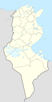
Remada is a town in Tunisia, close to the border with Libya. It is located at around 32°18′22″N10°22′56″E. Remada was built as a garrison town by the French and is today home to a Tunisian military base.

Czarnogoździce is a village in the administrative district of Gmina Krośnice, within Milicz County, Lower Silesian Voivodeship, in south-western Poland. It lies approximately 6 kilometres (4 mi) south of Milicz, and 45 kilometres (28 mi) north-east of the regional capital Wrocław.

Kuźnica is a village in the administrative district of Gmina Zelów, within Bełchatów County, Łódź Voivodeship, in central Poland. It lies approximately 9 kilometres (6 mi) north-east of Zelów, 19 km (12 mi) north of Bełchatów, and 31 km (19 mi) south of the regional capital Łódź.

Bobry is a village in the administrative district of Gmina Radomsko, within Radomsko County, Łódź Voivodeship, in central Poland. It lies approximately 6 kilometres (4 mi) south-west of Radomsko and 85 km (53 mi) south of the regional capital Łódź.

Brylisko is a settlement in the administrative district of Gmina Radomsko, within Radomsko County, Łódź Voivodeship, in central Poland. It lies approximately 5 kilometres (3 mi) south of Radomsko and 85 km (53 mi) south of the regional capital Łódź.
Sośnina is a village in the administrative district of Gmina Mniów, within Kielce County, Świętokrzyskie Voivodeship, in south-central Poland.
Płosków-Kolonia is a village in the administrative district of Gmina Sarnaki, within Łosice County, Masovian Voivodeship, in east-central Poland.
Kuskowo Kmiece is a village in the administrative district of Gmina Strzegowo, within Mława County, Masovian Voivodeship, in east-central Poland.
Wroninko is a village in the administrative district of Gmina Płońsk, within Płońsk County, Masovian Voivodeship, in east-central Poland.
Henryków is a village in the administrative district of Gmina Iłów, within Sochaczew County, Masovian Voivodeship, in east-central Poland.
Szadek is a village in the administrative district of Gmina Blizanów, within Kalisz County, Greater Poland Voivodeship, in west-central Poland.

Szklana Huta is a settlement in the administrative district of Gmina Zbąszyń, within Nowy Tomyśl County, Greater Poland Voivodeship, in west-central Poland. It lies approximately 8 kilometres (5 mi) north-east of Zbąszyń, 10 km (6 mi) west of Nowy Tomyśl, and 64 km (40 mi) west of the regional capital Poznań.

Witrogoszcz is a village in the administrative district of Gmina Łobżenica, within Piła County, Greater Poland Voivodeship, in west-central Poland. It lies approximately 6 kilometres (4 mi) north-east of Łobżenica, 42 km (26 mi) north-east of Piła, and 104 km (65 mi) north of the regional capital Poznań.

Dębowo is a settlement in the administrative district of Gmina Sława, within Wschowa County, Lubusz Voivodeship, in western Poland. It lies approximately 6 kilometres (4 mi) north-west of Sława, 24 km (15 mi) north-west of Wschowa, and 36 km (22 mi) east of Zielona Góra.
Bliźniaki is a village in the administrative district of Gmina Rudniki, within Olesno County, Opole Voivodeship, in south-western Poland.

Wieczywno is a village in the administrative district of Gmina Lipnica, within Bytów County, Pomeranian Voivodeship, in northern Poland. It lies approximately 11 kilometres (7 mi) south-west of Lipnica, 27 km (17 mi) south-west of Bytów, and 100 km (62 mi) south-west of the regional capital Gdańsk.

Zdrójki is a settlement in the administrative district of Gmina Przechlewo, within Człuchów County, Pomeranian Voivodeship, in northern Poland. It lies approximately 4 kilometres (2 mi) east of Przechlewo, 18 km (11 mi) north of Człuchów, and 107 km (66 mi) south-west of the regional capital Gdańsk.

Elk Grove is a former settlement in Humboldt County, California. It was located 6 miles (9.7 km) north-northeast of Orick, at an elevation of 151 feet. It still appeared on maps as of 1947.
Wareside is a small village and civil parish in the East Hertfordshire District, in the county of Hertfordshire. The population of the civil parish as of the 2011 census is 735. It is approximately 3 miles away from the town of Ware and the larger town of Hertford, the county town of Hertfordshire. Nearby villages include Widford, Hunsdon, Babbs Green and Bakers End. Nearby hamlets include Cold Christmas and Helham Green. The B1004 linking Ware to Bishop's Stortford goes through the village and the main A10 road can be picked up at Thundridge. Fanhams Hall Road also links Wareside back to Ware. Ware railway station on the Hertford East Branch Line is located two and a half miles away.


