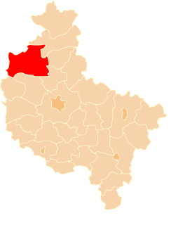
Biała is a village in the administrative district of Gmina Trzcianka, within Czarnków-Trzcianka County, Greater Poland Voivodeship, in west-central Poland. It lies approximately 5 kilometres (3 mi) east of Trzcianka, 17 km (11 mi) north of Czarnków, and 76 km (47 mi) north of the regional capital Poznań.
Dłużewo is a village in the administrative district of Gmina Trzcianka, within Czarnków-Trzcianka County, Greater Poland Voivodeship, in west-central Poland. It lies approximately 5 kilometres (3 mi) north of Trzcianka, 22 km (14 mi) north of Czarnków, and 82 km (51 mi) north of the regional capital Poznań.
Ginterowo is a settlement in the administrative district of Gmina Trzcianka, within Czarnków-Trzcianka County, Greater Poland Voivodeship, in west-central Poland. It lies approximately 6 kilometres (4 mi) south-west of Trzcianka, 19 km (12 mi) north-west of Czarnków, and 79 km (49 mi) north-west of the regional capital Poznań.
Kadłubek is a village in the administrative district of Gmina Trzcianka, within Czarnków-Trzcianka County, Greater Poland Voivodeship, in west-central Poland. It lies approximately 3 kilometres (2 mi) south-east of Trzcianka, 17 km (11 mi) north of Czarnków, and 77 km (48 mi) north of the regional capital Poznań.
Kępa is a village in the administrative district of Gmina Trzcianka, within Czarnków-Trzcianka County, Greater Poland Voivodeship, in west-central Poland. It lies approximately 9 kilometres (6 mi) north-east of Trzcianka, 25 km (16 mi) north of Czarnków, and 84 km (52 mi) north of the regional capital Poznań.
Łomnica is a village in the administrative district of Gmina Trzcianka, within Czarnków-Trzcianka County, Greater Poland Voivodeship, in west-central Poland. It lies approximately 8 kilometres (5 mi) north-east of Trzcianka, 23 km (14 mi) north of Czarnków, and 82 km (51 mi) north of the regional capital Poznań.
Łomnica-Folwark is a settlement in the administrative district of Gmina Trzcianka, within Czarnków-Trzcianka County, Greater Poland Voivodeship, in west-central Poland. It lies approximately 7 kilometres (4 mi) north of Trzcianka, 24 km (15 mi) north of Czarnków, and 84 km (52 mi) north of the regional capital Poznań.
Łomnica-Młyn is a settlement in the administrative district of Gmina Trzcianka, within Czarnków-Trzcianka County, Greater Poland Voivodeship, in west-central Poland. It lies approximately 10 kilometres (6 mi) north-east of Trzcianka, 23 km (14 mi) north of Czarnków, and 82 km (51 mi) north of the regional capital Poznań.
Niekursko is a village in the administrative district of Gmina Trzcianka, within Czarnków-Trzcianka County, Greater Poland Voivodeship, in west-central Poland. It lies approximately 9 kilometres (6 mi) north-west of Trzcianka, 27 km (17 mi) north-west of Czarnków, and 87 km (54 mi) north-west of the regional capital Poznań.
Nowa Wieś is a village in the administrative district of Gmina Trzcianka, within Czarnków-Trzcianka County, Greater Poland Voivodeship, in west-central Poland. It lies approximately 6 kilometres (4 mi) south of Trzcianka, 14 km (9 mi) north-west of Czarnków, and 74 km (46 mi) north-west of the regional capital Poznań.
Pańska Łaska is a village in the administrative district of Gmina Trzcianka, within Czarnków-Trzcianka County, Greater Poland Voivodeship, in west-central Poland. It lies approximately 4 kilometres (2 mi) north-west of Trzcianka, 21 km (13 mi) north-west of Czarnków, and 81 km (50 mi) north-west of the regional capital Poznań.
Pokrzywno is a village in the administrative district of Gmina Trzcianka, within Czarnków-Trzcianka County, Greater Poland Voivodeship, in west-central Poland. It lies approximately 9 kilometres (6 mi) north-east of Trzcianka, 25 km (16 mi) north of Czarnków, and 84 km (52 mi) north of the regional capital Poznań.
Radolin is a village in the administrative district of Gmina Trzcianka, within Czarnków-Trzcianka County, Greater Poland Voivodeship, in west-central Poland. It lies approximately 8 kilometres (5 mi) south-east of Trzcianka, 12 km (7 mi) north of Czarnków, and 72 km (45 mi) north of the regional capital Poznań.
Smolarnia is a village in the administrative district of Gmina Trzcianka, within Czarnków-Trzcianka County, Greater Poland Voivodeship, in west-central Poland. It lies approximately 7 kilometres (4 mi) west of Trzcianka, 20 km (12 mi) north-west of Czarnków, and 80 km (50 mi) north-west of the regional capital Poznań.
Smolary is a village in the administrative district of Gmina Trzcianka, within Czarnków-Trzcianka County, Greater Poland Voivodeship, in west-central Poland. It lies approximately 8 kilometres (5 mi) west of Trzcianka, 22 km (14 mi) north-west of Czarnków, and 81 km (50 mi) north-west of the regional capital Poznań.
Stobno is a village in the administrative district of Gmina Trzcianka, within Czarnków-Trzcianka County, Greater Poland Voivodeship, in west-central Poland. It lies approximately 12 kilometres (7 mi) east of Trzcianka, 22 km (14 mi) north of Czarnków, and 79 km (49 mi) north of the regional capital Poznań.
Straduń is a village in the administrative district of Gmina Trzcianka, within Czarnków-Trzcianka County, Greater Poland Voivodeship, in westcentral Poland. It lies approximately 6 kilometres (4 mi) west of Trzcianka, 21 km (13 mi) north-west of Czarnków, and 81 km (50 mi) north-west of the regional capital Poznań.
Teresin is a village in the administrative district of Gmina Trzcianka, within Czarnków-Trzcianka County, Greater Poland Voivodeship, in west-central Poland. It lies approximately 5 kilometres (3 mi) south-east of Trzcianka, 14 km (9 mi) north of Czarnków, and 74 km (46 mi) north of the regional capital Poznań.
Teresin-Karczma is a settlement in the administrative district of Gmina Trzcianka, within Czarnków-Trzcianka County, Greater Poland Voivodeship, in west-central Poland.
Wrząca is a village in the administrative district of Gmina Trzcianka, within Czarnków-Trzcianka County, Greater Poland Voivodeship, in west-central Poland. It lies approximately 10 kilometres (6 mi) east of Trzcianka, 20 km (12 mi) north of Czarnków, and 79 km (49 mi) north of the regional capital Poznań.