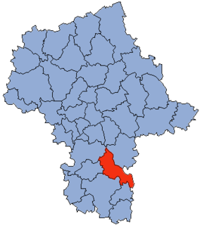
Dąbrowa Duża is a village in the administrative district of Gmina Chynów, within Grójec County, Masovian Voivodeship, in east-central Poland.
Franciszków is a village in the administrative district of Gmina Chynów, within Grójec County, Masovian Voivodeship, in east-central Poland.
Mąkosin is a village in the administrative district of Gmina Chynów, within Grójec County, Masovian Voivodeship, in east-central Poland.
Paulin is a settlement in the administrative district of Gmina Warka, within Grójec County, Masovian Voivodeship, in east-central Poland.

Samwodzie is a village in the administrative district of Gmina Kozienice, within Kozienice County, Masovian Voivodeship, in east-central Poland. It lies approximately 7 kilometres (4 mi) east of Kozienice and 82 km (51 mi) south-east of Warsaw.
Potok is a settlement in the administrative district of Gmina Sobienie-Jeziory, within Otwock County, Masovian Voivodeship, in east-central Poland.
Atalin is a village in the administrative district of Gmina Zwoleń, within Zwoleń County, Masovian Voivodeship, in east-central Poland.
Barycz-Kolonia is a village in the administrative district of Gmina Zwoleń, within Zwoleń County, Masovian Voivodeship, in east-central Poland.
Bożenczyzna is a village in the administrative district of Gmina Zwoleń, within Zwoleń County, Masovian Voivodeship, in east-central Poland.
Józefów is a village in the administrative district of Gmina Zwoleń, within Zwoleń County, Masovian Voivodeship, in east-central Poland.
Linów is a village in the administrative district of Gmina Zwoleń, within Zwoleń County, Masovian Voivodeship, in east-central Poland. It lies approximately 7 kilometres (4 mi) north-west of Zwoleń and 98 km (61 mi) south of Warsaw.
Męciszów is a village in the administrative district of Gmina Zwoleń, within Zwoleń County, Masovian Voivodeship, in east-central Poland. It lies approximately 9 kilometres (6 mi) north-west of Zwoleń and 96 km (60 mi) south of Warsaw.
Mostki is a village in the administrative district of Gmina Zwoleń, within Zwoleń County, Masovian Voivodeship, in east-central Poland.
Niwki is a village in the administrative district of Gmina Zwoleń, within Zwoleń County, Masovian Voivodeship, in east-central Poland.
Osiny is a village in the administrative district of Gmina Zwoleń, within Zwoleń County, Masovian Voivodeship, in east-central Poland. It lies approximately 2 kilometres (1 mi) south-west of Zwoleń and 104 km (65 mi) south of Warsaw.
Sycyna Południowa is a village in the administrative district of Gmina Zwoleń, within Zwoleń County, Masovian Voivodeship, in east-central Poland.
Sydół is a village in the administrative district of Gmina Zwoleń, within Zwoleń County, Masovian Voivodeship, in east-central Poland. It lies approximately 3 kilometres (2 mi) south of Zwoleń and 106 km (66 mi) south of Warsaw.
Wacławów is a village in the administrative district of Gmina Zwoleń, within Zwoleń County, Masovian Voivodeship, in east-central Poland.
Wacławów-Gajówka is a village in the administrative district of Gmina Zwoleń, within Zwoleń County, Masovian Voivodeship, in east-central Poland.
Marianka is a village in the administrative district of Gmina Mszczonów, within Żyrardów County, Masovian Voivodeship, in east-central Poland.