This article relies largely or entirely on a single source .(May 2007) |
Kodikulam is a panchayath in the Idukki district [1] of the Indian state of Kerala. It is about 12 kilometers east of Thodupuzha, the nearest town.[ citation needed ]
This article relies largely or entirely on a single source .(May 2007) |
Kodikulam is a panchayath in the Idukki district [1] of the Indian state of Kerala. It is about 12 kilometers east of Thodupuzha, the nearest town.[ citation needed ]
Kodikulam is a part of Thodupuzha taluk and the main population centers are East Kodikulam, West Kodikulam, Parappuzha, Thennathoor, Thalakkampuram, Chalakkamukku, Koduvely, Vellamchira and Vazhakkala. Kodikulam is divided into two - the eastern part is named Kizhake Kodikulam and the western Padinjare Kodikulam.[ citation needed ]
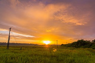
It is part of the agrarian country side of Kerala. Rubber plantations are the main industry in this panchayat.[ citation needed ]
The population is a mix of Hindus, Christians and Muslims.
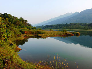
St. Ann's church well-known. It is among the few churches in India named for St. Ann, the mother of the Virgin Mary. Three temples are located in Kodikulam. Thrikkovil Subrahmania temple is in West Kodikulam, Sri Chandrapillil Devi Kshetram managed by NSS Karayogam) is situated on the bank of a tributary to Kaliyar river at West kodikulam, and Anchakulam Bhagavathy temple.[ citation needed ]There are two juma masjid.Both named Muhiyuddeen juma masjid, one situated in vellamchira and other one in west kodikulam

Taliparamba is a Municipality in Taliparamba taluk of Kannur district, Kerala, India. The municipal town spreads over an area of 18.96 square kilometres (7.32 sq mi) and is inhabited by 44,247 number of people.

Muvattupuzha is a municipality in the Ernakulam district of Kerala, India. It is located 26 km (16.2 mi) east of the district headquarters in Thrikkakara and about 170 km (105.6 mi) north of the state capital Thiruvananthapuram. As per the 2011 Indian census, Muvattupuzha has a population of 30,397 people, and a population density of 2,306/km2 (5,970/sq mi).

Perumbavoor is a municipality in the Ernakulam district of Kerala, India. It is located 18 km (11.2 mi) north of the district collectorate in Thrikkakara and about 187 km (116.2 mi) north of the state capital Thiruvananthapuram. Perumbavoor is part of the Kochi metropolitan area and is located 26 km (16.2 mi) northeast of the Kochi city centre. As per the 2011 Indian census, Perumbavoor has a population of 28,110 people, and a population density of 2,065/km2 (5,350/sq mi).

Thrissur, anglicised as Trichur, is one of the 14 districts in the Indian state of Kerala. It is situated in the central region of the state. Spanning an area of about 3,032 km2 (1,171 sq mi), the district is home to over 9% of Kerala's population.
Eloor is a suburb of Kochi and a municipality in Paravur Taluk, Ernakulam District in the Indian state of Kerala, India. It is an industrial area situated around 13 kilometres north of the city centre. It is an island of 14.21 km2 formed between two distributaries of river Periyar and is the largest industrial belt in Kerala. The neighbouring places of Eloor are Kalamassery industrial hub, Aluva, Cheranalloor and Paravur.

Chengamanad is a small town in Aluva, Ernakulam district in the state of Kerala, India. It is situated on the banks of the river Periyar.

Mavoor is a town situated in Kozhikode district in Kerala, India. It is 19 km away from Kozhikode city.

Pappinisseri is a census town and a suburb of Kannur city in Kannur district in the Indian state of Kerala. Pappinissery have consistently won the Swaraj Trophy for best Grama Panchayat from 2017-2018 to 2021. Pappinisseri Panchayat also bagged the third position in the Swaraj Trophy during 2015-2016. Also, Pappinissery has been declared as the best Grama Panchayat in Kerala by Kerala government. Pappinisseri Panchayat comprises two villages, viz Pappinisseri and Aroli. Pappinisseri better known for visha chikitsa kendram
Paravur Taluk, IPA:[pɐrɐʋuːr], is a taluk of Ernakulam District in the Indian State of Kerala. North Paravur is the capital of the taluk. Paravur Taluk lies in the north western part of Ernakulam district bordering Thrissur district. The surrounding taluks are Kochi to the west consisting of Vypin Island, Kodungallur to the north, Chalakudy to the north consisting of Mala, Aluva to the east consisting of Angamaly, Nedumbassery and Aluva, Kanayanur to the south consisting of Cochin City. Paravur is a part of Kochi urban agglomeration area. The western parts of taluk are coastal areas with cultivations like prawn and pokkali rice. The eastern parts are fertile lands. The heavy industries of Kochi is located in Udyogmandal area of the taluk.
Perunad (Ranni-Perunad) is a scenic hilly village in Pathanamthitta district, Kerala state, India. Thiruvalla is the nearest railway station located at a distance of 58 km (36 mi). It's located on the banks of Pamba River and Kakkad River.

Yendayar is a village in Kottayam district, Kerala, India that is totally surrounded by hills. According to local tradition, Mr. J.J. Murphy named the place, which was to be his home until death in 1957, after his mother and the local river. Yendayar is a combination of 'yen' (my) 'thai' (mother) and 'ar' (river). Murphy had come in 1904 to the place which was a thick forest and had no name or people then. He had traveled a long way to reach there. There he established India's first successful rubber plantation. He brought workers from near and far – Kerala, Tamil Nadu, and Karnataka.
Mannancherry is a village in Alappuzha district in Kerala, India. It is situated about 10 km north of Alappuzha town. Vembanad Lake forms the eastern boundary of the village. In governance, Mannancherry is a Panchayat. In parliamentary representation, it is part of the Alappuzha Assembly constituency, as well as the Alappuzha LokSabha constituency. The primary occupation of the village's inhabitants has been coir-making for the past several decades.

Cherukunnu is a census town in Kannur district in the Indian state of Kerala. Cherukunnu town is located on Valapattanam-Pappinisseri-Pazhayangadi main road, situated to the south of the Pazhayangadi in Kannur District in Kerala.
Velom Grama Panchayath is a village in Kozhikode district in the state of Kerala, India.
Elanad is a small town in Thrissur district in the state of Kerala, India.

Vatanappally (Vatanappilly/) is a panchayat and census town in Thrissur district, in the state of Kerala, India.

Muttom is a rural area in Idukki district in the Indian state of Kerala. This place is 66 km away from Cochin. Geographically this place is part of Midland or Idanad region of Kerala.
Perumpillichira is a small village that comes under the Panchayat of Kumaramangalam in Idukki district in the Indian state of Kerala. The name ‘Perumpillichira’ comes from the name of a large water reservoir adjacent to a Hindu temple at the heart of the village. This temple is the center point of the village. Water from Perumpillichira reservoir flows to nearby paddy field throughout the year except in peak summer and it finally reaches the Thodupuzha river. This place is 70 km away from the largest city Cochin in the state of Kerala.

Panathur is a major town in Vellarikundu Taluk of Kasaragod district in Kerala State, India. It belongs to Kanhangad legislative constituency. Its population is about 12,000. It lies 1 km away from Kerala - Karnataka border, 42 km away from the nearest municipality, Kanhangad and 53 km away from the district headquarters, Kasaragod. It is surrounded from three sides by forest reserves and cashew plantations. Kudumbur River flows adjacent to the town.
Chilavu is a small village in Thodupuzha Taluk. It lies in the Idukki district of Kerala, South India. The village is 12 km east of Thodupuzha, on the Velliyamattom route.
10°00′N79°12′E / 10.000°N 79.200°E