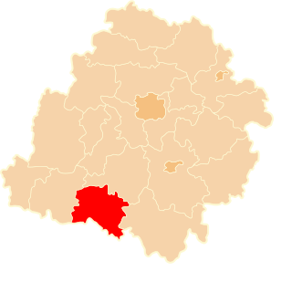
Blizanowice is a village in the administrative district of Gmina Siechnice, within Wrocław County, Lower Silesian Voivodeship, in south-western Poland. Prior to 1945 it was a village of Germany.
Center for Defence Electronics Application Laboratory (DEAL) is a laboratory of the Defence Research & Development Organization (DRDO). Located in Dehradun, its primary function is research and development in the radio communication devices for defence applications. Its mission is development of Radio Communication Systems, Data links, Satellite Communication Systems, Millimeter Wave Communication systems
Trzcianek is a village in the administrative district of Gmina Wąbrzeźno, within Wąbrzeźno County, Kuyavian-Pomeranian Voivodeship, in north-central Poland.

Lisek is a village in the administrative district of Gmina Fabianki, within Włocławek County, Kuyavian-Pomeranian Voivodeship, in north-central Poland. It lies approximately 7 kilometres (4 mi) north-west of Fabianki, 14 km (9 mi) north of Włocławek, and 43 km (27 mi) south-east of Toruń.
Chojeniec-Kolonia is a village in the administrative district of Gmina Siedliszcze, within Chełm County, Lublin Voivodeship, in eastern Poland.
Horodnianka is a settlement in the administrative district of Gmina Czarna Białostocka, within Białystok County, Podlaskie Voivodeship, in north-eastern Poland.

Kaznówek is a village in the administrative district of Gmina Świnice Warckie, within Łęczyca County, Łódź Voivodeship, in central Poland. It lies approximately 5 kilometres (3 mi) north of Świnice Warckie, 22 km (14 mi) west of Łęczyca, and 51 km (32 mi) north-west of the regional capital Łódź.
Kodrań is a village in the administrative district of Gmina Sulmierzyce, within Pajęczno County, Łódź Voivodeship, in central Poland.

Straszówek is a village in the administrative district of Gmina Rozprza, within Piotrków County, Łódź Voivodeship, in central Poland. It lies approximately 5 kilometres (3 mi) east of Rozprza, 13 km (8 mi) south of Piotrków Trybunalski, and 58 km (36 mi) south of the regional capital Łódź.
Łosiniec is a village in the administrative district of Gmina Stoczek Łukowski, within Łuków County, Lublin Voivodeship, in eastern Poland.
Stary Jamielnik is a village in the administrative district of Gmina Stoczek Łukowski, within Łuków County, Lublin Voivodeship, in eastern Poland.

Gabułtów is a village in the administrative district of Gmina Kazimierza Wielka, within Kazimierza County, Świętokrzyskie Voivodeship, in south-central Poland. It lies approximately 4 kilometres (2 mi) east of Kazimierza Wielka and 67 km (42 mi) south of the regional capital Kielce.
Sokólnik is a village in the administrative district of Gmina Grudusk, within Ciechanów County, Masovian Voivodeship, in east-central Poland.
Choiny is a village in the administrative district of Gmina Stanisławów, within Mińsk County, Masovian Voivodeship, in east-central Poland.
Borki Siedleckie is a village in the administrative district of Gmina Suchożebry, within Siedlce County, Masovian Voivodeship, in east-central Poland.

Tanecznica is a village in the administrative district of Gmina Piaski, within Gostyń County, Greater Poland Voivodeship, in west-central Poland. It lies approximately 4 kilometres (2 mi) south of Piaski, 5 km (3 mi) south-east of Gostyń, and 62 km (39 mi) south of the regional capital Poznań.

Bojszowy Nowe is a village, in the administrative district of Gmina Bojszowy, within Bieruń-Lędziny County, Silesian Voivodeship, in southern Poland. It lies approximately 4 kilometres (2 mi) south-west of Bojszowy, 11 km (7 mi) south of Bieruń, and 24 km (15 mi) south of the regional capital Katowice.

Jędrychowo is a village in the administrative district of Gmina Frombork, within Braniewo County, Warmian-Masurian Voivodeship, in northern Poland. It lies approximately 8 kilometres (5 mi) south of Frombork, 15 km (9 mi) south-west of Braniewo, and 77 km (48 mi) north-west of the regional capital Olsztyn.

Liwiec is a village in the administrative district of Gmina Barwice, within Szczecinek County, West Pomeranian Voivodeship, in north-western Poland. It lies approximately 6 kilometres (4 mi) north-west of Barwice, 27 km (17 mi) west of Szczecinek, and 120 km (75 mi) east of the regional capital Szczecin.

Červený Újezd is a village and municipality in Prague-West District in the Central Bohemian Region of the Czech Republic.


