
Lakeview is a town in Lake County, Oregon, United States. The population was 2,418 at the 2020 census. It is the county seat of Lake County. The city bills itself as the "Tallest Town in Oregon" because of its elevation, 4,802 feet (1,464 m) above sea level. Lakeview is situated in the Goose Lake Valley at the foot of the Warner Mountains and at the edge of Oregon's high desert country. Its economy is based on agriculture, lumber production, and government activities. In addition, tourism is an increasingly important part of the city's economy. Oregon's Outback Scenic Byway passes through Lakeview.

Beaver is a city in Beaver County in southwestern Utah, United States. It also serves as the county seat. The population was 3,112 at the 2010 census. It is the county seat of Beaver County.

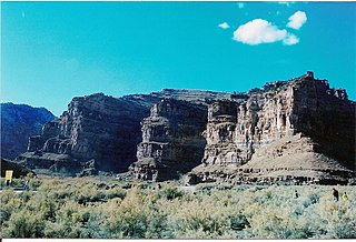
Emery is a town in Emery County, Utah, United States. The population was 288 at the 2010 census.

Owens Lake is a mostly dry lake in the Owens Valley on the eastern side of the Sierra Nevada in Inyo County, California. It is about 5 miles (8.0 km) south of Lone Pine, California. Unlike most dry lakes in the Basin and Range Province that have been dry for thousands of years, Owens held significant water until 1913, when much of the Owens River was diverted into the Los Angeles Aqueduct, causing Owens Lake to desiccate by 1926. A 2004 court order required the LADWP to reestablish a small flow from the river into the lake. Nevertheless, as of 2013, it is the largest single source of dust pollution in the United States.

The Sevier River is a 400-mile (640 km)-long river in the Great Basin of southwestern Utah in the United States. Originating west of Bryce Canyon National Park, the river flows north through a chain of high farming valleys and steep canyons along the west side of the Sevier Plateau, before turning southwest and terminating in the endorheic basin of Sevier Lake in the Sevier Desert. It is used extensively for irrigation along its course, with the consequence that Sevier Lake is usually dry.

The Walker River is a river in west-central Nevada in the United States, approximately 62 miles (100 km) long. Fed principally by snowmelt from the Sierra Nevada mountains of California, it drains an arid portion of the Great Basin southeast of Reno and flows into the endorheic basin of Walker Lake. The river is an important source of water for irrigation in its course through Nevada; water diversions have reduced its flow such that the level of Walker Lake has fallen 160 feet (49 m) between 1882 and 2010. The river was named for explorer Joseph Reddeford Walker, a mountain man and experienced scout who is known for establishing a segment of the California Trail.

The California Trail was an emigrant trail of about 1,600 mi (2,600 km) across the western half of the North American continent from Missouri River towns to what is now the state of California. After it was established, the first half of the California Trail followed the same corridor of networked river valley trails as the Oregon Trail and the Mormon Trail, namely the valleys of the Platte, North Platte, and Sweetwater rivers to Wyoming. The trail has several splits and cutoffs for alternative routes around major landforms and to different destinations, with a combined length of over 5,000 mi (8,000 km).

The historical Burro Schmidt Tunnel is located in the El Paso Mountains of the northern Mojave Desert, in eastern Kern County, southern California.
Las Vegas Boulevard is a major road in Clark County, Nevada, United States, best known for the Las Vegas Strip portion of the road and its casinos. Formerly carrying U.S. Route 91 (US 91), which had been the main highway between Los Angeles, California and Salt Lake City, Utah, it has been bypassed by Interstate 15 and serves mainly local traffic with some sections designated State Route 604.

The Old Spanish Trail is a historical trade route that connected the northern New Mexico settlements of Santa Fe, New Mexico with those of Los Angeles, California and southern California. Approximately 700 mi (1,100 km) long, the trail ran through areas of high mountains, arid deserts, and deep canyons. It is considered one of the most arduous of all trade routes ever established in the United States. Explored, in part, by Spanish explorers as early as the late 16th century, the trail was extensively used by traders with pack trains from about 1830 until the mid-1850s.
The Fremont Valley is a valley located in the western Mojave Desert of California.
Ninemile Canyon is a canyon, approximately 40 miles (64 km) long, located in Carbon and Duchesne counties in eastern Utah, United States. Promoted as "the world's longest art gallery", the canyon is known for its extensive rock art, most of it created by the Fremont culture and the Ute people. The rock art, shelters, and granaries left behind by the Fremont make Ninemile Canyon a destination for archaeologists and tourists alike.

Summer Lake is a large, shallow, alkali lake in Lake County, Oregon, United States located 5 miles (8 km) south of the small, unincorporated community of Summer Lake, Oregon. At high water it is about 15 miles (24 km) long and 5 miles (8 km) wide, and supports a wide variety of birds and other wildlife in its marshes. The lake was named by explorer John C. Fremont on his expedition into Central Oregon in 1843.

Searles Valley is a census-designated place (CDP) in the Searles Valley of the Mojave Desert, in northwestern San Bernardino County, California.
Gypsite was a small community at the site of a mill in Kern County, California.
Saltdale is an unincorporated community in Kern County, California. It is located near Koehn Lake 21 miles (34 km) south-southwest of Ridgecrest near Garlock, California.

The Goose Lake Valley is located in south-central Oregon and northeastern California in the United States. It is a high valley at the northwestern corner of North America's Great Basin. Much of the valley floor is covered by Goose Lake, a large endorheic lake that straddles the Oregon–California border. Native Americans inhabited the Goose Lake Valley for thousands of years before explorers arrived in the 19th century. The pioneer wagon route known as the Applegate Trail crossed the Goose Lake Valley on its way to southern Oregon. At the south end of Goose Lake, the Lassen Cutoff separated from the Applegate Trail and headed south toward the Sacramento Valley. Today, Lakeview, Oregon, is the largest settlement in the valley. Livestock ranching and lumber mills are the valley's main commercial activity. The Goose Lake Valley offers a number of recreational opportunities including hang-gliding, hunting, fishing, and birdwatching.
Mormon Road, also known to the 49ers as the Southern Route, of the California Trail, was a seasonal wagon road first pioneered by a Mormon party from Salt Lake City, Utah led by Jefferson Hunt, that followed the route of Spanish explorers and the Old Spanish Trail across southwestern Utah, northwestern Arizona, southern Nevada and the Mojave Desert of California to Los Angeles in 1847. From 1855, it became a military and commercial wagon route between California and Utah, called the Los Angeles – Salt Lake Road. In later decades this route was variously called the "Old Mormon Road", the "Old Southern Road", or the "Immigrant Road" in California. In Utah, Arizona and Nevada it was known as the "California Road".

The Laguna Creek watershed consists of 25.1 square miles (100 km2) of land within northern California's Alameda County. The watershed drains the foothills of the Diablo Range south of Niles Canyon. To the southeast, the area of Mission Peak Regional Preserve around Mission Peak is included. Agua Caliente, Canada del Aliso, Mission, Morrison, Sabercat, Vargas, and Washington creeks drain the area of the watershed. They drain into Laguna Creek and eventually Mud Slough.

Fremont was an unincorporated community located in Lake County, Oregon, United States. The first homesteaders arrived in the area around Fremont in 1905. The population grew quickly, and the Fremont post office was opened in 1908. By 1915, the local population was declining rapidly due to a severe drought that dried up surface water and lowered the water table in the area around Fremont. Today, Fremont is a ghost town with no population and no surviving structures. The site is located approximately 5 miles (8.0 km) west of Fort Rock state park. The nearest inhabited place is the small unincorporated community of Fort Rock, Oregon, which is 6 miles (9.7 km) southeast of the Fremont townsite.

