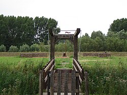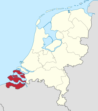
Zeeland is the westernmost and least populous province of the Netherlands. The province, located in the southwest of the country, borders North Brabant to the east, South Holland to the north, as well as the country of Belgium to the south and west. It consists of a number of islands and peninsulas and a strip bordering the Flemish provinces of East and West Flanders. Its capital is Middelburg with a population of 48,544 as of November 2019, although the largest municipality in Zeeland is Terneuzen. Zeeland has two seaports: Vlissingen and Terneuzen. Its area is 2,933 square kilometres (1,132 sq mi), of which 1,154 square kilometres (446 sq mi) is water; it had a population of about 391,000 as of January 2023.

Terneuzen is a city and municipality in the southwestern Netherlands, in the province of Zeeland, in the middle of Zeelandic Flanders. With almost 55,000 inhabitants, it is the most populous municipality of Zeeland.

Sas van Gent is a town in the Netherlands. It is located in the Dutch province of Zeeland. It is a part of the municipality of Terneuzen and lies about 30 km south of Vlissingen on the border with Belgium.

Moerbeke is a municipality in the Belgian province of East Flanders. It is sometimes unofficially called Moerbeke-Waas to distinguish between this place and Moerbeke in Geraardsbergen. The municipality comprises the town of Moerbeke proper, and part of the Dutch-Belgian village Koewacht. In 2021, Moerbeke had a total population of 6,619. The total area is 37.80 km².

Stekene is a municipality located in the Belgian province of East Flanders. Since 1976, the municipality has comprised the towns of Kemzeke, Klein-Sinaai and Stekene proper. It also includes the village Koewacht. In 2021, Stekene had a total population of 18,863. The total area is 44.80 km2.

Zeelandic Flanders is the southernmost region of the province of Zeeland in the south-western Netherlands. It lies south of the Western Scheldt that separates the region from the remainder of Zeeland and the Netherlands to the north. Zeelandic Flanders is bordered to the south and to the east by Belgium.
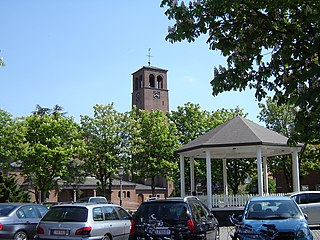
Philippine is a small city in the province of Zeeland, the Netherlands. It lies about 23 kilometres (14 mi) southeast of Vlissingen. It is located on the border with Belgium, 5 kilometres (3.1 mi) southwest of the city of Terneuzen. It received city rights in 1506.

Westdorpe is a village in the Dutch province of Zeeland. It is a part of the municipality of Terneuzen, and lies about 31 km southeast of Vlissingen.

Renesse is a village in the Dutch province of Zeeland. It is a part of the municipality of Schouwen-Duiveland, and lies about 28 km west of Hellevoetsluis.
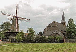
Hoek is a village in the Dutch province of Zeeland. It is a part of the municipality of Terneuzen, and lies about 22 km south-east of Vlissingen.
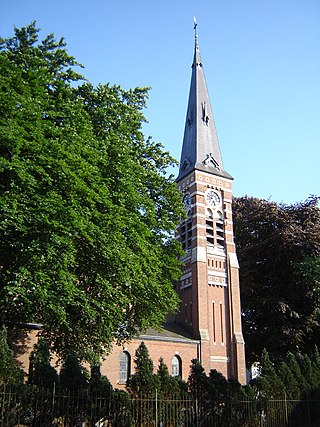
Zuiddorpe is a village in the Dutch province of Zeeland. It is a part of the municipality of Terneuzen, and lies about 34 km southeast of Vlissingen.

Overslag is a village in the Dutch province of Zeeland. It is a part of the municipality of Terneuzen, and lies about 36 km southeast of Vlissingen.

Hoedekenskerke is a village in the Dutch province of Zeeland. It is a part of the municipality of Borsele, and lies about 22 km east of Middelburg.
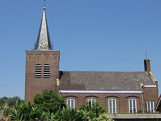
Ellewoutsdijk is a village in the Dutch province of Zeeland. It is a part of the municipality of Borsele, and lies about 18 km east of Vlissingen.

Hoofdplaat is a village in the Dutch province of Zeeland. It is located on the Westerschelde, about 7 km east of Breskens, in the municipality of Sluis.

Waterlandkerkje is a village in the Dutch province of Zeeland. It is located in the municipality of Sluis.

Neeritter is a village in the Dutch province of Limburg. It is located in the municipality of Leudal.

Kieldrecht is a village and deelgemeente (sub-municipality) of Beveren in East Flanders, Belgium. Kieldrecht was an independent municipality until 1977, when it merged with Beveren as part of the fusion of municipalities in Belgium. The village is located on the border with the Netherlands, and forms a single urban area with the Dutch village of Nieuw-Namen.

Viane is a village in the Geraardsbergen municipality of the East Flanders province in the Flemish Community of Belgium. The village is situated in the Denderstreek in the south east of the province, on the border with Flemish Brabant and Hainaut. The river Mark separates the village from the rest of Geraardsbergen.
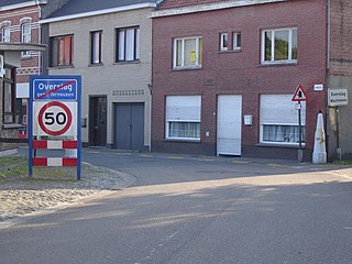
Overslag is a village in the municipality of Wachtebeke in the province of East Flanders in Belgium. The original village was cut in two by the Belgium–Netherlands border. The eponymous village in the Netherlands is part of the municipality of Terneuzen.
