Kolham | |
|---|---|
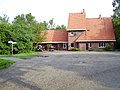
 Church at Kolham | |
 Kolham Location in province of Groningen in the Netherlands  Kolham Kolham (Netherlands) | |
| Coordinates: 53°10′53″N6°44′34″E / 53.1815°N 6.7427°E | |
| Country | Netherlands |
| Province | Groningen |
| Municipality | Midden-Groningen |
| Area | |
• Total | 9.91 km2 (3.83 sq mi) |
| Elevation | 1 m (3 ft) |
| Population (2021) [1] | |
• Total | 1,345 |
| • Density | 140/km2 (350/sq mi) |
| Time zone | UTC+1 (CET) |
| • Summer (DST) | UTC+2 (CEST) |
| Postal code | 9615 |
| Dialing code | 0598 |
Kolham is a village in the Dutch province of Groningen. It is part of the municipality of Midden-Groningen. In 1959, natural gas was discovered at Kolham. Later, it was revealed that Groningen gas field was the largest natural gas field in Europe.