
Debhata is an Upazila of Satkhira District in the Division of Khulna, Bangladesh.

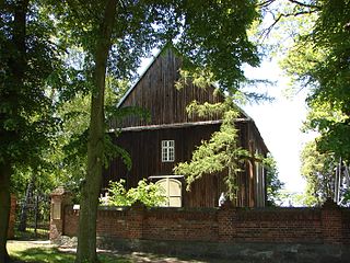
Glinno Wielkie is a village in the administrative district of Gmina Rojewo, within Inowrocław County, Kuyavian-Pomeranian Voivodeship, in north-central Poland. It lies approximately 9 kilometres (6 mi) north-east of Rojewo, 21 km (13 mi) north of Inowrocław, 20 km (12 mi) south-west of Toruń, and 29 km (18 mi) south-east of Bydgoszcz.
Magdaleniec is a village in the administrative district of Gmina Rojewo, within Inowrocław County, Kuyavian-Pomeranian Voivodeship, in north-central Poland. It lies approximately 10 kilometres (6 mi) north-east of Rojewo, 21 km (13 mi) north of Inowrocław, 19 km (12 mi) south-west of Toruń, and 30 km (19 mi) south-east of Bydgoszcz.

Strzygi is a village in the administrative district of Gmina Chodecz, within Włocławek County, Kuyavian-Pomeranian Voivodeship, in north-central Poland. It lies approximately 5 kilometres (3 mi) west of Chodecz, 29 km (18 mi) south of Włocławek, and 75 km (47 mi) south of Toruń.
Gąbinek is a village in the administrative district of Gmina Lubanie, within Włocławek County, Kuyavian-Pomeranian Voivodeship, in north-central Poland. It lies approximately 4 kilometres (2 mi) south-east of Lubanie, 11 km (7 mi) north-west of Włocławek, and 41 km (25 mi) south-east of Toruń.
Humlin is a village in the administrative district of Gmina Włocławek, within Włocławek County, Kuyavian-Pomeranian Voivodeship, in north-central Poland. It lies approximately 13 kilometres (8 mi) south-west of Włocławek and 59 km (37 mi) south-east of Toruń.
Markowo is a village in the administrative district of Gmina Włocławek, within Włocławek County, Kuyavian-Pomeranian Voivodeship, in north-central Poland. It lies approximately 12 kilometres (7 mi) south-west of Włocławek and 57 km (35 mi) south-east of Toruń.
Bielawy is a village in the administrative district of Gmina Lubraniec, within Włocławek County, Kuyavian-Pomeranian Voivodeship, in north-central Poland. It lies approximately 4 kilometres (2 mi) north-east of Lubraniec, 16 km (10 mi) south-west of Włocławek, and 55 km (34 mi) south of Toruń.
Dąbie Kujawskie is a village in the administrative district of Gmina Lubraniec, within Włocławek County, Kuyavian-Pomeranian Voivodeship, in north-central Poland.
Kazanie is a village in the administrative district of Gmina Lubraniec, within Włocławek County, Kuyavian-Pomeranian Voivodeship, in north-central Poland. It lies approximately 6 kilometres (4 mi) north-east of Lubraniec, 14 km (9 mi) south-west of Włocławek, and 56 km (35 mi) south of Toruń.
Milżyn, Włocławek, Poland is a village in the administrative district of Gmina Lubraniec, within Włocławek County, Kuyavian-Pomeranian Voivodeship, in north-central Poland. It lies approximately 7 kilometres (4 mi) south of Lubraniec, 26 km (16 mi) south-west of Włocławek, and 63 km (39 mi) south of Toruń.
Kamionek is a village in the administrative district of Gmina Mogilno, within Mogilno County, Kuyavian-Pomeranian Voivodeship, in north-central Poland. It lies approximately 10 kilometres (6 mi) south of Mogilno, 62 km (39 mi) south of Bydgoszcz, and 67 km (42 mi) south-west of Toruń.
Kopytów is a village in the administrative district of Gmina Kodeń, within Biała Podlaska County, Lublin Voivodeship, in eastern Poland, close to the border with Belarus. It lies approximately 8 kilometres (5 mi) north of Kodeń, 32 km (20 mi) east of Biała Podlaska, and 106 km (66 mi) north-east of the regional capital Lublin.
Dąbrowa is a village in the administrative district of Gmina Strzegowo, within Mława County, Masovian Voivodeship, in east-central Poland. It lies approximately 8 kilometres (5 mi) north of Strzegowo, 18 km (11 mi) south of Mława, and 97 km (60 mi) north-west of Warsaw.
Zielonka is a village in the administrative district of Gmina Wierzbinek, within Konin County, Greater Poland Voivodeship, in west-central Poland. It lies approximately 4 kilometres (2 mi) east of Wierzbinek, 32 km (20 mi) north-east of Konin, and 113 km (70 mi) east of the regional capital Poznań.
Sierpowo is a village in the administrative district of Gmina Śmigiel, within Kościan County, Greater Poland Voivodeship, in west-central Poland. It lies approximately 6 kilometres (4 mi) south-east of Śmigiel, 15 km (9 mi) south-west of Kościan, and 54 km (34 mi) south-west of the regional capital Poznań.
Ugoda is a village in the administrative district of Gmina Rawicz, within Rawicz County, Greater Poland Voivodeship, in west-central Poland. It lies approximately 9 kilometres (6 mi) south-east of Rawicz and 93 km (58 mi) south of the regional capital Poznań.
Boruta is a village in the administrative district of Gmina Lubsza, within Brzeg County, Opole Voivodeship, in south-western Poland. It lies approximately 7 kilometres (4 mi) north-east of Lubsza, 13 km (8 mi) north-east of Brzeg, and 43 km (27 mi) north-west of the regional capital Opole.
Borima is a village in Troyan Municipality, Lovech Province, northern Bulgaria.
Namangan is a raion (district) of Namangan Region in Uzbekistan. The capital lies at Tashbulak.

