Grudza is a village in the administrative district of Gmina Mirsk, within Lwówek Śląski County, Lower Silesian Voivodeship, in south-western Poland, close to the Czech border.
Mieniany is a village in the administrative district of Gmina Hrubieszów, within Hrubieszów County, Lublin Voivodeship, in eastern Poland, close to the border with Ukraine. It lies approximately 11 kilometres (7 mi) south-east of Hrubieszów and 113 km (70 mi) south-east of the regional capital Lublin.
Grabówka is a village in the administrative district of Gmina Annopol, within Kraśnik County, Lublin Voivodeship, in eastern Poland. It lies approximately 9 kilometres (6 mi) north-east of Annopol, 20 km (12 mi) west of Kraśnik, and 56 km (35 mi) south-west of the regional capital Lublin.
Ostrów is a village in the administrative district of Gmina Suraż within Białystok County, Podlaskie Voivodeship, in northeastern Poland.
Podgórze is a village in the administrative district of Gmina Świnice Warckie, within Łęczyca County, Łódź Voivodeship, in central Poland. It lies approximately 4 kilometres (2 mi) north-east of Świnice Warckie, 18 km (11 mi) west of Łęczyca, and 48 km (30 mi) north-west of the regional capital Łódź.
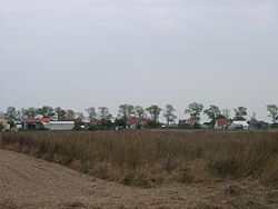
Tuchań is a village in the administrative district of Gmina Kiełczygłów, within Pajęczno County, Łódź Voivodeship, in central Poland.
Idzikowice is a village in the administrative district of Gmina Dalików, within Poddębice County, Łódź Voivodeship, in central Poland. It lies approximately 8 kilometres (5 mi) north of Dalików, 11 km (7 mi) north-east of Poddębice, and 32 km (20 mi) north-west of the regional capital Łódź.
Kłódno is a village in the administrative district of Gmina Wartkowice, within Poddębice County, Łódź Voivodeship, in central Poland.
Wygwizdów is a village in the administrative district of Gmina Przedbórz, within Radomsko County, Łódź Voivodeship, in central Poland. It lies approximately 5 kilometres (3 mi) east of Przedbórz, 35 km (22 mi) east of Radomsko, and 84 km (52 mi) south-east of the regional capital Łódź.
Pławidła is a village in the administrative district of Gmina Żytno, within Radomsko County, Łódź Voivodeship, in central Poland. It lies approximately 3 kilometres (2 mi) north-east of Żytno, 20 km (12 mi) south-east of Radomsko, and 94 km (58 mi) south of the regional capital Łódź.
Krzywiec is a village in the administrative district of Gmina Aleksandrów Łódzki, within Zgierz County, Łódź Voivodeship, in central Poland. It lies approximately 5 kilometres (3 mi) south of Aleksandrów Łódzki, 12 km (7 mi) south-west of Zgierz, and 13 km (8 mi) west of the regional capital Łódź.
Julianki is a village in the administrative district of Gmina Parzęczew, within Zgierz County, Łódź Voivodeship, in central Poland. It lies approximately 3 kilometres (2 mi) east of Parzęczew, 16 km (10 mi) north-west of Zgierz, and 24 km (15 mi) north-west of the regional capital Łódź.
Koszyce Małe is a village in the administrative district of Gmina Tarnów, within Tarnów County, Lesser Poland Voivodeship, in southern Poland.
Krzepin is a village in the administrative district of Gmina Secemin, within Włoszczowa County, Świętokrzyskie Voivodeship, in south-central Poland. It lies approximately 8 kilometres (5 mi) east of Secemin, 12 km (7 mi) south of Włoszczowa, and 50 km (31 mi) west of the regional capital Kielce.
Grochy-Krupy is a village in the administrative district of Gmina Gzy, within Pułtusk County, Masovian Voivodeship, in east-central Poland.
Papiernia is a village in the administrative district of Gmina Włoszakowice, within Leszno County, Greater Poland Voivodeship, in west-central Poland. It lies approximately 6 kilometres (4 mi) west of Włoszakowice, 21 km (13 mi) west of Leszno, and 69 km (43 mi) south-west of the regional capital Poznań.
Turze is a village in the administrative district of Gmina Ostrzeszów, within Ostrzeszów County, Greater Poland Voivodeship, in west-central Poland. It lies approximately 7 kilometres (4 mi) south-west of Ostrzeszów and 137 km (85 mi) south-east of the regional capital Poznań.
Przyłęki is a village in the administrative district of Gmina Pełczyce, within Choszczno County, West Pomeranian Voivodeship, in north-western Poland. It lies approximately 11 kilometres (7 mi) south of Pełczyce, 25 km (16 mi) south of Choszczno, and 73 km (45 mi) south-east of the regional capital Szczecin.
Viisu is a village in Roosna-Alliku Parish, Järva County in northern-central Estonia.

The Muma River is a right tributary of the Han River in the Yangtze river basin of northern China. It has a length of 128 kilometres (80 mi) and a drainage area of 2,782 square kilometres (1,074 sq mi). It originates in and flows entirely within Xixiang County of Shaanxi Province. The annual average flow is 45 cubic metres per second (1,600 cu ft/s). It has a natural drop of 1,613 metres (5,292 ft) and water reserves of 90,000 kilowatts. It arises near the border with Sichuan Province at 32°45′23″N107°22′15″E, flows northwest and debouches into the Han River at 33°05′47″N107°56′51″E.