Łopuchówko is a village in the administrative district of Gmina Murowana Goślina, within Poznań County, Greater Poland Voivodeship, in west-central Poland. It lies approximately 7 kilometres (4 mi) north-east of Murowana Goślina and 26 km (16 mi) north-east of the regional capital Poznań.
Ruda Milicka is a village in the administrative district of Gmina Milicz, within Milicz County, Lower Silesian Voivodeship, in south-western Poland. Prior to 1945 it was in Germany.

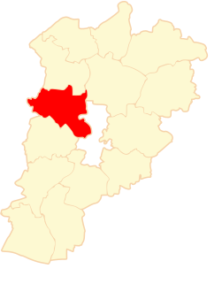
Staw is a village in the administrative district of Gmina Zbiczno, within Brodnica County, Kuyavian-Pomeranian Voivodeship, in north-central Poland. It lies 7 kilometres (4 mi) east of Zbiczno, 11 km (7 mi) north-east of Brodnica, and 67 km (42 mi) north-east of Toruń.
Boguszyn is a village in the administrative district of Gmina Wałcz, within Wałcz County, West Pomeranian Voivodeship, in north-western Poland. It lies approximately 15 kilometres (9 mi) north-west of Wałcz and 117 km (73 mi) east of the regional capital Szczecin.
Wólka Rejowiecka is a village in the administrative district of Gmina Rejowiec, within Chełm County, Lublin Voivodeship, in eastern Poland. It lies approximately 2 kilometres (1 mi) north of Rejowiec, 16 km (10 mi) west of Chełm, and 52 km (32 mi) east of the regional capital Lublin.
Zawada is a village in the administrative district of Gmina Łęczyca, within Łęczyca County, Łódź Voivodeship, in central Poland. It lies approximately 8 kilometres (5 mi) north-west of Łęczyca and 42 km (26 mi) north-west of the regional capital Łódź.
Zakrzew-Czekaj is a settlement in the administrative district of Gmina Kodrąb, within Radomsko County, Łódź Voivodeship, in central Poland.
Strzelce Małe is a village in the administrative district of Gmina Masłowice, within Radomsko County, Łódź Voivodeship, in central Poland. It lies approximately 25 km (16 mi) east of Radomsko and 80 km (50 mi) south of the regional capital Łódź.
Olszamowice-Porąbka is a village in the administrative district of Gmina Fałków, within Końskie County, Świętokrzyskie Voivodeship, in south-central Poland.
Górki Pierwsze is a village in the administrative district of Gmina Gostynin, within Gostynin County, Masovian Voivodeship, in east-central Poland.
Pęchratka Mała is a village in the administrative district of Gmina Andrzejewo, within Ostrów Mazowiecka County, Masovian Voivodeship, in east-central Poland. It lies approximately 8 kilometres (5 mi) west of Andrzejewo, 15 km (9 mi) east of Ostrów Mazowiecka, and 103 km (64 mi) north-east of Warsaw.
Łączewna is a village in the administrative district of Gmina Przedecz, within Koło County, Greater Poland Voivodeship, in west-central Poland.
Bylew is a village in the administrative district of Gmina Ślesin, within Konin County, Greater Poland Voivodeship, in west-central Poland.
Brudzew is a village in Turek County, Greater Poland Voivodeship, in west-central Poland. It is the seat of the gmina called Gmina Brudzew. It lies approximately 12 kilometres (7 mi) north-east of Turek and 120 km (75 mi) east of the regional capital Poznań.
Bogacka Szklarnia is a village in the administrative district of Gmina Kluczbork, within Kluczbork County, Opole Voivodeship, in south-western Poland. From the Prussian-led unification of Germany in 1871 until the end of WWII, it was known as Glashütte in the administrative district of Upper Silesia in Eastern Prussia, and settled predominantly by ethnic Slavs, Evangelical Protestants, and Silesian German farmers. No other evidence of protestant evangelical influence remains, except for the abandoned schoolhouse which still stands behind an overgrown copse of trees.
Suchorze is a village in the administrative district of Gmina Trzebielino, within Bytów County, Pomeranian Voivodeship, in northern Poland. It lies approximately 9 kilometres (6 mi) north of Trzebielino, 31 km (19 mi) north-west of Bytów, and 101 km (63 mi) west of the regional capital Gdańsk.

Sitno , (German: Zittno) is a village in the administrative district of Gmina Kartuzy, within Kartuzy County, Pomeranian Voivodeship, in northern Poland. It lies approximately 7 kilometres (4 mi) east of Kartuzy and 22 km (14 mi) west of the regional capital Gdańsk.
Pietrzwałd is a village in the administrative district of Gmina Sztum, within Sztum County, Pomeranian Voivodeship, in northern Poland. It lies approximately 5 kilometres (3 mi) east of Sztum and 57 km (35 mi) south-east of the regional capital Gdańsk.
Małe Turze is a village in the administrative district of Gmina Tczew, within Tczew County, Pomeranian Voivodeship, in northern Poland. It lies approximately 8 kilometres (5 mi) west of Tczew and 30 km (19 mi) south of the regional capital Gdańsk.
Przybrodzie is a settlement in the administrative district of Gmina Polanów, within Koszalin County, West Pomeranian Voivodeship, in north-western Poland. It lies approximately 2 kilometres (1 mi) east of Polanów, 37 km (23 mi) east of Koszalin, and 160 km (99 mi) north-east of the regional capital Szczecin.