Matczyn is a village in the administrative district of Gmina Bełżyce, within Lublin County, Lublin Voivodeship, in eastern Poland. It lies approximately 5 kilometres (3 mi) north-east of Bełżyce and 19 km (12 mi) west of the regional capital Lublin.
Wierzbowo is a village in the administrative district of Gmina Lisewo, within Chełmno County, Kuyavian-Pomeranian Voivodeship, in north-central Poland. It lies 13 kilometres (8 mi) south-east of Chełmno and 32 km (20 mi) north of Toruń.
Linówek is a village in the administrative district of Gmina Śliwice, within Tuchola County, Kuyavian-Pomeranian Voivodeship, in north-central Poland. It lies approximately 4 kilometres (2 mi) north-east of Śliwice, 29 km (18 mi) north-east of Tuchola, and 70 km (43 mi) north of Bydgoszcz.
Wioska is a village in the administrative district of Gmina Skępe, within Lipno County, Kuyavian-Pomeranian Voivodeship, in north-central Poland.
Kownaty is a village in the administrative district of Gmina Piątnica, within Łomża County, Podlaskie Voivodeship, in north-eastern Poland. It lies approximately 11 kilometres (7 mi) north-east of Piątnica, 13 km (8 mi) north-east of Łomża, and 65 km (40 mi) west of the regional capital Białystok.
Kamionka is a village in the administrative district of Gmina Bolesławiec, within Wieruszów County, Łódź Voivodeship, in central Poland. It lies approximately 4 kilometres (2 mi) north-east of Bolesławiec, 10 km (6 mi) south-east of Wieruszów, and 107 km (66 mi) south-west of the regional capital Łódź.
Kolonia Bogoria is a village in the administrative district of Gmina Bogoria, within Staszów County, Świętokrzyskie Voivodeship, in south-central Poland. It lies approximately 4 kilometres (2 mi) south-west of Bogoria, 9 km (6 mi) north-east of Staszów, and 52 km (32 mi) south-east of the regional capital Kielce.
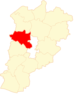
Budy Strzegowskie is a village in the administrative district of Gmina Strzegowo, within Mława County, Masovian Voivodeship, in east-central Poland.
Kajetanów is a village in the administrative district of Gmina Iłża, within Radom County, Masovian Voivodeship, in east-central Poland. It lies approximately 7 kilometres (4 mi) north of Iłża, 21 km (13 mi) south of Radom, and 112 km (70 mi) south of Warsaw.
Kłonowiec-Kurek is a village in the administrative district of Gmina Skaryszew, within Radom County, Masovian Voivodeship, in east-central Poland.
Sosna-Trojanki is a village in the administrative district of Gmina Suchożebry, within Siedlce County, Masovian Voivodeship, in east-central Poland.
Budy Kupientyńskie is a village in the administrative district of Gmina Sokołów Podlaski, within Sokołów County, Masovian Voivodeship, in east-central Poland. It lies approximately 5 kilometres (3 mi) north of Sokołów Podlaski and 88 km (55 mi) east of Warsaw.
Lipiny is a village in the administrative district of Gmina Osiek Mały, within Koło County, Greater Poland Voivodeship, in west-central Poland. It lies approximately 5 kilometres (3 mi) north of Osiek Mały, 14 km (9 mi) north of Koło, and 115 km (71 mi) east of the regional capital Poznań.

Zaparcin is a settlement in the administrative district of Gmina Stęszew, within Poznań County, Greater Poland Voivodeship, in west-central Poland. It lies approximately 5 kilometres (3 mi) south of Stęszew and 26 km (16 mi) south-west of the regional capital Poznań.
Maryniec is a village in the administrative district of Gmina Krajenka, within Złotów County, Greater Poland Voivodeship, in west-central Poland. It lies approximately 10 kilometres (6 mi) south of Krajenka, 16 km (10 mi) south of Złotów, and 92 km (57 mi) north of the regional capital Poznań.
Kiełpin is a village in the administrative district of Gmina Konarzyny, within Chojnice County, Pomeranian Voivodeship, in northern Poland. It lies approximately 8 kilometres (5 mi) north-west of Konarzyny, 26 km (16 mi) north-west of Chojnice, and 102 km (63 mi) south-west of the regional capital Gdańsk.
Hopy is a village in the administrative district of Gmina Przodkowo, within Kartuzy County, Pomeranian Voivodeship, in northern Poland. It lies approximately 5 kilometres (3 mi) north-west of Przodkowo, 8 km (5 mi) north of Kartuzy, and 27 km (17 mi) west of the regional capital Gdańsk.
Rybaki is a village in the administrative district of Gmina Somonino, within Kartuzy County, Pomeranian Voivodeship, in northern Poland. It lies approximately 7 kilometres (4 mi) south-west of Somonino, 13 km (8 mi) south of Kartuzy, and 36 km (22 mi) south-west of the regional capital Gdańsk.
Swaryszewo is a settlement in the administrative district of Gmina Nowy Dwór Gdański, within Nowy Dwór Gdański County, Pomeranian Voivodeship, in northern Poland. It lies approximately 8 kilometres (5 mi) east of Nowy Dwór Gdański and 42 km (26 mi) east of the regional capital Gdańsk.
Pieniężno Drugie is a village in the administrative district of Gmina Pieniężno, within Braniewo County, Warmian-Masurian Voivodeship, in northern Poland.