Karaikudi is the largest city in Sivaganga district in the Indian state of Tamil Nadu. Karaikudi Urban Agglomoration is the 21st largest urban area of Tamil Nadu based on 2011 census data. It is part of the area commonly referred to as "Chettinad" and has been declared a City Municipal Corporation by the Government of Tamil Nadu, on account of the palatial houses built with limestone called Kaarai veedu. For this reason, the place is sometimes called Kaarai Nagar locally. The newly formed Karaikudi Municipal Corporation spreads about 94.31 km2 (36.41 sq mi) which undergoes major developments as part of Government Schemes.

Chettinad is a name that collectively refers to a locality that comprises 56 villages in the Sivaganga district and 20 villages in Pudukottai district, which was historically ruled by the Ramnad kingdom of Pandya Nadu. It has a small portion extending into the Pudukottai District in Tamil Nadu; Karaikudi is the major town of this area and is considered the urban center for the Chettinadu villages.

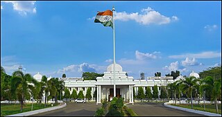
Sivaganga is a City and headquarters of the Sivaganga district in the Indian state of Tamil Nadu. It is known for the 16th-century Sivagangai Fort, located in City Centre. Inside the fort, the Rajarajeshwari Amman Temple features many ornate sculptures. Nearby, the Government Museum has prehistoric relics and natural history displays. There are many famous places like historical monuments, Historical temples and lands donated by King Muthuvaduganatha Thevar and other many temples been built and maintained by King Maruthpandiyar brothers, Princess Velunachiyar which are still available and maintained in good condition by public and authorities. The City is located at a distance of 48 km from Madurai and 449 km from the state capital Chennai.

Pudukkottai City is the administrative headquarters of Pudukkottai district in the Indian state of Tamil Nadu. It is one of the oldest and Heritage city in India which contains a lot of histories. The city is also known as Thondaiman Pudukkottai. Pudukottai Municipal Corporation is located on the banks of the Vellar River. It has been ruled, at different times, by the Mutharaiyar dynasty, Cholas, Early Pandyas, Thondaimans, and the British. It is situated about 372 kilometres (231 mi) southwest of the state capital Chennai,50 kilometres (31 mi) southeast of Tiruchirappalli, 60 kilometres (37 mi) southwest of Thanjavur ,108 kilometres (67 mi) northeast of Madurai,116 kilometres (72 mi) East of Dindigul and 78 kilometres (48 mi) Northeast of Sivaganga. Tamil Nadu's first woman Asian Games competitor, Santhi Soundarajan, is from Pudukkottai.

Rayavaram is a village Panchayat in Pudukkottai district in Tamil Nadu, India.

Thirumayam is a town located in Pudukkottai district of the Indian state of Tamil Nadu. It is a place of historical importance located about 22 km from the town of Pudukkottai & 22 km from the city of Karaikudi. The noted Indian independence activist Sathyamurthy was born in Thirumayam in 1887.

Melur is the Northern entrance of Madurai district. It is the town and municipality in the Madurai North in the Indian state of Tamil Nadu. Melur Old Name is Called Naduvi Nadu. The name Melur name comes from "Mela Nadu". Melur is called Thaigramam. It is the biggest taluk within the Madurai District. As of 2011, the town had a population of 40,017. Melur is an agricultural land in Madurai and the climate around the area is tropical.

Puduvayal is a town in Karaikudi taluk, Sivaganga district in the Indian state of Tamil Nadu. It is a town located in the Chettinad region of the Sivagangai district. On road, it is 12 km away from Karaikudi and 21 km away from Aranthangi. This town is famous for its rice mills. Puduvayal is the 2nd largest rice producer in Tamil Nadu. Puduvayal is an important commercial centre for trade in the Sivaganga district and part of the suburban region of Karaikudi. The town is famous for its Veerasekara Umaiyambigai Temple. Nearby Kandanur is famous for Kandanur Sivan Kovil—which is a replica of the Madurai Meenakshi Temple—built by Nagarthars.
Aranthangi is a town in Pudukkottai district in the state of Tamil Nadu, India. As of 2011, it had a population of 40,814.
Vellakovil is a municipal town in Kangeyam taluk of Tirupur District, in the Indian state of Tamil Nadu. It is located on National Highway 81 between Trichy and Coimbatore. The town is spread in an area of 64.75 km2. As of 2011, the town had a population of 40,359. Kannapuram village located near to this town is famous for Kangeyam breed cattle market that happens on every year during Mariyamman temple festival in the month of April. It is an industrialized town with traditional agriculture being the occupation for most of the people. It holds lot of Power looms weaving bedsheets, floor mats and cotton materials being exported to foreign countries via exporters present in Karur.

Avudaiyarkoil is a village in the Pudukkotai district of Tamil Nadu, India. The village has a temple named Tirupperunturai. It is about 14 kilometres (9 mi) South East of the Major town Aranthangi along State Highway 26, on the South bank of the Vellar River.
Narchandupatti is a small town located 16 kilometres from Pudukkottai. Many members of the Nagarathar groups are among its inhabitants. The town contains historic temples. Various festivals and religious ceremonies take place here. There are many small villages around Nachandupatti including Pudur and Kottur.
Virachilai is a village in the Pudukkottai district in Tamil Nadu, India. It lies 22 km away from Pudukkottai, on the road in between Pudukottai and Ponnamaravathi. The name virachilai is an eponym, etymologically derived from veera chalai or Veera Saali, a place allegedly named by Lord Rama.
Gandarvakottai is a taluk under Pudukkottai district, Tamil Nadu, India. It is the big town between Pudukottai and Thanjavur. The nearest city is Thanjavur, 22 km away.
Kundagavayal is a village in the Avadaiyarkoil revenue block of Pudukkottai district, Tamil Nadu, India.

Maramadakki is a village in the Aranthangi revenue block of Pudukkottai district, Tamil Nadu, India.
Rajendrapuram is a village in the Aranthangi revenue block of Pudukkottai district, Tamil Nadu, India.
Silattur is a large village located in Aranthangi Taluk of Pudukkottai district in the state of Tamil Nadu, India. Silattur is also called Small Singapore. As of 2011, total 1289 families residing in Silattur Village. As per constitution of India and Panchyati Raaj Act, Silattur village is administrated by Sarpanch who is elected representative of village. Silattur is situated 10 km away from sub-district headquarter Aranthangi and 25 km away from district headquarter Pudukkottai.
Kallur is a village in the Arimalamrevenue block of Pudukkottai district, Tamil Nadu, India. Kallur is one of the village located on Aranthangi-Karaikudi SH-29 Highway Road that comes under Thirumayam Taluk, Pudukottai District.
Kalathur.T is a Panchayat village in Karaikudi Assembly, Kannankudi union and Devakottai Taluk of Sivaganga district in the Indian state of Tamil Nadu.