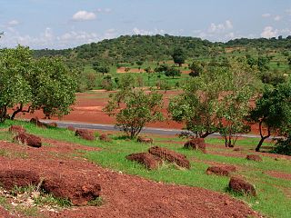
Touba Department is a department of Bafing Region in Woroba District, Ivory Coast. In 2014, its population was 75,032 and its seat is the settlement of Touba. The sub-prefectures of the department are Dioman, Foungbesso, Guintéguéla, and Touba.

Kayes Region is one of eight first level national subdivisions in Mali called Regions. It is the first administrative area of Mali and covers an area of 120,760 square kilometres or 46,630 square miles. Its capital is the town of Kayes. The province was historically part of the Ghana Empire and the Mali Empire.

Bafing Region is one of the 31 regions of Ivory Coast and is part of Woroba District. The region's seat is Touba. The region's area is 8,922 km², and its population in the 2014 census was 183,047.

Koro is a town in northwest Ivory Coast. It is a sub-prefecture of and the seat of Koro Department in Bafing Region, Woroba District. Koro is also a commune.

Touba is a town in western Ivory Coast. It is a sub-prefecture of and the seat of Touba Department. It is also a commune and the seat of Bafing Region in Woroba District, near the border with Ivory Coast.

Booko is a town in north-western Ivory Coast. It is a sub-prefecture and commune of Koro Department in Bafing Region, Woroba District.

Borotou is a town in northwest Ivory Coast. It is a sub-prefecture and commune of Koro Department in Bafing Region, Woroba District.

Dioman is a town in the far west of Ivory Coast. It is a sub-prefecture of Touba Department in Bafing Region, Woroba District.

Foungbesso is a town in western Ivory Coast. It is a sub-prefecture of Touba Department in Bafing Region, Woroba District.

Gouékan is a town in the far west of Ivory Coast. It is a sub-prefecture of Ouaninou Department in Bafing Region, Woroba District.

Guintéguéla is a town in western Ivory Coast. It is a sub-prefecture and commune of Touba Department in Bafing Region, Woroba District. In 2014, the population of the sub-prefecture of Guintéguéla was 18,994.

Mahandougou is a town in northwest Ivory Coast. It is a sub-prefecture of Koro Department in Bafing Region, Woroba District. Less than two kilometres west of town is a border crossing with Guinea.

Niokosso is a town in northwest Ivory Coast. It is a sub-prefecture of Koro Department in Bafing Region, Woroba District. Five kilometres southwest of town is a border crossing with Guinea.

Ouaninou is a town in northwest Ivory Coast. It is a sub-prefecture of and the seat of Ouaninou Department in Bafing Region, Woroba District. Ouaninou is also a commune. In 2014, the population of the sub-prefecture of Ouaninou was 20,790.

Saboudougou is a town in the far west of Ivory Coast. It is a sub-prefecture of Ouaninou Department in Bafing Region, Woroba District.

Santa is a town in the far west of Ivory Coast. It is a sub-prefecture of Ouaninou Department in Bafing Region, Woroba District.

Koro Department is a department of Bafing Region in Woroba District, Ivory Coast. In 2014, its population was 59,210 and its seat is the settlement of Koro. The sub-prefectures of the department are Booko, Borotou, Koro, Mahandougou, and Niokosso.

The districts of Ivory Coast are the first-level administrative subdivisions of the country. The districts were created in 2011 in an effort to further decentralise the state, but in practice most of them have not yet begun to function as governmental entities.

Ouaninou Department is a department of Bafing Region in Woroba District, Ivory Coast. In 2014, its population was 48,805 and its seat is the settlement of Ouaninou. The sub-prefectures of the department are Gbelo, Gouékan, Koonan, Ouaninou, Saboudougou, and Santa.

Gbélo is a town in the far west of Ivory Coast. It is a sub-prefecture of Ouaninou Department in Bafing Region, Woroba District.
This page is based on this
Wikipedia article Text is available under the
CC BY-SA 4.0 license; additional terms may apply.
Images, videos and audio are available under their respective licenses.


