Wróbliniec is a village in the administrative district of Gmina Milicz, within Milicz County, Lower Silesian Voivodeship, in south-western Poland. Prior to 1945 it was in Germany.
Skrobacja is a village in the administrative district of Gmina Bartniczka, within Brodnica County, Kuyavian-Pomeranian Voivodeship, in north-central Poland.
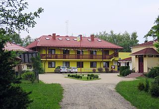
Kawęczyn is a village in the administrative district of Gmina Gniewkowo, within Inowrocław County, Kuyavian-Pomeranian Voivodeship, in north-central Poland.
Skrajna is a village in the administrative district of Gmina Cekcyn, within Tuchola County, Kuyavian-Pomeranian Voivodeship, in north-central Poland.

Lubonia is a village in the administrative district of Gmina Grabica, within Piotrków County, Łódź Voivodeship, in central Poland. It lies approximately 2 kilometres (1 mi) north-west of Grabica, 16 km (10 mi) north-west of Piotrków Trybunalski, and 32 km (20 mi) south of the regional capital Łódź.
Kliczków-Kolonia is a village in the administrative district of Gmina Brzeźnio, within Sieradz County, Łódź Voivodeship, in central Poland.
Kopanina Kaliszańska is a village in the administrative district of Gmina Łaziska, within Opole Lubelskie County, Lublin Voivodeship, in eastern Poland. It lies approximately 5 kilometres (3 mi) south of Łaziska, 9 km (6 mi) south-west of Opole Lubelskie, and 52 km (32 mi) west of the regional capital Lublin.
Brzeście is a village in the administrative district of Gmina Pińczów, within Pińczów County, Świętokrzyskie Voivodeship, in south-central Poland. It lies approximately 2 kilometres (1 mi) north-east of Pińczów and 39 km (24 mi) south of the regional capital Kielce.
Kopanina is a village in the administrative district of Gmina Staszów, within Staszów County, Świętokrzyskie Voivodeship, in south-central Poland. It lies approximately 4 kilometres (2 mi) north of Staszów and 51 km (32 mi) south-east of the regional capital Kielce.
Grabnik is a village in the administrative district of Gmina Jaktorów, within Grodzisk Mazowiecki County, Masovian Voivodeship, in east-central Poland. It lies approximately 4 kilometres (2 mi) north-east of Jaktorów, 6 km (4 mi) west of Grodzisk Mazowiecki, and 34 km (21 mi) west of Warsaw.
Wierzbica is a village in the administrative district of Gmina Serock, within Legionowo County, Masovian Voivodeship, in east-central Poland. It lies approximately 3 kilometres (2 mi) north of Serock, 19 km (12 mi) north-east of Legionowo, and 36 km (22 mi) north of Warsaw.
Ostrowo is a village in the administrative district of Gmina Wierzbinek, within Konin County, Greater Poland Voivodeship, in west-central Poland.
Kopanina is a settlement in the administrative district of Gmina Osieczna, within Leszno County, Greater Poland Voivodeship, in west-central Poland.
Kopanina is a village in the administrative district of Gmina Damasławek, within Wągrowiec County, Greater Poland Voivodeship, in west-central Poland. It lies approximately 6 kilometres (4 mi) west of Damasławek, 17 km (11 mi) east of Wągrowiec, and 61 km (38 mi) north-east of the regional capital Poznań.
Wesoła is a village in the administrative district of Gmina Sośnicowice, within Gliwice County, Silesian Voivodeship, in southern Poland.
Kłączno is a village in Gmina Studzienice, Bytów County, Pomeranian Voivodeship, in northern Poland. It lies approximately 11 kilometres (7 mi) south-east of Bytów and 78 km (48 mi) south-west of Gdańsk.
Nowy Dwór Wejherowski is a village in the administrative district of Gmina Wejherowo, within Wejherowo County, Pomeranian Voivodeship, in northern Poland. It lies approximately 7 kilometres (4 mi) south of Wejherowo and 30 km (19 mi) north-west of the regional capital Gdańsk.
Łozice-Cegielnia is a settlement in the administrative district of Gmina Bobolice, within Koszalin County, West Pomeranian Voivodeship, in north-western Poland.
Stare Łozice is a village in the administrative district of Gmina Bobolice, within Koszalin County, West Pomeranian Voivodeship, in north-western Poland. It lies approximately 6 kilometres (4 mi) south-west of Bobolice, 39 km (24 mi) south-east of Koszalin, and 141 km (88 mi) north-east of the regional capital Szczecin.
Mułek is a settlement in the administrative district of Gmina Malechowo, within Sławno County, West Pomeranian Voivodeship, in north-western Poland. It lies approximately 5 kilometres (3 mi) north of Malechowo, 10 km (6 mi) west of Sławno, and 165 km (103 mi) north-east of the regional capital Szczecin.


