
Issyk-Kul or Ysyk-Köl is an endorheic saline lake in the western Tianshan Mountains in eastern Kyrgyzstan, just south of a dividing range separating Kyrgyzstan from Kazakhstan. It is the eighth-deepest lake in the world, the eleventh-largest lake in the world by volume, the deepest lake whose deepest point is above sea level, and the third-largest saline lake. Issyk-Kul means "warm lake" in the Kyrgyz language; although it is located at a lofty elevation of 1,607 metres (5,272 ft) and subject to severe cold during winter, it rarely freezes over due to high salinity.

Balykchy is a town at the western end of Lake Issyk-Kul in Kyrgyzstan, at an elevation of about 1,900 metres. Its area is 38 square kilometres (15 sq mi), and its resident population was 42,875 in 2021. A major industrial and transport centre during the Soviet era, it lost most of its economic base after the collapse of the Soviet Union and the closure of virtually all of its industrial facilities.

Naryn Region is the largest region of Kyrgyzstan. It is located in the east of the country and borders with Chüy Region in the north, Issyk-Kul Region in the northeast, Xinjiang Uyghur Autonomous Region of China in the southeast, Osh Region in the southwest, and Jalal-Abad Region in the west. Its capital is Naryn. Its total area is 44,160 km2 (17,050 sq mi). The resident population of the region was 292,140 as of January 2021.

The Ysyk-Köl Region is one of the regions of Kyrgyzstan. Its capital is Karakol. It is surrounded by Almaty Region, Kazakhstan to the north, Chüy Region to the west, Naryn Region to the southwest, and Xinjiang, China to the southeast. It takes its name from Lake Issyk-Kul, the world's second-largest high altitude lake. Its total area is 43,735 km2 (16,886 sq mi). The resident population of the region was 501,933 as of January 2021. The region has a sizeable Russian minority.
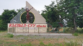
Kyzyl-Suu is a village in the Issyk-Kul Region of Kyrgyzstan. About 10km inland from Lake Issyk Kul on the A363 highway between Jeti-Ögüz resort and Barskoon, it is the capital of Jeti-Ögüz District. Its population was 15,075 in 2021.

Cholpon-Ata is a resort town on the northern shore of Lake Issyk-Kul in Kyrgyzstan with a population of 14,237 (2021). It is the administrative center of the Issyk-Kul District of Issyk-Kul Region; this district occupies most of the lake's north shore. To the west along highway A363 is Tamchy and to the east is Bosteri.
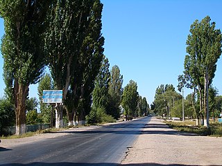
Tamchy is a village in the Issyk-Kul District of the Issyk-Kul Region of Kyrgyzstan. Its population was 2,412 in 2021.
Orto-Tokoy is an urban-type settlement in the Issyk-Kul Region of Kyrgyzstan, just north of the A365 highway between Kochkor and Balykchy. Its population was 491 in 2021. Administratively, it is part of the city of Balykchy. It is on the east-flowing part of the upper river Chu, downstream from the Orto-Tokoy Reservoir and dam.

Chok-Tal is a village in the Issyk-Kul District of the Issyk-Kul Region of Kyrgyzstan. Its population was 1,910 in 2021. It is located on the northern shore of Lake Issyk Kul between Tamchy and Cholpon Ata.

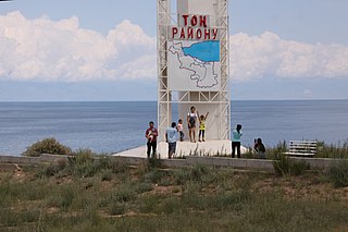
Bökönbai is a village in the Issyk-Kul Region of Kyrgyzstan. It is the seat of the Tong District and of the Kün-Chygysh village community. It was established as Kol'tsovka village in 1912. With a population of 14,267 (2021), it is the largest village on the south shore of lake Issyk Kul. Its industry has decayed since Soviet times. It is now a base for tourism into the mountains to the south. There are demonstrations of falconry with eagles. The road to the west to Balykchy goes through dry and less-attractive country.

Bosteri is a village in the Issyk-Kul Region of Kyrgyzstan. It is part of the Issyk-Kul District. Its population was 8,908 in 2021. The town is entirely devoted to mass tourism. There are soviet-era hotels and sanitoria. To the west along highway A363 is Cholpon-Ata, and to the east Korumdu.

Anan'yevo is a village in the Issyk-Kul Region of Kyrgyzstan. It is part of the Issyk-Kul District. Its population was 9,362 in 2021. Located on highway A363 on the north shore of Lake Issyk Kul, the next town to the west is Semyonovka, and to the east, Tüp. It was founded in 1871 as Sazonovka settlement and there is still a significant Russian population. In 1942, the village was renamed after one of the Panfilov's Twenty-Eight Guardsmen - Nikolay Yakovlevich Anan'yev, who was born in Sazonovka in 1912. There are a church and a mosque in the village.

Kochkor is a large village in northern Naryn Region of Kyrgyzstan. It is the administrative centre of Kochkor District. The village was established in 1909 as Stolypino and renamed to Kochkor in 1917. Altitude 1,800 m. Its population was 11,373 in 2021. It is on the main A365 highway from Torugart Pass (China) north to Bishkek. About 7 km west A367 branches west toward Jalal-Abad Region and the Ferghana Valley. About 25 km northeast along the highway is the Orto-Tokoy reservoir and about 45 km northeast is Balykchy on Lake Issyk-Kul. The village is a base for excursions into the high country and tourist infrastructure is fairly well developed. There is a regional museum.
Jeti-Ögüz is a district of Issyk-Kul Region in north-eastern Kyrgyzstan. Its seat lies at Kyzyl-Suu. Its area is 14,499 square kilometres (5,598 sq mi), and its resident population was 93,392 in 2021. It comprises much of the eastern end of the Terskey Ala-Too Range.
Tong is a district of Issyk-Kul Region in north-eastern Kyrgyzstan. The seat lies at Bökönbaev. Its area is 7,230 square kilometres (2,790 sq mi), and its resident population was 53,401 in 2021. Tong District borders Issyk-Kul District to the north-west, Jeti-Ögüz District to the south and south-east, Kochkor District to the south-west, Naryn District to the south, Kemin District to the north-west, and Issyk Kul - to the north.

Tüp is a district of Issyk-Kul Region in north-eastern Kyrgyzstan. The seat lies at Tüp. Its area is 2,121 square kilometres (819 sq mi), and its resident population was 65,169 in 2021. It borders Issyk-Kul District to the west, Ak-Suu District to the east and south-east, Kazakhstan to the north, and Issyk Kul to the south.

Issyk-Kul District is a district of Issyk-Kul Region in north-eastern Kyrgyzstan. The seat lies at Cholpon-Ata. Its area is 3,603 square kilometres (1,391 sq mi), and its resident population was 84,876 in 2021.

Toktogul is a district of Jalal-Abad Region in western Kyrgyzstan. The administrative seat lies at Toktogul. Its area is 7,815 square kilometres (3,017 sq mi), and its resident population was 103,310 in 2021.

Kochkor is a district of Naryn Region in northern-central Kyrgyzstan. The administrative seat lies at Kochkor. Its area is 5,868 km2 (2,266 sq mi), and its resident population was 67,363 in 2021.
Kosh-Döbö is a village in the Issyk-Kul Region of Kyrgyzstan. It is part of the Tüp District. The population of the village was 662 in 2021.


