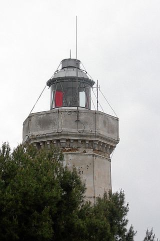
Rivinletto Light is a sector light tower located on Kaasamatala, a small island at the mouth of river Kiiminkijoki in Haukipudas, Oulu, Finland. The tower is concrete, with its top half painted black and bottom half painted white. The steel lantern room is painted white. The tower is located on the south side of the main channel of Kiiminkijoki river.
Keskiniemi Light is a sector light tower located in the northwestern promontory of Hailuoto island in the Gulf of Bothnia in Finland. It was built in 1908 and is located next to the Keskiniemi beacon tower built in 1858.

Cleveland Point Light, also known as Point Cleveland Light, is a lighthouse located on the north-eastern tip of Cleveland Point, at Cleveland, Redland City, Queensland, Australia. It overlooks Moreton Bay to the east and Raby Bay to the west. The old lighthouse was established in 1864-1865 as a wooden hexagonal tower. It is one of only two surviving lighthouses of this form, the other being Old Burnett Heads Light. A newer light, constructed of a concrete post, replaced it in 1976, and the old lighthouse was relocated a short distance away, where it stands today. The newer light was removed in 2009.

North Reef Light is an active lighthouse located on North Reef, a 5.6 square kilometres (2.2 sq mi) planar reef, about 120 kilometres (75 mi) northeast of Gladstone, Queensland, Australia in the Capricorn and Bunker Group. The lighthouse was constructed on a migratory patch of sand inside a fringing coral reef, which over the years disappeared and reappeared, as sand was washed away and accumulated, and is now a vegetated sandy island. Its construction is unique, having a hollow concrete base that both gives it resistance to the shifting nature of the sandbar and serves as a freshwater tank. As such, it is considered one of the major achievement in Australian lighthouse construction. It is also notable in that due to the harsh conditions, only bachelors were allowed to serve as lighthouse keepers. At 24 metres (79 ft) it is also the tallest of Queensland's timber-framed iron clad lighthouses.
Eborac Island Light is an active lighthouse on Eborac Island, a small rocky island in the Adolphus Channel just off Cape York, the northern tip of Cape York Peninsula, Far North Queensland, Australia. It guides ships into the coastal channel inside the Great Barrier Reef. A concrete structure was built in 1921 and converted to solar power in 1990. It was replaced with a fiberglass structure in 2012.

Wyborn Reef Light is an active lighthouse located at Wyborn Reef, formerly known as Y Reef, about 16 kilometres (9.9 mi) southeast of Albany Island, east of the tip of Cape York Peninsula, Queensland, Australia. It marks the entrance to the Albany Passage. The lighthouse was constructed in 1938 and upgraded in 1991 and 1995. The structure is a stainless steel tower with a fiberglass hut within the framework, carrying a lantern.

Low Point Lighthouse is an historic Canadian lighthouse marking the eastern entrance to Sydney Harbour at New Victoria, Nova Scotia, near New Waterford, Nova Scotia. This is one of the earliest and most important light stations of Nova Scotia, one of the first dozen beacons in Nova Scotia to be lit to guide mariners, a classic red-and-white lighthouse still operated by the Canadian Coast Guard.

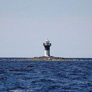
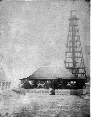
Lågskär Lighthouse is an automated lighthouse located on the north side of Lågskär, one of Finland's Åland in the Sea of Åland of the Baltic. It is the only striking feature on Lågskär on the generally uninhabited island.

The Adra Lighthouse is an active lighthouse near Adra in the Spanish province of Almería on the Mediterranean coast in Andulasia.
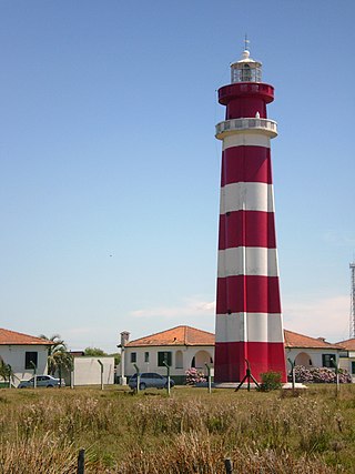
Albardão Lighthouse is an active lighthouse located on a sandy strip known as Praia do Cassino, in the municipality of Santa Vitória do Palmar, Brazil on the South Atlantic Ocean; the lighthouse is one of the southernmost Brazilian lights.
Chuí Lighthouse is an active lighthouse in Barra do Chuí, at the mouth of Chuí Stream, just 1 kilometre (0.62 mi) from the Uruguayan border; the lighthouse is the southernmost of all the Brazilian lights.

Ilha de Santana Lighthouse is an active lighthouse on the namesake island located at the east entrance of the Baía de São Marcos, Maranhão, Brazil

Capo Peloro Lighthouse is an active lighthouse located in Punta del Faro on the Strait of Messina, the most north-eastern promontory of Sicily, settled in the Province of Messina, the place closest to Calabria.
Capo Rizzuto Lighthouse is an active lighthouse located on the promontory with the same name in the municipality of Isola di Capo Rizzuto in Calabria on the Ionian Sea.
Capo Spartivento Lighthouse is an active lighthouse located on Cape Spartivento promontory which is the southernmost point of Sardinia and represents the eastern boundary of the Gulf of Teulada and the western limit of the Gulf of Cagliari on the Tyrrhenian Sea. The structure is situated in the municipality of Domus de Maria.

Porto Conte Lighthouse is an active lighthouse located on a promontory, halfway on the east side of the bay of Porto Conte, opposite to Capo Caccia Lighthouse and west of Alghero on the Sea of Sardinia.
Capo Cefalù Lighthouse is an active lighthouse located on the promontory of Capo Cefalù under the steep limestone ridge, 280 metres (920 ft) high, named Rocca east of Cefalù, Sicily on the Tyrrhenian Sea.
Capo Zafferano Lighthouse is an active lighthouse located at the extreme tip of the homonymy promontory, under a steep ridge, that marks the eastern entrance to the port of Palermo. The lighthouse is in the municipality of Santa Flavia on the Tyrrhenian Sea.

The St. Andrews North Point Lighthouse is an active lighthouse in St. Andrews, New Brunswick on the southern tip of the peninsula in the Passamaquoddy Bay; it is commonly known as Pendlebury Lighthouse from the name of the family who took care of it.
Sombrero Lighthouse is a lighthouse that marks the Anegada Passage, which is the route from Europe into the Caribbean. The lighthouse is located near the centre of Sombrero island, and reaches a height of almost 51 metres (167 ft) above sea level.


