Kraggenburg | |
|---|---|
 Oud Kraggenburg lighthouse | |
 Flag | |
 Kraggenburg Location of Kraggenburg in the province of Flevoland  Kraggenburg Kraggenburg (Netherlands) | |
| Coordinates: 52°39′4″N5°53′58″E / 52.65111°N 5.89944°E | |
| Country | Netherlands |
| Province | Flevoland |
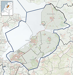
| Municipality | Noordoostpolder |
| Established | 1948 |
| Area | |
• Total | 38.79 km2 (14.98 sq mi) |
| Elevation | −2.4 m (−7.9 ft) |
| Population (2021) [1] | |
• Total | 1,445 |
| • Density | 37.25/km2 (96.48/sq mi) |
| Time zone | UTC+1 (CET) |
| • Summer (DST) | UTC+2 (CEST) |
| Postal code | 8317 [1] |
| Dialing code | 0527 |
Kraggenburg is a settlement in the Noordoostpolder area of the Netherlands.. The village is situated south east of the regional town Emmeloord.
Contents
- 19th century Kraggenburg
- Kraggenburg after reclaiming land from the sea
- Future
- Public transportation
- Gallery
- References
- External links
Kraggenburg was established in 1948,. [3] and received her name from a former lighthouse that is named Oud Kraggenburg. It belongs to the oldest buildings of the reclaimed land area called Noordoostpolder, see also Schokland.


