Emmeloord

Last updated
Emmeloord
Emmeloord, straatzicht Beursstraat-De Deel foto1 2013-04-28 15.04.jpg
View from the town square De Deel on the Beursstraat (left) and the west-entrance of the shopping street Lange Nering, 2013
2010-NL-P12-Flevoland-positiekaart-gemnamen.jpg
Red pog.svg
Emmeloord
Location of Emmeloord in the province of Flevoland
Coordinates: 52°42′35″N5°45′3″E / 52.70972°N 5.75083°E / 52.70972; 5.75083
Country Netherlands
Province Flevoland
Municipality Noordoostpolder
Population
 (1 January 2019)
  Total26,055 [1]

Emmeloord is the administrative centre of the municipality of Noordoostpolder, Flevoland, Netherlands. In 2019, it had a population of 26,055.

Contents

Overview

Topographic map of Emmeloord, March 2014 Emmeloord-plaats-OpenTopo.jpg
Topographic map of Emmeloord, March 2014

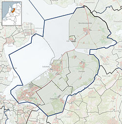
At the heart of the Noordoostpolder, where the three main drainage canals Lemstervaart, Urkervaart and Zwolsevaart [2] intersect, is the city of Emmeloord (1943). Named after an abandoned village on the island of Schokland, Emmeloord is located in a polder: land reclaimed from the IJsselmeer, which earlier was part of the sea. Planned from the outset to be the first and the only major town of the polder, it is the local government and services centre.

The first district built was called the Onkruidbuurt ("weed neighbourhood"). Street names were chosen from the weeds that were growing all around on the former sea floor, like reed (Rietstraat), thistle (Distelstraat) and sea aster (Zeeasterstraat).

From Emmeloord three main canals take their water to three pumping stations: the Buma near Lemmer (north), the Smeenge at Vollenhove (south-east) and the Vissering on Urk (south-west).

In the center of Emmeloord there is a 65 meter tall water tower called the Poldertoren. The tower is the central point of the Noordoostpolder and could be seen from almost every location in the early years of the Noordoostpolder, when there were no tall trees. In Japan there is a replica of this water tower.

Surrounding villages

Ten smaller villages, conceived more as agricultural communities, were planned in a wide circle around Emmeloord, with the distances between them determined to be easily reachable by bicycle. In order from first to last, these settlements were Marknesse (1946), Ens (1948), Kraggenburg (1948), Luttelgeest 1950, Bant (1951), Rutten (1952), Creil (1953), Nagele (1954), Espel (1956) and finally Tollebeek (1956).

Transportation

There is no railway station in Emmeloord, but good bus connections exist to the nearest stations. Only relevant rail connections are mentioned in below table:

StationDestinationsBus route
to station
Lelystad Centrum, Lelystad Almere, Amsterdam, Amsterdam Airport Schiphol, The Hague, Rotterdam Bus 140
Kampen, Kampen Zwolle Bus 141, 641
Zwolle, Zwolle Emmen, Almelo, Enschede, Deventer, Arnhem, 's-Hertogenbosch, Amersfoort, Utrecht Bus 71, 641
Heerenveen, Heerenveen Leeuwarden Bus 315, 324 (Qliner)

The connection with Heerenveen, Drachten and Groningen is ensured by Arriva Qliner intercity buses.

Emmeloord lies at the intersection of the A6 motorway and the N50 dual carriageway, providing a rapid connection to Amsterdam, Zwolle and Friesland.

See also

Related Research Articles

Flevoland Province of the Netherlands

Flevoland is the 12th and youngest province of the Netherlands, established in 1986, when the Southern and Eastern Flevopolders, together with the Noordoostpolder were merged into one provincial entity. It is in the centre of the country in the former Zuiderzee, which was turned into the freshwater IJsselmeer by the closure of the Afsluitdijk in 1932. Almost all of the land belonging to Flevoland was reclaimed in the 1950s and 1960s while splitting the Markermeer and Bordering lakes from the IJsselmeer. As to dry land, it is the smallest province of the Netherlands at 1,412 km2 (545 sq mi), but not gross land as that includes much of the waters of the fresh water lakes (meres) mentioned. The province has a population of 423,021 as of January 2020 and consists of six municipalities. Its capital is Lelystad and its most populous city is Almere.

Polder Reclaimed land

A polder is a low-lying tract of land that forms an artificial hydrological entity, enclosed by embankments known as dikes. The three types of polder are:

  1. Land reclaimed from a body of water, such as a lake or the seabed
  2. Flood plains separated from the sea or river by a dike
  3. Marshes separated from the surrounding water by a dike and subsequently drained; these are also known as koogs, especially in Germany
Lelystad City and Municipality in Flevoland, Netherlands

Lelystad is a municipality and a city in the centre of the Netherlands, and it is the capital of the province of Flevoland. The city, built on reclaimed land, was founded in 1967 and was named after Cornelis Lely, who engineered the Afsluitdijk, making the reclamation possible. Lelystad is approximately 3 metres below sea level.

Zuiderzee Former inland sea in the Netherlands, now the IJsselmeer

The Zuiderzee or Zuider Zee was a shallow bay of the North Sea in the northwest of the Netherlands, extending about 100 km inland and at most 50 km wide, with an overall depth of about 4 to 5 metres (13–16 feet) and a coastline of about 300 km. It covered 5,000 km2 (1,900 sq mi). Its name is Dutch for "southern sea", indicating that the name originates in Friesland, to the north of the Zuiderzee. In the 20th century the majority of the Zuiderzee was closed off from the North Sea by the construction of the Afsluitdijk, leaving the mouth of the inlet to become part of the Wadden Sea. The salt water inlet changed into a fresh water lake now called the IJsselmeer after the river that drains into it, and by means of drainage and polders, an area of some 1,500 km2 (580 sq mi) was reclaimed as land. This land eventually became the province of Flevoland, with a population of nearly 400,000 (2011).

Zuiderzee Works Land reclamation in the Netherlands

The Zuiderzee Works is a man-made system of dams and dikes, land reclamation and water drainage work, in total the largest hydraulic engineering project undertaken by the Netherlands during the twentieth century. The project involved the damming of the Zuiderzee, a large, shallow inlet of the North Sea, and the reclamation of land in the newly enclosed water using polders. Its main purposes are to improve flood protection and create additional land for agriculture.

Noordoostpolder Municipality in Flevoland, Netherlands

Noordoostpolder is a polder and municipality in the Flevoland province in the central Netherlands. Formerly, it was also called Urker Land. Emmeloord is the administrative center, located in the heart of the Noordoostpolder.

Urk Municipality in Flevoland, Netherlands

Urk is a municipality and a town in the Flevoland province in the central Netherlands.

Schoonhoven City and former municipality in South Holland, Netherlands

Schoonhoven is a city and former municipality in the western Netherlands, in the province of South Holland. Since 2015 it has been a part of the municipality of Krimpenerwaard, before it had been an independent municipality.

Hoofddorp

Hoofddorp is the main town of the Haarlemmermeer municipality in the province of North Holland in the Netherlands. In 2021, the population was 77,885. The town was founded in 1853, immediately after the Haarlemmermeer had been drained.

Schokland

Schokland is a former island in the Dutch Zuiderzee, in the municipality of Noordoostpolder. Schokland was an elongated strip of peat land which ceased to be an island when the Noordoostpolder was reclaimed from the sea in 1942. It is now just a slightly elevated part of the polder, with a still partly intact retaining wall of the waterfront of Middelbuurt. On 1 April 2014, it had 8 inhabitants, but according to Statistics Netherlands there are five people living on the former island.

Tollebeek Village in Flevoland, Netherlands

Tollebeek is a village in the Dutch province of Flevoland. It is a part of the municipality of Noordoostpolder, and is approximately 90 kilometres north east of Amsterdam.

Ens, Netherlands Village in Flevoland, Netherlands

Ens is a village in the Dutch province of Flevoland. It is a part of the municipality of Noordoostpolder, and lies about 10 km southeast of Emmeloord.

Creil is one of the ten so-called green villages (Dutch: groendorpen) in the Dutch province of Flevoland. It is a part of the municipality of Noordoostpolder, and lies about 6 km northwest of Emmeloord.

Bant is one of the so-called green villages (Dutch: groendorpen) in the Dutch province of Flevoland. It is a part of the municipality of Noordoostpolder, and lies about 7 km north of Emmeloord.

Espel is one of the so-called green villages (Dutch: groendorpen) in the Dutch province of Flevoland. It lies in the municipality of Noordoostpolder next to a crossroads where provincial road N712 from Urk to Lemmer intersects with road N714 to Emmeloord, roughly 6 km to the east.

Nagele Village in Flevoland, Netherlands

Nagele is a village in the Dutch province of Flevoland. It is a part of the municipality of Noordoostpolder, and lies about 10 km south of Emmeloord.

Poldertoren

The Poldertoren is a water tower at the town center of Emmeloord, Netherlands. The Dutch name Poldertoren could be translated as Polder Tower. The 65-meter tower was built in 1959 and has a large carillon. The tower is no longer in use as a water tower. The owner of the tower was the water company, Vitens, but since 2005 the municipality of Noordoostpolder has owned the tower.

Rutten, Netherlands Village in Flevoland, Netherlands

Rutten is a village in the central Netherlands. It is located in Noordoostpolder, Flevoland, about 8 km northwest of Emmeloord. It was founded in 1952.

Pilot Polder Andijk

The pilot Polder Andijk, or Test Polder Andijk, Proefpolder Andijk in Dutch, is a polder established in 1926 - 1927 in the Zuiderzee near the village of Andijk. The aim of this prototype is to study the embankments and agriculture for future polders in the Zuiderzee Works. In 1929, the pilot polder was inaugurated by Queen Wilhelmina of the Netherlands.

Sonoy

Sonoy was a restaurant located in Emmeloord, in the Netherlands. It held a Michelin-star rating in the period 2010–2013.

References

  1. (in Dutch) Feiten en cijfers Archived 2014-04-19 at the Wayback Machine , Municipality of Noordoostpolder
  2. Peilbesluit stedelijk gebied gemeente Noordoostpolder

Coordinates: 52°42′35″N5°45′3″E / 52.70972°N 5.75083°E / 52.70972; 5.75083