Feraoun is a town in the province of Béjaïa in northern Algeria. It serves as the administrative center of the commune of Feraoun.
Rwang Pam Stadium is a multi-use stadium in Jos, Nigeria. It is used mostly for football matches and is the home stadium of Jos teams JUTH F.C., Plateau United and Mighty Jets. The stadium has a capacity of 15,000 spectators.

Saratak is a village in the Shirak Province of Armenia.
Groton Town is an unincorporated community in Accomack County, Virginia.
Holonki is a village in the administrative district of Gmina Brańsk, within Bielsk County, Podlaskie Voivodeship, in north-eastern Poland.

Pelagia is a village in the administrative district of Gmina Wodzierady, within Łask County, Łódź Voivodeship, in central Poland. It lies approximately 4 kilometres (2 mi) south-west of Wodzierady, 12 km (7 mi) north of Łask, and 26 km (16 mi) south-west of the regional capital Łódź.

Gülyatan is a village in the Astara Rayon of Azerbaijan.

Staropole is a village in the administrative district of Gmina Żelechlinek, within Tomaszów Mazowiecki County, Łódź Voivodeship, in central Poland. It lies approximately 5 kilometres (3 mi) south-east of Żelechlinek, 20 km (12 mi) north of Tomaszów Mazowiecki, and 44 km (27 mi) east of the regional capital Łódź.

Kopiec is a settlement in the administrative district of Gmina Ostrówek, within Wieluń County, Łódź Voivodeship, in central Poland. It lies approximately 6 kilometres (4 mi) east of Ostrówek, 15 km (9 mi) north-east of Wieluń, and 74 km (46 mi) south-west of the regional capital Łódź.
Antoniówka Wilczkowska is a village in the administrative district of Gmina Maciejowice, within Garwolin County, Masovian Voivodeship, in east-central Poland.
Nowiny Giżyńskie is a village in the administrative district of Gmina Strzegowo, within Mława County, Masovian Voivodeship, in east-central Poland.
Milewo-Rączki is a village in the administrative district of Gmina Krasne, within Przasnysz County, Masovian Voivodeship, in east-central Poland.
Romany-Janowięta is a village in the administrative district of Gmina Krzynowłoga Mała, within Przasnysz County, Masovian Voivodeship, in east-central Poland.

Czarnolas-Kolonia is a village in the administrative district of Gmina Policzna, within Zwoleń County, Masovian Voivodeship, in east-central Poland. It lies approximately 12 kilometres (7 mi) north-east of Zwoleń and 99 km (62 mi) south-east of Warsaw.
Grabice is a village in the administrative district of Gmina Gubin, within Krosno Odrzańskie County, Lubusz Voivodeship, in western Poland, close to the German border.
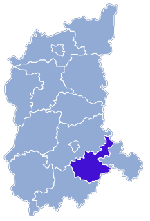
Wyszanów is a village in the administrative district of Gmina Szlichtyngowa, within Wschowa County, Lubusz Voivodeship, in western Poland.

Młyńsk is a settlement in the administrative district of Gmina Kaliska, within Starogard County, Pomeranian Voivodeship, in northern Poland. It lies approximately 5 kilometres (3 mi) south-east of Kaliska, 22 km (14 mi) south-west of Starogard Gdański, and 61 km (38 mi) south-west of the regional capital Gdańsk.

Karsk is a village in the administrative district of Gmina Nowogard, within Goleniów County, West Pomeranian Voivodeship, in north-western Poland. It lies approximately 4 kilometres (2 mi) north-west of Nowogard, 24 km (15 mi) north-east of Goleniów, and 45 km (28 mi) north-east of the regional capital Szczecin.
Mstyora is a rural locality in Vyaznikovsky District of Vladimir Oblast, Russia, situated 13 kilometers (8.1 mi) south of an urban locality of the same name (Mstyora). Municipally, it is a part of Mstyora Urban Settlement, of which the other Mstyora is the administrative center.

Vlahovići is a village in the municipality of Višegrad, Bosnia and Herzegovina.


