Krotz Springs Bridge

Last updated
Krotz Springs Bridge
Coordinates 30°32′46.0″N91°44′59.0″W / 30.546111°N 91.749722°W / 30.546111; -91.749722
Carries4 lanes of US 190.svg US 190
Crosses Atchafalaya River
Locale Krotz Springs, Louisiana and East Krotz Springs, Louisiana
Official nameFrank and Sal Diesi Bridge
Maintained by LaDOTD
Characteristics
DesignDual continuous truss bridges
History
Opened1973, 1988
Location
Krotz Springs Bridge

The Krotz Springs Bridge, officially named the Frank and Sal Diesi Bridge, is a pair of continuous truss bridges in the U.S. state of Louisiana which carry US 190 over the Atchafalaya River at Krotz Springs.

Contents

Although it was long rumored that the bridge was constructed due to Governor Huey Long's political issues with the town of Melville upstream, which was originally on the route for U.S. Highway 71 and Jefferson Highway, plans for this bridge in Krotz Springs (originally as a toll) were announced as early as 1925. [1] This original span opened July 1, 1928, as a free bridge and carried railroad and automobile traffic, similar to the Atchafalya River Crossing in Simmesport. [2] This dual crossing was short-lived and construction on a dedicated auto bridge began in 1931. Shortly before the dual crossing ended, the railroad commission charged tolls for automobiles.

The original bridge, a truss span costing $1 million, was built in 1934 and carried two lanes of US 190 traffic. It was one of many bridges constructed in the early 1930s named the Long-Allen Bridge. In 1973, a parallel span was built to accommodate westbound traffic as traffic counts overwhelmed the original bridge. In 1985, the original span closed and was demolished, temporarily converting the 1973 span to two-lane traffic. The current eastbound span opened in 1988. In September 2015, the bridge was named for Krotz Springs Port officials Frank and Sal Diesi. [3]

Old Krotz Springs Bridge, replaced by dual span bridges in 1973. Krotz springs bridge.jpg
Old Krotz Springs Bridge, replaced by dual span bridges in 1973.
New Krotz Springs bridge span, the one on the right was built in 1973, and the one on the left was built in 1988. Krotz Springs Bridge new.jpg
New Krotz Springs bridge span, the one on the right was built in 1973, and the one on the left was built in 1988.

See also

Related Research Articles

<span class="mw-page-title-main">Krotz Springs, Louisiana</span> Town in Louisiana, United States

Krotz Springs is a town in St. Landry Parish, Louisiana, United States, on the Atchafalaya River. The population was 1,198 at the 2010 census, down from 1,219 in 2000. It is part of the Opelousas–Eunice Micropolitan Statistical Area.

<span class="mw-page-title-main">Blue Water Bridge</span> Twin-span bridge between Point Edward, Ontario, Canada and Port Huron, Michigan, US

The Blue Water Bridge is a twin-span international bridge across the St. Clair River that links Port Huron, Michigan, United States, and Point Edward, Ontario, Canada. The Blue Water Bridge connects Highway 402 in Ontario with both Interstate 69 (I-69) and Interstate 94 (I-94) in Michigan.

<span class="mw-page-title-main">U.S. Route 190</span> Highway in the United States

U.S. Route 190 (US 190) is an east–west United States Highway in Louisiana and Texas. Segments of US 190 will be upgraded to Interstate 14 (I-14); the first 24.8-mile (39.9 km) segment was opened on January 26, 2017.
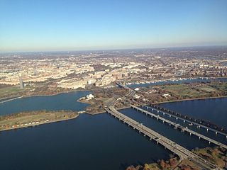
<span class="mw-page-title-main">Richmond–San Rafael Bridge</span> Bridge crossing the San Francisco Bay

The Richmond–San Rafael Bridge is the northernmost of the east–west crossings of California's San Francisco Bay, carrying Interstate 580 from Richmond on the east to San Rafael on the west. It opened in 1956, replacing ferry service by the Richmond–San Rafael Ferry Company, and was officially renamed in 1981 to honor California State Senator John F. McCarthy, who championed the bridge's creation.

<span class="mw-page-title-main">Mid-Hudson Bridge</span> Bridge in New York and Poughkeepsie, New York

The Franklin Delano Roosevelt Mid-Hudson Bridge is a toll suspension bridge which carries US 44 and NY 55 across the Hudson River between Poughkeepsie and Highland in the state of New York.

<span class="mw-page-title-main">McKinley Bridge</span> Bridge in Missouri and Venice, Illinois

The McKinley Bridge is a steel truss bridge across the Mississippi River. It connects northern portions of the city of St. Louis, Missouri with Venice, Illinois. It opened in 1910 and was taken out of service on October 30, 2001. The bridge was reopened for pedestrian and bicyclists on November 17, 2007 with a grand re-opening celebration. Since December 2007, McKinley has been open to vehicular traffic as well. It is accessible from Illinois Route 3 in Illinois and from the intersection of Salisbury and North 9th Street in the city of St. Louis. The bridge carried both railroad and vehicular traffic across the Mississippi River for decades. By 1978, the railroad line over the span was closed, and an additional set of lanes was opened for vehicles in the inner roadway.

<span class="mw-page-title-main">MacArthur Bridge (St. Louis)</span> Bridge in Missouri and East St. Louis, Illinois

The MacArthur Bridge is a truss bridge that connects St. Louis, Missouri and East St. Louis, Illinois over the Mississippi River. The bridge was initially called the "St. Louis Municipal Bridge" and known popularly as the "Free Bridge" due to the original lack of tolls. Tolls were added for auto traffic beginning in 1932. In 1942, the bridge was renamed for Douglas MacArthur. The bridge was constructed to break the monopoly of the Terminal Railroad Association, which controlled two other bridges at St. Louis and charged what were viewed as unreasonable tolls.

<span class="mw-page-title-main">Huey P. Long Bridge (Jefferson Parish)</span> Road and railroad bridge in Louisiana, U.S.

The Huey P. Long Bridge, located in Jefferson Parish, Louisiana, is a cantilevered steel through-truss bridge that carries a two-track railroad line over the Mississippi River at mile 106.1, with three lanes of US 90 on each side of the central tracks. It is several kilometers upriver from the city of New Orleans. The East Bank entrance is at Elmwood, Louisiana, and the West Bank at Bridge City.

<span class="mw-page-title-main">Fort Madison Toll Bridge</span> Bridge in and Niota, Illinois

The Fort Madison Toll Bridge is a tolled, double-decked swinging truss bridge over the Mississippi River that connects Fort Madison, Iowa, and unincorporated Niota, Illinois. A double-track railway occupies the lower deck of the bridge, while two lanes of road traffic are carried on the upper deck. The bridge is about 1 mile (1.6 km) long with a swing span of 525 feet (160 m), and was the longest and largest double-deck swing-span bridge in the world when constructed in 1927. It replaced an inadequate combination roadway/single-track bridge completed in 1887. The main river crossing consists of four 270-foot (82 m) Baltimore through truss spans and a swing span made of two equal arms, 266 feet (81 m) long. In 1999, it was listed in the National Register of Historic Places under the title, Fort Madison Bridge, ID number 99001035. It was also documented as survey number IA-62 by the Historic American Engineering Record, archived at the Library of Congress. Construction and photographic details were recorded at the time in Scientific American magazine.

<span class="mw-page-title-main">Old Vicksburg Bridge</span> Bridge in Louisiana and Vicksburg, Mississippi

The Old Vicksburg Bridge, also known as Mississippi River Bridge, is a cantilever bridge carrying one rail line across the Mississippi River between Delta, Louisiana and Vicksburg, Mississippi.

<span class="mw-page-title-main">Interstate 10 in Louisiana</span> Highway in Louisiana

Interstate 10 (I-10), a major transcontinental Interstate Highway in the Southern United States, runs across the southern part of Louisiana for 274.42 miles (441.64 km) from Texas to Mississippi. It passes through Lake Charles, Lafayette, and Baton Rouge, dips south of Lake Pontchartrain to serve the New Orleans metropolitan area, then crosses Lake Pontchartrain and leaves the state.

<span class="mw-page-title-main">Airline Highway</span>

Airline Highway is a divided highway in the U.S. state of Louisiana, built in stages between 1925 and 1953 to bypass the older Jefferson Highway. It runs 115.6 miles (186.0 km), carrying U.S. Highway 61 from New Orleans northwest to Baton Rouge and U.S. Highway 190 from Baton Rouge west over the Mississippi River on the Huey P. Long Bridge. US 190 continues west towards Opelousas on an extension built at roughly the same time.
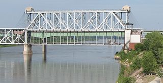
<span class="mw-page-title-main">Louisiana Highway 10</span>

Louisiana Highway 10 (LA 10) is a state highway located in southern Louisiana. It runs 255.51 miles (411.20 km) in an east–west direction from U.S. Highway 171 (US 171) south of Leesville to the Mississippi state line east of Bogalusa.

<span class="mw-page-title-main">Intercity Viaduct</span> Bridge in Kansas–Kansas City, Missouri

The Intercity Viaduct is an automobile and pedestrian crossing of the Kansas River in the United States. Designed by Waddell and Hedrick, this four lane, two level deck truss bridge opened to the public on January 29, 1907. It rises above the West Bottoms, and several sets of railroad tracks. It was the first roadway bridge to connect Kansas City, Missouri, with Kansas City, Kansas, non-stop all the way across. It is about 1.5 miles (2.4 km) long and carries eastbound traffic for Interstate 70 (I-70)/U.S. Route 24 (US 24)/US 40/US 169, while its sister bridge, the Lewis and Clark Viaduct, built in 1962, carries westbound traffic.

<span class="mw-page-title-main">Ellsworth Street Bridge</span> Bridge in Albany, Oregon

The Ellsworth Street Bridge is a highway bridge that crosses the Willamette River in Albany, Oregon, United States. Built in 1925, the two-lane structure carries U.S. Route 20 eastbound traffic, with the adjacent Lyon Street Bridge carrying westbound traffic. The 1,090-foot-long (330 m) steel truss bridge was designed by Conde McCullough and opened in 1926.

<span class="mw-page-title-main">U.S. Route 65 in Louisiana</span> Section of U.S. Highway in Louisiana, United States

U.S. Highway 65 (US 65) is a part of the United States Numbered Highway System that spans 966 miles (1,555 km) from Clayton, Louisiana to Albert Lea, Minnesota. Within the state of Louisiana, the highway travels 100.77 miles (162.17 km) from the national southern terminus at US 425/LA 15 in Clayton to the Arkansas state line north of Lake Providence.

<span class="mw-page-title-main">Peats Ferry Bridge</span> Bridge in New South Wales, Australia

The Peats Ferry Bridge is a steel truss bridge that carries the Pacific Highway (B83) across the Hawkesbury River, between Kangaroo Point and Mooney Mooney Point, located 40 kilometres (25 mi) north of Sydney in New South Wales, Australia. The bridge carries the Hornsby to Kariong section of highway, while the adjacent Brooklyn Bridge carries the Pacific Motorway (M1).

<span class="mw-page-title-main">Louisiana State Route 7</span>

Louisiana State Route 7 was one of the 98 original state highways that were established in 1924. It was split into two separate segments, with the western section running in a west to east direction for 110.80 miles (178.32 km), spanning from Deweyville to the Atchafalaya River. The eastern section ran for 144.50 miles (232.55 km) from Lottie to the Mississippi state line, in a west to east direction.

References

  1. "Proposal of Gulf Coast for a Toll Bridge Presented". The State-Times. Baton Rouge. March 10, 1925. p. 10-A.
  2. "Atchafalaya River Bridge Opened". The Rayne Tribute. July 7, 1928. p. 1.
  3. "Atchafalya Bridge in Krotz Springs renamed on Wednesday | KLFY". Archived from the original on 2018-04-15.