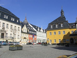
Zschopau, is a town in the Erzgebirgskreis district of Saxony, Germany.
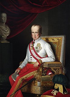
Ferdinand I was the Emperor of Austria from March 1835 until his abdication in December 1848. As ruler of Austria, he was also President of the German Confederation, King of Hungary, Croatia and Bohemia, King of Lombardy–Venetia and holder of many other lesser titles. Due to his rocky, passive but well-intentioned character, he gained the sobriquet The Benign or The Benevolent.

Bad Gottleuba-Berggießhübel is a spa town in the district Sächsische Schweiz-Osterzgebirge in the Free State of Saxony, Germany. The municipality borders the Czech Republic in the south. The municipality was formed on 1 January 1999 by the merger of the former municipalities Bad Gottleuba, Berggießhübel, Langenhennersdorf and Bahratal. Surrounded by forests and near a water dam Bad Gottleuba-Berggießhübel has several facilities, including a spa health park, a plant garden and a heated open air pool.

Mittweida is a town in the Free State of Saxony, Germany, in the Mittelsachsen district.
Großenhain is a Große Kreisstadt in the district of Meissen, Saxony, Germany. It was originally known as Hayne. The current name simply means "big Hayne"

Erlau is a municipality in the district of Mittelsachsen in Saxony in Germany. In 1994 it absorbed the former municipalities Beerwalde, Crossen and Schweikershain, and in 1999 Milkau.

Meerane is a town in the Zwickau district of Saxony, Germany. It lies midway between the towns of Altenburg and Zwickau, west of Chemnitz.
Weißenberg is a town in the district of Bautzen, in the Free State of Saxony, Germany. It is located 11 km north of Löbau, and 16 km east of Bautzen. In 1993 it absorbed the former municipality Maltitz, and in 1994 Gröditz, Kotitz, Nostitz and Wurschen.

Frankenthal is a municipality in eastern Saxony, Germany. It belongs to the district of Bautzen and lies west of the eponymous city. It is named after Frankish colonists who settled in Lusatia ca. 1200.

Königswalde is a municipality in the district of Erzgebirgskreis, in Saxony, Germany.

Gelenau is a municipality in the district of Erzgebirgskreis, in Saxony, Germany.
Rammenau is a municipality in the district of Bautzen, in Saxony, Germany. It is known as the birthplace of the well-known German philosopher Johann Gottlieb Fichte.

Oberlichtenau is a village and a former municipality in the district of Bautzen, in Saxony. Since 1 January 2009, it is part of the town Pulsnitz.

Großschönau is a municipality in the district Görlitz, in Saxony, Germany located in the cross-border region with the Czech Republic. It used to be a famous Upper Lusatian center of Damask fabric production until the end of the 1980s. Since then it has turned into an area of tourism.

Oppach is a municipality in the district Görlitz, in Saxony, Germany.

Striegistal is a municipality in the district of Mittelsachsen, in Saxony, Germany. In 1994, the unification of the former municipalities of Berbersdorf, Goßberg, Mobendorf and Pappendorf as part of the regional administrative reform, created the municipality of Striegistal. In 2008 it absorbed the former municipality Tiefenbach. It received its name from the two rivers that flow through the community, the Little Striegis and the Big Striegis.

Parthenstein is a municipality in the Leipzig district in Saxony, Germany. It was created in 1994 by the merger of the former municipalities Grethen, Großsteinberg, Klinga and Pomßen.
Morgenröthe-Rautenkranz is a village and a former municipality in the Vogtlandkreis district, in Saxony, Germany. Since 1 October 2009, along with Tannenbergsthal and Hammerbrücke, it is part of the municipality Muldenhammer.

The village of Cämmerswalde in the municipality of Neuhausen/Erzgeb. lies in the south of the Saxon district of Mittelsachsen in eastern Germany. The state-recognised spa resort with its 800-year-old history, lies near Seiffen in the eastern part of the Western Ore Mountains not far from the Czech border. The village is a classic Waldhufendorf, with a length of over five kilometres. Cämmerswalde is divided into Oberdorf, Mitteldorf and Niederdorf. Since 1994 Cämmerswalde has belonged to the municipality of Neuhausen/Erzgeb., but used to be an independent parish with the hamlets of Deutschgeorgenthal, Haindorf and, from 1924, Neuwernsdorf and Rauschenbach.
Frohnau is a village in the Saxon town of Annaberg-Buchholz in the district of Erzgebirgskreis in southeast Germany. The discovery of silver on the Schreckenberg led in 1496 to the foundation of the neighbouring mining town of Annaberg. The village of Frohnau is best known for its museum of technology, the Frohnauer Hammer, and the visitor mine of Markus Röhling Stolln. The mining area around Frohnau has been selected as a candidate for a UNESCO World Heritage Site: the Ore Mountain Mining Region.


