Dobieszewo is a village in the administrative district of Gmina Kcynia, within Nakło County, Kuyavian-Pomeranian Voivodeship, in north-central Poland.

Cierpice is a village in the administrative district of Gmina Wielka Nieszawka, within Toruń County, Kuyavian-Pomeranian Voivodeship, in north-central Poland. It lies approximately 2 kilometres (1 mi) south-west of Wielka Nieszawka and 10 km (6 mi) south-west of Toruń.

Łapczyna Wola is a village in the administrative district of Gmina Kluczewsko, within Włoszczowa County, Świętokrzyskie Voivodeship, in south-central Poland. It lies approximately 7 kilometres (4 mi) north of Kluczewsko, 16 km (10 mi) north of Włoszczowa, and 52 km (32 mi) west of the regional capital Kielce.
Strzemieczne-Oleksy is a village in the administrative district of Gmina Młynarze, within Maków County, Masovian Voivodeship, in east-central Poland.
Łady-Mans is a village in the administrative district of Gmina Czerwin, within Ostrołęka County, Masovian Voivodeship, in east-central Poland.

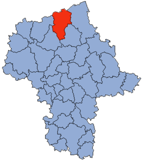
Szczepanki is a village in the administrative district of Gmina Czernice Borowe, within Przasnysz County, Masovian Voivodeship, in east-central Poland. It lies approximately 6 kilometres (4 mi) south of Czernice Borowe, 10 km (6 mi) south-west of Przasnysz, and 87 km (54 mi) north of Warsaw.

Turowo is a village in the administrative district of Gmina Czernice Borowe, within Przasnysz County, Masovian Voivodeship, in east-central Poland. It lies approximately 9 kilometres (6 mi) south-east of Czernice Borowe, 6 km (4 mi) south-west of Przasnysz, and 86 km (53 mi) north of Warsaw.

Załogi is a village in the administrative district of Gmina Czernice Borowe, within Przasnysz County, Masovian Voivodeship, in east-central Poland. It lies approximately 7 kilometres (4 mi) south-east of Czernice Borowe, 8 km (5 mi) south-west of Przasnysz, and 87 km (54 mi) north of Warsaw.
Milewo-Rączki is a village in the administrative district of Gmina Krasne, within Przasnysz County, Masovian Voivodeship, in east-central Poland.

Bogate is a village in the administrative district of Gmina Przasnysz, within Przasnysz County, Masovian Voivodeship, in east-central Poland. It lies approximately 10 kilometres (6 mi) south-east of Przasnysz and 82 km (51 mi) north of Warsaw.

Cierpigórz is a village in the administrative district of Gmina Przasnysz, within Przasnysz County, Masovian Voivodeship, in east-central Poland. It lies approximately 4 kilometres (2 mi) south of Przasnysz and 86 km (53 mi) north of Warsaw.

Dobrzankowo is a village in the administrative district of Gmina Przasnysz, within Przasnysz County, Masovian Voivodeship, in east-central Poland. It lies approximately 7 kilometres (4 mi) south-east of Przasnysz and 86 km (53 mi) north of Warsaw.

Fijałkowo is a village in the administrative district of Gmina Przasnysz, within Przasnysz County, Masovian Voivodeship, in east-central Poland. It lies approximately 8 kilometres (5 mi) east of Przasnysz and 87 km (54 mi) north of Warsaw.

Golany is a village in the administrative district of Gmina Przasnysz, within Przasnysz County, Masovian Voivodeship, in east-central Poland. It lies approximately 5 kilometres (3 mi) south-west of Przasnysz and 86 km (53 mi) north of Warsaw.

Józefowo is a settlement in the administrative district of Gmina Przasnysz, within Przasnysz County, Masovian Voivodeship, in east-central Poland. It lies approximately 8 kilometres (5 mi) south-east of Przasnysz and 86 km (53 mi) north of Warsaw.

Leszno is a village in the administrative district of Gmina Przasnysz, within Przasnysz County, Masovian Voivodeship, in east-central Poland. It lies approximately 5 kilometres (3 mi) south-east of Przasnysz and 86 km (53 mi) north of Warsaw.

Lisiogóra is a village in the administrative district of Gmina Przasnysz, within Przasnysz County, Masovian Voivodeship, in east-central Poland. It lies approximately 9 kilometres (6 mi) south-east of Przasnysz and 82 km (51 mi) north of Warsaw.
Stare Helenowo is a village in the administrative district of Gmina Przasnysz, within Przasnysz County, Masovian Voivodeship, in east-central Poland.

Osowiec is a settlement in the administrative district of Gmina Dobiegniew, within Strzelce-Drezdenko County, Lubusz Voivodeship, in western Poland. It lies approximately 10 kilometres (6 mi) east of Dobiegniew, 28 km (17 mi) north-east of Strzelce Krajeńskie, and 52 km (32 mi) north-east of Gorzów Wielkopolski.
Sulino is a village in the administrative district of Gmina Lipiany, within Pyrzyce County, West Pomeranian Voivodeship, in north-western Poland.


