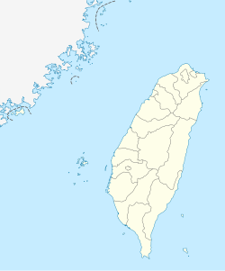
Kaohsiung, officially Kaohsiung City, is a special municipality located in southern Taiwan. It ranges from the coastal urban center to the rural Yushan Range with an area of 2,952 km2 (1,140 sq mi). Kaohsiung City has a population of approximately 2.73 million people as of March 2023 and is Taiwan's third most populous city and largest city in southern Taiwan.

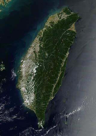
Taiwan, officially the Republic of China (ROC), is an island country located in East Asia. The island of Taiwan, formerly known as Formosa, makes up 99% of the land area of the territories under ROC control. The main island measures 35,808 square kilometres (13,826 sq mi) and lies some 180 kilometres (112 mi) across the Taiwan Strait from the southeastern coast of the People's Republic of China (PRC). The East China Sea lies to the north of the island, the Philippine Sea to its east, the Luzon Strait directly to its south and the South China Sea to its southwest. The ROC also controls a number of smaller islands, including the Penghu archipelago in the Taiwan Strait, the Kinmen and Matsu Islands in Fuchien near the PRC's coast, and some of the South China Sea Islands.

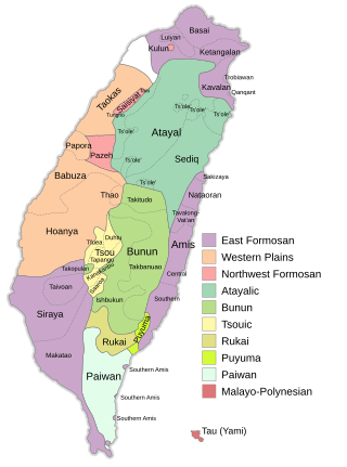
The Formosan languages are a geographic grouping comprising the languages of the indigenous peoples of Taiwan, all of which are Austronesian. They do not form a single subfamily of Austronesian but rather nine separate subfamilies. The Taiwanese indigenous peoples recognized by the government are about 2.3% of the island's population. However, only 35% speak their ancestral language, due to centuries of language shift. Of the approximately 26 languages of the Taiwanese indigenous peoples, at least ten are extinct, another four are moribund, and all others are to some degree endangered.

Pingtung County is a county located in southern Taiwan. It has a warm tropical monsoon climate and is known for its agriculture and tourism. Kenting National Park, Taiwan's oldest national park, is located in the county. The county seat is Pingtung City.
Highways in Taiwan are classified into five types:

The Formosan black bear, also known as the Taiwanese black bear or white-throated bear, is a subspecies of the Asiatic black bear. It was first described by Robert Swinhoe in 1864. Formosan black bears are endemic to Taiwan. They are also the largest land animals and the only native bears (Ursidae) in Taiwan. They are seen to represent the Taiwanese nation.

The Rukai are one of the indigenous people of Taiwan. They consist of six communities residing in southern Taiwan, each of which has its own dialect of the Rukai language. As of the year 2014, the Rukai numbered 12,699, and is the seventh-largest of the 13 officially recognized indigenous groups in Taiwan. The Rukai were formerly called Tsarisen or Tsalisen, which means "people living in the mountain".

Liuqiu, also known by several other names, is a coral island in the Taiwan Strait about 13 kilometers (8 mi) southwest of the main island of Taiwan. It has an area of 6.8 km2 (2.6 sq mi) and approximately 13,000 residents, the vast majority of whom share only 10 surnames. It is administered as a township of Pingtung County in Taiwan Province, Republic of China. As of 2019 the township chief is Chen Lung-chin.

Saaroa or Lhaʼalua is a Southern Tsouic language is spoken by the Saaroa (Hla'alua) people, an indigenous people of Taiwan. It is a Formosan language of the Austronesian family.
The Formosa Aboriginal Song and Dance Troupe is an ensemble that performs Taiwanese folk music. The group consists of younger musicians and performers who learn dances and music from elder experts and ethnologists. The group has toured internationally in North America, Europe, and Asia.

Agriculture is one of the main industries in Taiwan. It contributes to the food security, rural development and conservation of Taiwan. Around 24% of Taiwan's land is used for farming.

Provincial Highway 9 is an important highway across eastern Taiwan from Taipei City to Fangshan, Pingtung, Pingtung County. This provincial highway, at 476.1 km long, is the longest provincial highway in Taiwan and passes the regions of Taipei City, New Taipei City, Yilan County, Hualien County, Taitung County and Pingtung County.

Typhoon Morakot, known in the Philippines as Typhoon Kiko, was the deadliest typhoon to impact Taiwan in recorded history. The eighth named storm and fourth typhoon of the 2009 Pacific typhoon season, Morakot wrought catastrophic damage in Taiwan, leaving 673 people dead and 26 missing, and causing roughly NT$110 billion (US$3.3 billion) in damages. Morakot originated as a tropical depression in the West Pacific on August 2. The system initially moved northeastward, before taking a westward track, developing into a tropical storm on August 3, with the JMA giving it the name Morakot. The storm gradually strengthened as it moved towards Taiwan, intensifying into a Category 1-equivalent typhoon on August 5. Morakot reached its peak intensity on August 7, with a minimum central pressure of 945 millibars (27.9 inHg), maximum 10-minute sustained winds of 140 km/h (85 mph), and maximum 1-minute sustained winds of 150 km/h (90 mph). Afterward, Morakot's forward motion slowed and the system gradually weakened, making landfall on central Taiwan later that day as a severe tropical storm. Over the next day, Morakot slowly meandered over Taiwan, before emerging into the Taiwan Strait and turning northward, making landfall on Mainland China on August 9. Afterward, Morakot accelerated northward while gradually weakening, before later turning northeastward. On August 11, Morakot degenerated into a remnant low in the East China Sea, before dissipating on August 13, over northern Japan.

Sandimen Township is a mountain indigenous township in Pingtung County, Taiwan Province, Republic of China. The population of the township consists mainly of the Paiwan people with a substantial Rukai minority.

Wutai Township is a mountain indigenous township in Pingtung County, Taiwan. It has a population total of 3,306 and an area of 278.80 square kilometres (107.65 sq mi).
Events from the year 2005 in Taiwan, Republic of China. This year is numbered Minguo 94 according to the official Republic of China calendar.
Events from the year 2015 in Taiwan, Republic of China. This year is numbered Minguo 104 according to the official Republic of China calendar.
The architecture of Taiwan can be traced back to stilt housing of the aborigines in prehistoric times; to the building of fortresses and churches in the north and south used to colonize and convert the inhabitants during the Dutch and Spanish period; the Tungning period when Taiwan was a base of anti-Qing sentiment and Minnan-style architecture was introduced; in Qing dynasty period, a mix of Chinese and Western architecture appeared and artillery battery flourished during Qing's Self-Strengthening Movement; During the Japanese rule of Taiwan, the Minnan, Japanese and Western culture were main influencers in architectural designs and saw the introduction and use of reinforced concrete. Due to excessive Westernization as a colony, after the retrocession of Taiwan to the Republic of China in 1945 from Japan at the end of World War II, Chinese classical style became popular and entered into international mainstream as a postmodern design style. Today, Taiwanese architecture has undergone much diversification, every style of architecture can be seen.

Wu Li-hua, known in the Rukai language as Saidhai Tahovecahe, is a Taiwanese Rukai educator and politician. She is the first legislator of the Democratic Progressive Party to represent the Highland Aborigine Constituency, to which she was elected in 2020.
Saqacengalj is an abandoned or so-called a former indigenous settlement of a Paiwan tribe in Gaoshi Village, Mudan Township, Pingtung County, Taiwan. The term “Saqacengalj” has the meaning of “a tool for chiseling slate,” and the site is believed to be the first settlement of the tribe when they moved to Hengchun. The site, dating back to 500-600 years ago, is about 200-300 meters above sea level, and covers an area of 3.5 hectares. 6-7 times of migrations happened after the site was abandoned, the tribe settled down at the location of Gaoshi Village nowadays at the last migration happened around 50 years ago. The location of the site is about 7 kilometers away from the current settlement of Gaoshi Village, there are still about 83 slate houses at present, which are arranged in parallel rows along the mountain steps


