Kulamara

Last updated

Kulamara is a revenue village located in Simdega district of the Indian state of Jharkhand. The village is located in Targa Panchayat. Kulamara is situated in Bansjore block. It is one of 19 villages in Bansjore Block.

Simdega City in Jharkhand, India

Simdega is a city in the Indian state of Jharkhand. Simdega is the administrative headquarters of the eponymous district and Subdivision. The city stands at an elevation of approximately 418 metres (1371 feet) above sea level and covers an area of 3,750 km2 (1,450 sq mi). Bounded in the north by Gumla, on the east by Ranchi and West Singhbhum, on the west by Jashpur Nagar, Chhattisgarh and on the south by Rourkela, Odisha. The distance between Greater Rourkela and Simdega is 35 km. It is accessible by road through National Highways from Rourkela and Ranchi. The nearest railway station is Rourkela railway station.

Jharkhand State in Eastern India

Jharkhand is a state in eastern India, carved out of the southern part of Bihar on 15 November 2000. The state shares its border with the states of Bihar to the north, Uttar Pradesh to the northwest, Chhattisgarh to the west, Odisha to the south and West Bengal to the east. It has an area of 79,710 km2 (30,778 sq mi). It is the 16th largest state by area, and the 14th largest by population. Hindi is official language of the state. The city of Ranchi is its capital and Dumka its sub capital. The state is known for its waterfalls, hills and holy places. Baidyanath Dham, Parasnath and Rajrappa are major religious places.

Bansjore block Block in Jharkhand, India

Bansjore is one of the community development block of the Simdega district, Jharkhand state, India.

Contents

Geography

Kulamara is located on the southern part of the Chota Nagpur Plateau, which forms the eastern edge of the Deccan plateau system. The Lurgangi river and the Dev river flow near Kulamara.

Chota Nagpur Plateau Plateau of India

The Chhota Nagpur Plateau is a plateau in eastern India, which covers much of Jharkhand state as well as adjacent parts of Odisha, West Bengal, Bihar and Chhattisgarh. The Indo-Gangetic plain lies to the north and east of the plateau, and the basin of the Mahanadi River lies to the south. The total area of the Chota Nagpur Plateau is approximately 65,000 square kilometres (25,000 sq mi).

Deccan Plateau large plateau in India

The Deccan Plateau is a large plateau in western and southern India. It rises to 100 metres (330 ft) in the north, and to more than 1,000 metres (3,300 ft) in the south, forming a raised triangle within the South-pointing triangle of the Indian subcontinent's coastline.

Climate

Kulamara has a sub-tropical climate with temperature ranges from 20 °C to 40 °C during summer, and 3 °C to 21 °C during winter. The annual rainfall is about 145 centimetres (57 in). From June to September, the rainfall level is about 115 cm.

Demographics

As of 2011 census of India, [1] Kulamara had a population of 1210. The major languages spoken in this region are Nagpuri (or Sadri), Hindi, Mundari and Khariya.

Sadri (Nagpuri) is an Eastern Indo-Aryan language spoken in the Indian states of Jharkhand, Bihar, Chhattisgarh and Odisha. It is sometimes considered a Hindi dialect. It is the native language of the Nagpuri people, an ethno-linguistic group of the western Chota Nagpur region. In addition to native speakers, Nagpuri is also used as a lingua franca by members of a large number of tribal groups such as the Kharia, Munda, Bhumij, and Kurukh, many of whom have adopted it as their first language. It spoken by many Tea-tribes of Assam, West Bengal and Bangladesh. According to the 2011 Census, there were 5,108,691 speakers of the Nagpuri language, including 4,345,677 identifying as "Sadan/Sadri" and 763,014 as "Nagpuria".

Hindi An official language of India

Hindi, or Modern Standard Hindi is a standardised and Sanskritised register of the Hindustani language. Hindi, written in the Devanagari script, is one of the official languages of India, along with the English language. It is one of the 22 scheduled languages of the Republic of India. However, it is not the national language of India because no language was given such a status in the Indian constitution.

Mundari (Muɳɖa) is a Munda language of the Austroasiatic language family spoken by the Munda people in eastern India, Bangladesh, and Nepal. It is closely related to Santali. Mundari Bani, a script specifically to write Mundari, was invented by Rohidas Singh Nag. It has also been written in Devanagari, Odia, Bengali, and Latin.

Kulamra is home to people of many castes such as Binjhiya, Bhogta, Gond, Khariya, Kurmi, Das, Lohra, and Munda.

Caste form of social stratification characterized by endogamy, hereditary transmission of a lifestyle often including occupation, status in a hierarchy, customary social interaction, and exclusion, existing in various regions including South Asia

Caste is a form of social stratification characterized by endogamy, hereditary transmission of a lifestyle which often includes an occupation, status in a hierarchy, customary social interaction, and exclusion. It is an extreme evolution of a system of legally-entrenched social classes, also endogamous and hereditary, such as that of feudal Europe. Although caste systems exist in various regions, its paradigmatic ethnographic example is the division of Indian hindu society into rigid social groups, with roots in India's ancient history and persisting until today; it is sometimes used as an analogical basis for the study of caste-like social divisions existing outside India. In biology, the term is applied to role stratification in eusocial animals like ants and termites, though the analogy is imperfect as these also involve extremely stratified reproduction.

Education

Kulamara hosts UPG GOVT MS Kulamara, which was established in 1960. It is a P. with U. Primary school. It educates some 81 boys and girls and is staffed by 3 teachers. It is primarily a Hindi medium school. The DISE code of the school is 20210900301.

Festivals and dances

The region celebrates several major festivals and dances.

Karma

Karma is a festival of brothers and sisters. It rotates from one village to another. It's divided into three categories:

Sarhul Dance

Sarhul is a prominent festival of Oraon and is celebrated with dancing. People hold hands to form a circle. Musicians use traditional Indian instruments, sitting inside the circle. Men traditionally wear a white dhoti with a red border, while women wear a white sari with a red border.

Kurukh people

The Oraon or Kurukh tribe, also spelled Uraon or Oram, are a Dravidian ethnic group inhabiting various states across central and eastern India, Rakhine State in Myanmar, Bangladesh, Nepal, and Bhutan. They spoke the Kurukh language, which belong to dravidian languages family.

Dhoti traditional mens garment of South Asia

The dhoti, also known as panche, vesti, dhuti, mardani, chaadra, dhotar or panchey, is a traditional men's garment worn in the Indian subcontinent. It is a rectangular piece of unstitched cloth, usually around 4.5 metres (15 ft) long, wrapped around the waist and the legs and knotted at the waist.

Sari womans draped garment of South Asia

A sari, saree or shari is a women's garment from the Indian subcontinent that consists of a drape varying from five to nine yards in length and two to four feet in breadth that is typically wrapped around the waist, with one end draped over the shoulder, baring the midriff. There are various styles sari manufacture and draping, the most common being the Nivi style, which originated in Deccan region of India. The sari is worn with fitted bodice commonly called a choli and petticoat called parkar or ul-pavadai. In the modern Indian subcontinent, the sari is considered a cultural icon.

Bheja Dance

In the Bheja dance, dozens of young boys and girls gather at a particular place, form a chain by holding hands in alternate succession then dance.

Related Research Articles

Gumla Town in Jharkhand, India

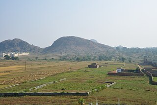
Gumla is a city which is the headquarters of Gumla district in the state of Jharkhand, India.

Yingkiong Town in Arunachal Pradesh, India

Yingkiong is the administrative headquarter of the Upper Siang district in the state of Arunachal Pradesh in India. A small town that lies 1 km east of Siang river in Upper Siang, Arunachal Pradesh. It is situated at an elevation of 200 meters (700 ft) above sea level,to its west flows the Siang river or. The town has a population of 8573 persons as of.

Dima Hasao district District in Assam, India

Dima Hasao (Pron: ˈdɪmə həˈsaʊ) district — earlier called North Cachar Hills district — is an administrative district in the state of Assam in north-eastern India. As of 2011 it is the least populous district of Assam. "Dima Hasao" means "Dimasa Hills" in the Dimasa language.

Gumla district district in Jharkhand, India

Gumla district is one of the twenty-four districts of Jharkhand state, India, and Gumla town is the administrative headquarters of this district.

Arhavi District in Black Sea, Turkey

Arhavi, is a town and district of Artvin Province located in the Black Sea region of Turkey. The terrain is hilly and mountainous. Area of the city center is about 6 km2, and the total district area is 314 km2. The length of the coast is about 10 km. In 2011 with 19.362 district population the 5th biggest district population of Artvin province. With 15.622 city population, in Turkey 308th and in Artvin province after Artvin and Hopa the 3rd biggest population. Laz people generate a large portion of the population.

Badagaon Town in Madhya Pradesh, India

Badagaon Dhasan is a town and a Nagar Parishad in Tikamgarh district in the state of Madhya Pradesh, India.

Barwadih city in Jharkhand, India

Barwadih is a Block present in Latehar district of Jharkhand state in India.

Belda Town in West Bengal, India

Belda is a town and headquarter of Narayangarh Block under Kharagpur subdivision of Paschim Medinipur district in West Bengal, India. It is a rapidly growing town both business and population wise after being declared a Municipality in 2014 by the government. It is located approximately 35 km south of Kharagpur town, 50 km from district headquarter Midnapore and 165 km from the state capital city Kolkata/Calcutta. NH 60 and SH 5 cross at Belda. It is also well connected by railways and also known as 'The Gateway to Odisha'. Thus, Belda plays an important role in connecting eastern India with southern India. Due to its easy access from different parts, it is a good business center.

Kunda Block Community development block in Jharkhand, India

Kunda is a community development block that forms an administrative division in Chatra subdivision of Chatra district, Jharkhand state, India.

Pratappur, Jharkhand Community development block in Jharkhand, India

Pratappur is a community development block that forms an administrative division in Chatra subdivision of Chatra district, Jharkhand state, India.

Simaria Block Community development block in Jharkhand, India

Simaria is a community development block that forms an administrative division in Simaria subdivision of Chatra district, Jharkhand state, India.

Kanhachatti Community Development Block in Jharkhand, India

Kanhachatti is a community development block that forms an administrative division in Chatra subdivision of Chatra district, Jharkhand state, India.

Mayurhand Block Community development block in Jharkhand, India

Mayurhand is a community development block that forms an administrative division in Chatra subdivision of Chatra district, Jharkhand state, India.

Itkhori Block Community development block in Jharkhand, India

Itkhori is a community development block that forms an administrative division in Chatra subdivision of Chatra district, Jharkhand state, India.

Lawalong Community development block in Jharkhand, India

Lawalong is a community development block that forms an administrative division in Simaria subdivision of Chatra district, Jharkhand state, India.

Bishnugarh (community development block) Community development block in Jharkhand, India

Bishnugarh, also known as Bishungarh, is a community development block that forms an administrative division in the Hazaribagh Sadar subdivision of Hazaribagh district in the Indian state of Jharkhand.

Jamua (community development block) Community development block in Jharkhand, India

Jamua is a community development block that forms an administrative division in Khori Mahuwa subdivision of Giridih district in the Indian state of Jharkhand.

Chatra (community development block) Community development block in Jharkhand, India

Chatra is a community development block that forms an administrative division in Chatra district in the Indian state of Jharkhand.

Shaligram Ramnarayanpur (community development block) Community development block in Jharkhand, India

Shaligram Ramnarayanpur (Hunterganj) is a community development block that forms an administrative division in Chatra subdivision of Chatra district in the Indian state of Jharkhand.

Koderma (community development block) Community development block in Jharkhand, India

Koderma is a community development block that forms an administrative division of Koderma district, Jharkhand state, India.

References

  1. Census of India 2011: Data from the 2001 Census, including cities, villages and towns (Provisional). Census Commission of India.

Coordinates: 22°25′57.69″N84°43′34.8″E / 22.4326917°N 84.726333°E / 22.4326917; 84.726333