Bhabua is main city of Kaimur district in the state of Bihar, India. Bhabua is known for the famous historical temple Mundeshwari Temple and the Kaimur Range of hills. It is located 84 kms from Varanasi.

Kaimur district is one of the 38 districts of Bihar, India. The district headquarters are at Bhabua. Before 1991, it was part of Rohtas District. Till 1764 the region was a part of Ghazipur District and was a part of Kamsaar Raj and later it was a part of Chainpur Estate till 1837.
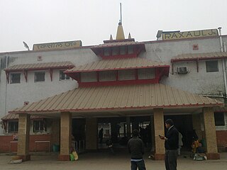
Raxaul is a sub-divisional town in the East Champaran district of the Indian state of Bihar. It is situated at the India-Nepal border with Birgunj city (Nepal). Raxaul is a major railway junction.
Warisaliganj is a Community Development block and a Municipal Council in Nawada district in the Indian state of Bihar.

Bhojpur district is one of the thirty-eight districts of the Indian state of Bihar. Arrah town is the administrative headquarters of this district. Bhojpur district came into existence in 1972. Earlier it was the part of Shahabad district. This district is named "Bhojpur" after great Parmara King Bhoja as most early settlers were Rajput rulers of Parmara dynasty then called as Ujjainiya.
Kodhiyar is a village in Sitamarhi district, Bihar state, India. It is situated one kilometer east from the river Bagmati four kilometers south of Dhang Railway Station, and adjacent to the village of Akhta. It is located in the Suppi subdistrict and Akhta Uttar panchayat.

Rampurwa is a village situated in Mehsi, East Champaran District in the Indian state of Bihar. The village is commonly known as Rampurwa among the localities. It lies in the Mirjapur Panchayat region. It is situated at the bank of river Burhi Gandak River on whose bank the village has flourished. It is well connected by road and railways. The nearest city Kaswa Mehsi in Mehsi, which is 2 km from the village. The nearest railway station is Mehsi railway station, which is around 5 km from the village.
Thakurganj railway station serves Thakurganj town in Kishanganj district in the Indian state of Bihar. The Mechi flowing nearby forms the boundary between Nepal and India in the area. On the other side of the border lies Prithivinagar town of Nepal.
Tengraha is a village in Minapur Block in Muzaffarpur district of Bihar, India. It belongs to Tirhut Division. It is located 26 km north of the Muzaffarpur district headquarters, 8 km from Minapur, and 91 km from the state capital, Patna. It is surrounded by Gandak and Bagmati rivers. Most of the people in this village are farmers. This village, as well as the rest of Muzaffarpur district, is famous for its Lichee trees, which grow litchis fruit. Tengrari has a small shopping market. Balua Bazar is near Tengrari, which has a shopping market and Rishabh Vastralaya.

Sandesh Assembly constituency is one of 243 assembly seats of the Bihar Legislative Assembly. It is part of Arrah Lok Sabha constituency along with other assembly constituencies viz Barhara, Arrah, Agiaon (SC), Tarari, Jagdishpur and Shahpur.
Ismailpur (Harauli) is a village in Vaishali district of Bihar state in India.
Ghosrawan is a village located in Giriyak block in the district of Nalanda in Bihar, India.
National Highway 922 is a National Highway in India. This highway connects Patna with Arrah and Buxar in Bihar. The eastern end of the Purvanchal Expressway at Haydaria in Ghazipur district is around 17 km from Buxar on NH-922.
Nauhatta is a large village in Nauhatta Block in Saharsa District of Bihar state, India. It belongs to Kosi Division. It is located 20 km towards North from District headquarters Saharsa. 165 km from State capital Patna. It comes under Mahisi constituency. The village had a population of 25,347 of which 13,124 were male while 12,223 were females as per Population Census 2011.
Teznarayanpur is a railway terminus on Katihar–Teznarayanpur branch line of Barauni–Katihar section. It is located in Katihar district, Bihar state, India. The station consists of two platforms, which are not well sheltered.
Jalpura Tapa is a village and gram panchayat in Koilwar block, Bhojpur district in the Indian state of Bihar. Situated close to the Sone River, it is a large village with more than 12,000 residents. Population-wise it is the largest village and area-wise, it is the 2nd-largest village of Koilwar block.
Sakaddi is a village and gram panchayat in Koilwar block, Bhojpur district in the Indian state of Bihar. Situated between Arrah and Koilwar, it is a large village with around 8,294 residents.
State Highway 81 (SH-81) is a state highway in Bihar state. It covers two major districts of Bihar state. This state highway starts from Sakaddi near Arrah and ends at Nasriganj near Dehri-on-Sone and Daudnagar.
Kulharia is a village in the Parbatta Subdistrict of Khagaria district, Bihar. It is 1 km from the bank of river Ganga and 5 km from the Subdistrict headquarter Parbatta. Maheslet More and Salarpur Chowk are the two major Bus Stops/Stands in Kulharia.


