Related Research Articles
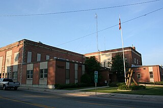
Bonner County is a county in the northern part of the U.S. state of Idaho. As of the 2010 census, the population was 40,877. The county seat and largest city is Sandpoint. Partitioned from Kootenai County and established in 1907, it was named for Edwin L. Bonner, a ferry operator.

Clark Fork is a small town in Bonner County, Idaho. The population was 536 at the time of the 2010 census.

Sandpoint is the largest city in, and the county seat of, Bonner County, Idaho. Its population was 7,365 at the 2010 census.

Bonners Ferry is a city in and the county seat of Boundary County, Idaho, United States. The population was 2,543 at the 2010 census.

Events from the year 1810 in Canada.

The Clark Fork, or the Clark Fork of the Columbia River, is a river in the U.S. states of Montana and Idaho, approximately 310 miles (500 km) long. The largest river by volume in Montana, it drains an extensive region of the Rocky Mountains in western Montana and northern Idaho in the watershed of the Columbia River. The river flows northwest through a long valley at the base of the Cabinet Mountains and empties into Lake Pend Oreille in the Idaho Panhandle. The Pend Oreille River in Idaho, Washington, and British Columbia, Canada which drains the lake to the Columbia in Washington, is sometimes included as part of the Clark Fork, giving it a total length of 479 miles (771 km), with a drainage area of 25,820 square miles (66,900 km2). In its upper 20 miles (32 km) in Montana near Butte, it is known as Silver Bow Creek. Interstate 90 follows much of the upper course of the river from Butte to Saint Regis. The highest point within the river's watershed is Mount Evans at 10,641 feet (3,243 m) in Deer Lodge County, Montana along the Continental Divide.

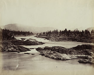
The Pend Oreille River is a tributary of the Columbia River, approximately 130 miles (209 km) long, in northern Idaho and northeastern Washington in the United States, as well as southeastern British Columbia in Canada. In its passage through British Columbia its name is spelled Pend-d'Oreille River. It drains a scenic area of the Rocky Mountains along the U.S.-Canada border on the east side of the Columbia. The river is sometimes defined as the lower part of the Clark Fork, which rises in western Montana. The river drains an area of 66,800 square kilometres (25,792 sq mi), mostly through the Clark Fork and its tributaries in western Montana and including a portion of the Flathead River in southeastern British Columbia. The full drainage basin of the river and its tributaries accounts for 43% of the entire Columbia River Basin above the confluence with the Columbia. The total area of the Pend Oreille basin is just under 10% of the entire 258,000-square-mile (670,000 km2) Columbia Basin. Box Canyon Dam is currently underway on a multimillion-dollar project for a fish ladder.

The Kootenay or Kootenai river is a major river in the Northwest Plateau, in southeastern British Columbia, Canada, and northern Montana and Idaho in the United States. It is one of the uppermost major tributaries of the Columbia River, the largest North American river that empties into the Pacific Ocean. The Kootenay River runs 781 kilometres (485 mi) from its headwaters in the Kootenay Ranges of the Canadian Rockies, flowing from British Columbia's East Kootenay region into northwestern Montana, then west into the northernmost Idaho Panhandle and returning to British Columbia in the West Kootenay region, where it joins the Columbia at Castlegar.

The Pend d'Oreille, also known as the Kalispel, are Indigenous peoples of the Northwest Plateau. Today many of them live in Montana and eastern Washington. The Kalispel peoples referred to their primary tribal range as Kaniksu.
Kettle Falls was an ancient and important salmon fishing site on the upper reaches of the Columbia River, in what is today the U.S. state of Washington, near the Canada–US border. The falls consisted of a series of rapids and cascades where the river passed through quartzite rocks deposited by prehistoric floods on a substrate of Columbia River basalt. The river dropped nearly 50 feet (15 m), and the sound of the falls could be heard for miles away. Kettle Falls was inundated in 1940, as the waters of the reservoir Lake Roosevelt rose behind Grand Coulee Dam, permanently flooding the site.

The Idaho Panhandle—locally known as North Idaho—is a salient region of the U.S. state of Idaho encompassing the state's 10 northernmost counties: Benewah, Bonner, Boundary, Clearwater, Idaho, Kootenai, Latah, Lewis, Nez Perce, and Shoshone. The Panhandle is bordered by the state of Washington to the west, Montana to the east, and the Canadian province of British Columbia to the north. The Idaho panhandle, along with Eastern Washington, comprises the region known as the Inland Northwest, headed by its largest city, Spokane, Washington.

Lake Pend Oreille in the northern Idaho Panhandle is the largest lake in the U.S. state of Idaho and the 38th-largest lake by area in the United States, with a surface area of 148 square miles (380 km2). It is 43 miles (69 km) long, and 1,150 feet (350 m) deep in some regions, making it the fifth-deepest in the nation and having a Volume: 43,939,940 acre ft= 54 km^3. The lake is fed by the Clark Fork River and the Pack River, and drains into the Pend Oreille River, as well as subsurfacely into the Spokane Valley–Rathdrum Prairie Aquifer. It is surrounded by national forests and a few small towns, with the largest population on the lake at Sandpoint. The majority of the shoreline is non-populated and all but the southern tip of the lake is in Bonner County. The southern tip is in Kootenai County and is home to Farragut State Park, formerly the Farragut Naval Training Station during World War II, of which a small part is still active and conducts U.S. Navy acoustic underwater submarine research.<
Spokane House was a fur-trading post founded in 1810 by the British-Canadian North West Company, located on a peninsula where the Spokane River and Little Spokane River meet. When established, it was the North West Company's farthest outpost in the Columbia River region. An American rival of the NWC, the Pacific Fur Company opened a station adjacent to Spokane House, called Fort Spokane. The War of 1812 and ongoing supply issues caused the collapse of the PFC, with its posts now under the control of the NWC. The original Spokane House was abandoned in favor of Fort Spokane, though the latter location was still called Spokane House. The second Spokane House saw use as a major post in the interior Oregon Country until the NWC was absorbed by the Hudson's Bay Company in 1821. During a general tour of the Pacific Northwest, Spokane House was abandoned by George Simpson in 1825, in favor of a new post that became Fort Colvile. The site of Spokane House is in Spokane County in the U.S. state of Washington, just northwest of the city of Spokane.

The Pack River is a medium-sized river located in Northern Idaho. It is about 40 miles (64 km) long and drains a high mountainous area of the Idaho Panhandle's Rocky Mountains and Selkirk Mountains. The river flows into Lake Pend Oreille and is part of the Columbia River watershed via the Pend Oreille River.
Saleesh House, also known as Flathead Post, was a North West Company fur trading post built near present-day Thompson Falls, Montana in 1809 by David Thompson and James McMillan of the North West Company. It became a Hudson's Bay Company (HBC) post after that company merged with the North West Company in 1821. Under HBC control the post was better known as Flathead rather than Saleesh. It continued to operate until at least 1855.
Kootanae House, also spelled Kootenae House, was a North West Company fur trading post built by Jaco Finlay under the direction of David Thompson near present-day Invermere, British Columbia in 1807. It was abandoned in 1812. In 1808 Thompson reckoned its location as 50°32′12″N115°56′15″W. The actual location is Kootenae House National Historic Site, located at 50.526624°N 116.045440°W.
State Highway 200 (SH-200) is an east–west state highway in northern Idaho, United States. It travels along the north side of Lake Pend Oreille and the Clark Fork River between the Sandpoint area and the Montana border, where it continues as Montana Highway 200. The highway is also a national scenic byway that is named the Pend Oreille Scenic Byway. This state highway is part of a continuous chain of similarly numbered state highways that stretch from Minnesota to Idaho.
The Kalispel Indian Community of the Kalispel Reservation is a federally recognized tribe of LowerKalispel people, located in Washington. They are an Indigenous people of the Northwest Plateau.

The fur trade in Montana was a major period in the area's economic history from about 1800 to the 1850s. It also represents the initial meeting of cultures between indigenous peoples and those of European ancestry. British and Canadian traders approached the area from the north and northeast focusing on trading with the indigenous people, who often did the trapping of beavers and other animals themselves. American traders moved gradually up the Missouri River seeking to beat British and Canadian traders to the profitable Upper Missouri River region.
Garfield is an unincorporated community in Bonner County, in the U.S. state of Idaho. The community is situated on Garfield Bay, an inlet of Lake Pend Oreille.
References
- ↑ Eddins, O. Ned. "David Thompson, Surveyor - Canadian Fur Trader - Explorer - Mapmaker". Mountain Man - Indian - Canadian Fur Trade. thefurtrapper.com. Archived from the original on November 28, 2012. Retrieved December 4, 2012.
- 1 2 A Brief History of Bonner County Archived 2008-07-19 at the Wayback Machine , Bonner County Historical Society
- ↑ Gunter, Bob (2011). "Kullyspell House". History of Sandpoint, Idaho. Retrieved December 4, 2012.
- ↑ "Kullyspel House" . Retrieved December 4, 2012.
- ↑ Nisbet, Jack (1994). Sources of the River: Tracking David Thompson Across Western North America. Sasquatch Books. p. 144. ISBN 1-57061-522-5.