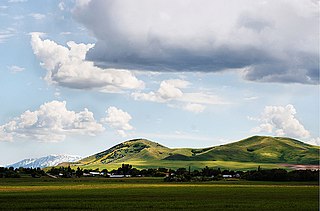
Hope, Idaho

Last updated

Hope, Idaho
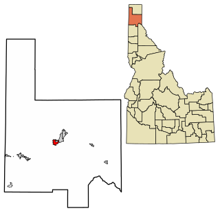
Bonner County Idaho Incorporated and Unincorporated areas Hope Highlighted 1638440.svg
Location of Hope in Bonner County, Idaho.
Coordinates: 48°14′55″N116°18′33″W / 48.24861°N 116.30917°W / 48.24861; -116.30917
CountryUnited States
State Idaho
County Bonner
Area
[1]
  Total0.47 sq mi (1.22 km2)
  Land0.46 sq mi (1.19 km2)
  Water0.01 sq mi (0.03 km2)
Elevation
2,192 ft (668 m)
Population
 (2010) [2]
  Total86
  Estimate 
(2019) [3]
102
  Density222.22/sq mi (85.88/km2)
Time zone UTC-8 (Pacific (PST))
  Summer (DST) UTC-7 (PDT)
ZIP code
83836
Area code(s) 208, 986
FIPS code 16-38440
GNIS feature ID0396664

Hope is a city in Bonner County, Idaho, United States. The population was 86 at the 2010 census. [4]

Contents

Geography

Hope is located at 48°14′55″N116°18′33″W / 48.24861°N 116.30917°W / 48.24861; -116.30917 (48.248728, -116.309214), [5] at an elevation of 2,192 feet (668 m) above sea level. The city sits on the northeast shore of Lake Pend Oreille.

According to the United States Census Bureau, the city has a total area of 0.52 square miles (1.35 km2), of which, 0.47 square miles (1.22 km2) is land and 0.05 square miles (0.13 km2) is water. [6]

Demographics

Historical population
CensusPop.Note
1910 215
1920 160−25.6%
1930 111−30.6%
1940 1164.5%
1950 111−4.3%
1960 96−13.5%
1970 63−34.4%
1980 10668.3%
1990 99−6.6%
2000 79−20.2%
2010 868.9%
2019 (est.)102 [3] 18.6%
U.S. Decennial Census [7]

2010 census

As of the census [2] of 2010, there were 86 people, 34 households, and 26 families living in the city. The population density was 183.0 inhabitants per square mile (70.7/km2). There were 59 housing units at an average density of 125.5 per square mile (48.5/km2). The racial makeup of the city was 98.8% White and 1.2% from two or more races.

There were 34 households, of which 35.3% had children under the age of 18 living with them, 61.8% were married couples living together, 8.8% had a female householder with no husband present, 5.9% had a male householder with no wife present, and 23.5% were non-families. 20.6% of all households were made up of individuals, and 2.9% had someone living alone who was 65 years of age or older. The average household size was 2.53 and the average family size was 2.77.

The median age in the city was 47 years. 22.1% of residents were under the age of 18; 12.8% were between the ages of 18 and 24; 13.9% were from 25 to 44; 38.3% were from 45 to 64; and 12.8% were 65 years of age or older. The gender makeup of the city was 51.2% male and 48.8% female.

2000 census

As of the census [8] of 2000, there were 79 people, 34 households, and 24 families living in the city. The population density was 197.0 inhabitants per square mile (76.1/km2). There were 57 housing units at an average density of 142.1 per square mile (54.9/km2). The racial makeup of the city was 100.00% White.

There were 34 households, out of which 29.4% had children under the age of 18 living with them, 64.7% were married couples living together, 2.9% had a female householder with no husband present, and 29.4% were non-families. 23.5% of all households were made up of individuals, and 8.8% had someone living alone who was 65 years of age or older. The average household size was 2.32 and the average family size was 2.75.

In the city, the population was spread out, with 21.5% under the age of 18, 7.6% from 18 to 24, 22.8% from 25 to 44, 36.7% from 45 to 64, and 11.4% who were 65 years of age or older. The median age was 44 years. For every 100 females, there were 97.5 males. For every 100 females age 18 and over, there were 106.7 males.

The median income for a household in the city was $24,500, and the median income for a family was $26,875. Males had a median income of $50,833 versus $31,250 for females. The per capita income for the city was $19,468. There were no families and 5.1% of the population living below the poverty line, including none under 18 and none of those over 64.

The town is mentioned in the 2009 video game Prototype as a town which was used by the government to test a virus. The virus mutated and killed the entire population except two survivors who were captured by the military to serve as test subjects. [9]

The town was a lifetime home for artist Edward Kienholz.

See also

Related Research Articles

<span class="mw-page-title-main">Bonner County, Idaho</span> County in Idaho, United States

Bonner County is a county in the northern part of the U.S. state of Idaho. As of the 2020 census, the population was 47,110. The county seat and largest city is Sandpoint. Partitioned from Kootenai County and established in 1907, it was named for Edwin L. Bonner, a ferry operator.

<span class="mw-page-title-main">Garden City, Idaho</span> City in Idaho, United States

Garden City is a city in Ada County, Idaho. The population was 12,316 at the time of the 2020 census. Garden City is nearly surrounded by Boise but retains a separate municipal government.

<span class="mw-page-title-main">Star, Idaho</span> City in Idaho, United States

Star is a city in northwestern Ada County, Idaho, with parts stretching into neighboring Canyon County. The population was 5,793 at the 2010 census, up from 1,795 in 2000. It was named in the 19th century by travelers on their way to Middleton and Boise who used the star on the school house to find east and west. The name stuck and it became Star, Idaho. Today, it is a rapidly growing suburb of Boise and its schools are shared with Middleton School District and West Ada School District.

<span class="mw-page-title-main">Tensed, Idaho</span> City in Idaho, United States

Tensed is a city in Benewah County, Idaho, United States. The population was 123 at the 2010 census, down from 126 in 2000. The city is within the Coeur d'Alene Reservation, and is accessed by U.S. Route 95, the state's primary north-south highway. The city is located about 1 mile (0.6 km) from the north entrance of McCroskey State Park.

<span class="mw-page-title-main">Clark Fork, Idaho</span> City in Idaho, United States

Clark Fork is a small town in Bonner County, Idaho. The population was 536 at the time of the 2010 census.

<span class="mw-page-title-main">Dover, Idaho</span> City in Idaho, United States

Dover is a city in Bonner County, Idaho. The population was 556 at the 2010 census.

<span class="mw-page-title-main">East Hope, Idaho</span> City in Idaho, United States

East Hope is a city in Bonner County, Idaho, United States. The population was 210 at the 2010 census.

<span class="mw-page-title-main">Kootenai, Idaho</span> City in Idaho, United States

Kootenai is a city in Bonner County, Idaho. The population was 678 at the 2010 census.

<span class="mw-page-title-main">Ponderay, Idaho</span> City in Idaho, United States

Ponderay is a city in Bonner County, Idaho. The population was 1,137 at the 2010 census, up from 638 in 2000. Ponderay's city motto is "Little City with the Big Future". Its name is an English phonetic spelling of the French words “Pend Oreille”, the name of the lake the city sits upon.

<span class="mw-page-title-main">Priest River, Idaho</span> City in Idaho, United States

Priest River is a city in Bonner County, Idaho. The population was 1,751 at the 2010 census. Located in the Idaho Panhandle region of the state, the city is at the mouth of the Priest River on the Pend Oreille River.

<span class="mw-page-title-main">Moyie Springs, Idaho</span> City in Idaho, United States

Moyie Springs is a city in Boundary County, Idaho, United States. The population was 718 at the 2010 census.

<span class="mw-page-title-main">Wilder, Idaho</span> City in Idaho, United States

Wilder is a city in Canyon County, Idaho, United States. The population was 1,533 at the 2010 census.
<span class="mw-page-title-main">Malta, Idaho</span> City in Cassia County, Idaho, United States

Malta is a city in Cassia County, Idaho, United States. The population was 193 at the 2010 census. It is part of the Burley, Idaho Micropolitan Statistical Area.

<span class="mw-page-title-main">White Bird, Idaho</span> Town in Idaho, United States

White Bird is a city in Idaho County, Idaho. The population was 91 at the time of the 2010 census, down from 106 in 2000.

<span class="mw-page-title-main">Dalton Gardens, Idaho</span> City in Kootenai County, Idaho, United States

Dalton Gardens is a city in Kootenai County, Idaho, United States. It is considered a suburb of Coeur d'Alene and borders the city to the north and east. The city of Dalton Gardens is also part of the larger Spokane-Coeur d'Alene Combined Metropolitan Statistical Area which encompasses Kootenai County, Idaho. The population of Dalton Gardens was 2,335 at the time of the 2010 census.

<span class="mw-page-title-main">Onaway, Idaho</span> City in Idaho, United States

Onaway is a city in Latah County, Idaho, United States. The population was 187 at the 2010 census, down from 230 in 2000.

<span class="mw-page-title-main">Peck, Idaho</span> City in Idaho, United States

Peck is a city in Nez Perce County, Idaho, United States. The population was 197 at the 2010 census. It is part of the Lewiston, ID-WA Metropolitan Statistical Area. Many residents of Peck work in nearby Orofino, Idaho. Additionally, Peck residents attend high school in Orofino since Peck does not have a high school.

<span class="mw-page-title-main">Grand View, Idaho</span> City in Owyhee County, Idaho, United States

Grand View is a city along the Snake River in Owyhee County, Idaho, United States. The population was 440 at the 2020 census. It is part of the Boise City–Nampa, Idaho Metropolitan Statistical Area.

<span class="mw-page-title-main">Payette, Idaho</span> City in Idaho, United States

Payette is a city in and the county seat of Payette County, Idaho, United States. The population was 7,433 at the 2010 census. It is part of the Ontario, OR−ID Micropolitan Statistical Area.

<span class="mw-page-title-main">Osburn, Idaho</span> City in Shoshone County, Idaho, United States

Osburn is a city in Shoshone County, Idaho, United States. Located in the Silver Valley mining region of northern Idaho, its population was 1,555 at the 2010 census.
References

  1. "2019 U.S. Gazetteer Files". United States Census Bureau. Retrieved July 9, 2020.
  2. 1 2 "U.S. Census website". United States Census Bureau . Retrieved December 18, 2012.
  3. 1 2 "Population and Housing Unit Estimates". United States Census Bureau. May 24, 2020. Retrieved May 27, 2020.
  4. Spokesman-Review Archived 2016-03-04 at the Wayback Machine - 2010 census - Hope, Idaho - accessed 2011-12-26
  5. "US Gazetteer files: 2010, 2000, and 1990". United States Census Bureau. February 12, 2011. Retrieved April 23, 2011.
  6. "US Gazetteer files 2010". United States Census Bureau. Archived from the original on January 25, 2012. Retrieved December 18, 2012.
  7. "Census of Population and Housing". Census.gov. Retrieved June 4, 2015.
  8. "U.S. Census website". United States Census Bureau . Retrieved January 31, 2008.
  9. "Jo Garcia: Prototype 2 is a blast". ESPN. Retrieved October 2, 2021.