Kumar Bandi is a town located in Kupwara, Muzaffarabad District, Pakistan. It is located at 34°16'15" North, 73°33'25" East at an altitude of 1434 metres."Sangir Syedan" about 17km away from the Capital Muzaffar abad, Azad Jammu & Kashmir, is the highest residential point from the sea level of this village. The town was electrified in 1986. Mobile phone coverage is now almost available in each corner of the town. "Sangir Syedan" has higher literacy rate, basic health unit, a small BAZAR where daily life needs are easily available. The top of the Sangir Syedan is very beautiful with a little plain and hilly area having forests of "CHEER (This tree has normal height of 20m+", "KAIL" tree with almost same height is also found there. There is a graveyard where the tree "DAWDAR" can also be seen which are about 300–400 years old trees. October 5, 2005 a massive earth quake also damaged badly this village but now the life is again coming in its charm with help of International community, Pakistan army, a great contribution of development NGOs like "TCF", Pakistani nation & AJK Government agencies and by itself of the residents of the town. Some of the residents are working abroad, contributing a whole sum per capita income of not only of the village but AJK & Pakistan.
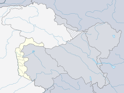
Muzaffarabad district of Azad Kashmir, Pakistan is located on the banks of the Jhelum and the Neelum rivers, and is very hilly. The district is bounded to Punjab in the west and to Kupwara and Baramulla districts of the Kashmir in the east. To the north is Neelum District; the fall on the northeast of the district and Bagh District forms the southern boundary. The total area of the district is 1,642 square kilometres. The city of Muzaffarabad serves as capital of Azad Kashmir.
Pakistan, officially the Islamic Republic of Pakistan, is a country in South Asia. It is the world’s sixth-most populous country with a population exceeding 212,742,631 people. In area, it is the 33rd-largest country, spanning 881,913 square kilometres. Pakistan has a 1,046-kilometre (650-mile) coastline along the Arabian Sea and Gulf of Oman in the south and is bordered by India to the east, Afghanistan to the west, Iran to the southwest, and China in the far northeast. It is separated narrowly from Tajikistan by Afghanistan's Wakhan Corridor in the northwest, and also shares a maritime border with Oman.
This page is based on this Wikipedia article Text is available under the CC BY-SA 4.0 license; additional terms may apply. Images, videos and audio are available under their respective licenses.
Related Research Articles
Azad Jammu and Kashmir, abbreviated as AJK and commonly known as Azad Kashmir, is a nominally self-governing jurisdiction administered by Pakistan. The territory lies west of the Indian-administered state of Jammu and Kashmir, and was part of the former princely state of Jammu and Kashmir.
Kharota Syedan is a village on the northern outskirts of Sialkot, Punjab, Pakistan. The villages has community services such as primary and secondary education, a post office, mosques, and banks. The town has utilities including gas, electricity, water, and telephone communications.
Sohawa is an administrative sub-division (Tehsil) of the Jhelum District, situated in the Punjab province of Pakistan, located in the northwestern part of the district. One sign of Sohawa is the toll plaza by the name of 'Tarakki' on the Grand Trunk Road. The main bazaar of Sohawa attracts people from nearby villages.
Sehnsa is a large town in Pakistan Administered Azad Kashmir which lies on the west of Gulpur on the Kotli-Rawaplindi road. Sehnsa is a sub-divisional (Tehsil) headquarters of Kotli district in the center of Sehnsa valley.
Pallandri is a township in Sudhanoti district of Azad Kashmir. It is located at latitude 33° 42′ 54″ N, longitude 73° 41′ 9″ E, 90 km (56 mi) from Islamabad, the capital of Pakistan. It is connected with Rawalpindi and Islamabad through Azad Pattan road. The main tribe of Pallandri is the Sudhan tribe.
Kotli is the chief town of Kotli District, in Azad Kashmir, a self-governing region administered by Pakistan. Kotli is linked with Mirpur by two metalled roads, one via Rajdhani, (90 km) and the other via Charhoi. It is also directly linked with Rawalakot via Tarar Khel (82 km) and a double road which links Kotli with the rest of Pakistan via Sehnsa, another major town in Azad Kashmir. Kotli is roughly a three hours drive from Islamabad and Rawalpindi, at a distance of 117 km via Sehnsa.
Takal is the biggest village in Choha Khalsa Union Council of Kallar Syedan Tehsil, Rawalpindi District of Punjab, Pakistan. Nearby towns are Bewal and Choha Khalsa. The village named after a Sikh – Tikka Lal Singh. It is located about 15 kilometres (9.3 mi) from Kallar Syedan, towards river Jehlam.
Changa Bangial is a town and Union Council, an administrative subdivision, of Gujar Khan Tehsil in the Punjab Province of Pakistan.
Kallar Syedan tehsil is a tehsil in the Rawalpindi District, Punjab, Pakistan. Earlier a part of the Kahuta Tehsil, it became a separate tehsil on 1 July 2004.
Mankiala is a village in the Potohar plateau, Punjab near Rawalpindi, Pakistan, known for the nearby Mankiala stupa - a Buddhist stupa located at the site where, according to legend, Buddha sacrificed some of his body parts to feed seven hungry tiger cubs.
Kotli Loharan is a small town in Sialkot District, Pakistan. K. L industry used to manufacture mine-laying machines, hydraulic jacks and instruments for F-86 aircraft engine maintenance for the Pakistan Army. A rural hospital funds were raised, a veterinary hospital, boys and girls colleges, schools and roads have been constructed. Bazaars have been widened in 2010, Fresh water filtration plants have been installed in various locations. New Building of veterinary Hospital constructed, Streets are cemented, Rural Hospital new building constructed and upgraded, Ring roads are made.
Potha Bainsi is a village in Mirpur District of Azad Kashmir, Pakistan. The nearest town is Kakra.
It's approximately 8 miles east from the city of Mirpur and approx 20 miles from the city of Jhelum.
Hadwala Gujaran is a village in the Islamabad Capital Territory of Pakistan. It is located at 33° 26' 35N 73° 17' 45E with an altitude of 520 metres (1,710 ft).
Banjosa Lake is an artificial lake and a tourist resort 18 kilometers (11 mi) from the city of Rawalakot in Poonch District of Azad Kashmir, Pakistan. It is located at an altitude of 1,981 meters (6,499 ft).
Miyal Syedan is a village located in Rawalpindi Tehsil Punjab Pakistan. It is in Chountra region and it belongs to Potohar town. It is almost 21 kilometers from Chakbeli khan and about 75 kilometers from Rawalpindi on Rawalpindi Chakwal boundary.
Bhura Hayal is a fairly large village in Tehsil Kahuta with a population of about 15,000 +. It is located about 8 Kilometers from Chowk Pindori on Thoa Khalsa- Matore Road.
Mona Syedan is a village situated at Malikwal Tehsil in the Mandi Bahauddin District in Pakistan's Punjab Province. The primary income source of the residents is land cultivation.
Kotla is a village and tourist resort in Bagh District, Azad Kashmir, Pakistan. Kotla is 6,560 feet (2,000 m) above sea level. Kotla contains pine trees that are hundreds of years old. It takes approximately 1 hour to drive from Bagh to Kotla.
Neela Sandh is a waterfall in Mouri Syedan, Rawalpindi District of Punjab the province of Pakistan. It is almost 40 kilometres (25 mi) away from Islamabad. It is surrounded by greenery, tall trees and extensive lush green mountains. It is a short height waterfall which has a clear blue water stream.
Kallar Syedan is a city in Punjab, Pakistan and the headquarters of the Kallar Syedan Tehsil.