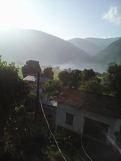
Wangla is a Market Center in Sandhikharka Municipality of Arghakhanchi District in the Lumbini Zone of southern Nepal. The former village development committee (VDC) was converted into a municipality on 18 May 2014 by merging the existing Sandhikharka, Wangla, Narapani, Khanchikot, Keemadada, Argha and Dibharna VDCs. At the time of the 1991 Nepal census, the town had a population of 5,142 living in 1,033 houses. At the time of the 2001 Nepal census, the population was 5,380, of which 66% was literate.

Kimadanda is a market center in Sandhikharka Municipality of Arghakhanchi District in the Lumbini Zone of Western Nepal. The former village development committee (VDC) was converted into municipality on 18 May 2014 by merging the existing Sandhikharka, Bangla, Narapani, Khanchikot, Kimadada, Argha and Dibharna VDCs. At the time of the 1991 Nepal census, the town had a population of 5,430 living in 1,085 houses. At the time of the 2001 Nepal census, the population was 3,514, of which 53% was literate.

Khanchikot is a market center in Sandhikharka Municipality of Arghakhanchi District. The district lies in the Lumbini Zone of Western Nepal. The former village development committee (VDC) was converted into municipality on 18 May 2014 by merging the existing Sandhikharka, Bangla, Narapani, Khanchikot, Keemadada, Argha and Dibharna VDCs. During 1991 Nepal census it was estimated to have a total population of 4,628 individuals and had 930 houses.

Aslewa is a village development committee (VDC) in Gulmi District in the Lumbini Zone of central Nepal. At the time of the 1991 Nepal census it had a population of 8088 persons living in 992 individual households. The village has a temple called Rudra Beni Dhaam and a school for higher level study, the Shree Janata Higher Secondary School.

Rupakot is a Village Development Committee (VDC) in Gulmi District in the Lumbini Zone of central Nepal. Its headquarters is in Myal pokhara. It is located in about the center of Gulmi District. It is surrounded by hills. Its main religion is Hinduism. There are many temples like Chhatra Thaan, Shiddababa temple, Shiva Temple, Ram Temple, Debi deurali temple etc. The main sources of revenue for the village are agriculture and foreign employment. At the time of the 2001 Nepal census, it had a population of 3521 persons residing in 704 individual households. 76.48% of students attend school. The most populated parts of this VDC is Damuka, Sota & Ekle Pipal.

Abhirao is a village development committee in Kapilvastu District in the Lumbini Zone of southern Nepal. At the time of the 1991 Nepal census it had a population of 4590 people living in 732 individual households. Under Abhirao VDC, it has Three villages: 1. Bhaiskunda, 2. Bharwaliya, 3. Mankhoriya.

Shivanagar is a town in Krishnanagar Municipality in Kapilvastu District in the Lumbini Zone of southern Nepal. The former VDC was merged to form the municipality established on 18 May 2014 Krishnanagar, Sirsihawa, Shivanagar VDCs. At the time of the 2011 Nepal census it had a population of 4,774 people living in 735 individual households.

Vidhyanagar is a village in Kapilvastu District in the Lumbini Zone of southern Nepal. At the time of the 1991 Nepal census it had a population of 3315 people living in 538 individual households.
Hardauna is a village in the sub-metropolitan municipality of Maharajganj in the Kapilvastu District of the Lumbini Province. The village is in a terai region in southern Nepal. It is on the Banganga, a river which arises on the southern slopes of the Sivalik Hills and flows across the terai, reaching into Uttar Pradesh state in India.

Hathihawa is a village development committee in Kapilvastu District in the Lumbini Zone of southern Nepal. At the time of the 1991 Nepal census it had a population of 5597 people living in 878 individual households. There are villages in this division. The Inhabitants of this area are Awadhi People. It borders Rupandehi district to the east, Bithuwa VDC to the west and south, Indian border Kakarahawa, Uttar Pradesh to the North.

Agryouli is a town in Kawaswati Municipality in Nawalparasi District in the Lumbini Zone of southern Nepal. The municipality was formed by merging the existing Kawaswati, Shivamandir, Pithauli, Agryouli VDCs. At the time of the 1991 Nepal census it had a population of 8820 people living in 1398 individual households.
Kawasoti is a Municipality in Nawalparasi District in the Lumbini Zone of southern Nepal. The municipality was formed by merging the existing Kawasoti, Shivamandir, Pithauli, Agryouli VDCs. At the time of the 1991 Nepal census it had a population of 6886 people living in 1169 individual households.

Kolhuwa is a village development committee in Nawalparasi District in the Lumbini Zone of southern Nepal. At the time of the 1991 Nepal census it had a population of 6292 people living in 1025 individual households. .This VDC was merged in the Madhyabindu municipality on 19 September 2015 along with Tamasariya and Narayani Village development committees (VDCs). The center of the municipality is established in the former Tamasariya VDC of Chormara Bazaar. After merging the three VDCs population it had a total population of 28,224 according to 2011 Nepal census.

Mukundapur is a town in Gaidakot Municipality in eastern part of Nawalparasi District in the Lumbini Zone of southern Nepal. It became a municipality in May 2014 by merging the existing Mukundapur, Amarapuri, Gaidakot, Nawalparasi, VDCs. At the time of the 1991 Nepal census it had a population of 7631. According to the 2011 Nepal census, the VDC had a population of 13,027 living in 3,023 houses. The VDC is historically important as the "Mukundasen Palace" built by King Madimukundasen of Palpa lies here. The VDC is named after this Palace.

'Panchanagar' is a town in Bardaghat Municipality in Nawalparasi District in the Lumbini Zone of southern Nepal. The municipality was established on 18 May 2014 by merging existing Makar and Panchanagar VDCs. At the time of the 1991 Nepal census it had a population of 6238 people living in 1023 individual households. This VDC lies near the Churya Hilly Range.The inhabitants people who live here are mostly Chhetri, Brahmin, Tharu, Magar, Newar, Dalits and Adhibasi. Most Youngest Nepali Football Team Star Bimal Magar was Born in Panchanagar VDC.

Pithauli is a town in Kawaswati Municipality in Nawalparasi District in the Lumbini Zone of southern Nepal. The municipality was formed by merging the existing Kawaswati, Shivamandir, Pithauli, Agryouli VDCs. At the time of the 1991 Nepal census it had a population of 5957 people living in 1084 individual households.

Pragatinagar is a town in Devachuli Municipality in Nawalparasi District in the Lumbini Zone of southern Nepal. The municipality was established on 18 May 2014 by merging existing Devachuli, Dibyapuri, Pragatinagar VDCs. At the time of the 2001 Nepal census it had a population of 11,771 people living in the VDC. There are 2690 households as of June 2010 in the VDC with 100 per cent school enrollment, and birth registration. It also has the lowest level of malnutrition and one of the highest level of adult literacy (86%) in Nepal.
Shivamandir is a town in Kawaswati Municipality in Nawalparasi District in the Lumbini Zone of southern Nepal. The municipality was formed by merging the existing Kawaswati, Shivamandir, Pithauli, Agryouli VDCs. At the time of the 1991 Nepal census it had a population of 12,948 people living in 2362 individual households.

Tamasariya is a village development committee in Nawalparasi District in the Lumbini Zone of southern Nepal. At the time of the 1991 Nepal census it had a population of 6942 people living in 1195 individual households. It is located between Madyabindu community forest and river Girubari. The economy of the VDC is highly depended on remittance. Most of the people are engaged in animal husbandry and farming. Chormara is generally referred to as a big market area of the region that includes tamasariya village development committee (VDC) and narayani VDC. It serves as administrative headquarters for Tamsariya VDC.

'Ghusel is a village and former Village Development Committee that is now part of Bagmati Rural Municipality in Bagmati Province of central Nepal. It is located southern part of Kathmandu Valley at similar or less heights. At the time of the 2011 Nepal census it had a population of 1510 in 308 individual households, down from the time of the 1991 Nepal census when it had a population of 1715 in 294 individual households.


