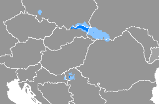
Banica is a village in the administrative district of Gmina Uście Gorlickie, within Gorlice County, Lesser Poland Voivodeship, in southern Poland, close to the border with Slovakia. It lies approximately 9 kilometres (6 mi) south-west of Uście Gorlickie, 22 km (14 mi) south of Gorlice, and 105 km (65 mi) south-east of the regional capital Kraków.

Blechnarka UKr.Бліхнарка}}, Blikhnarka) is a village in the administrative district of Gmina Uście Gorlickie, within Gorlice County, Lesser Poland Voivodeship, in southern Poland, close to the border with Slovakia. It lies approximately 11 kilometres (7 mi) south-east of Uście Gorlickie, 25 km (16 mi) south of Gorlice, and 115 km (71 mi) south-east of the regional capital Kraków.

Brunary is a village in the administrative district of Gmina Uście Gorlickie, within Gorlice County, Lesser Poland Voivodeship, in southern Poland, close to the border with Slovakia. It lies approximately 9 kilometres (6 mi) north-west of Uście Gorlickie, 15 km (9 mi) south-west of Gorlice, and 97 km (60 mi) south-east of the regional capital Kraków.

Czarna is a village in the administrative district of Gmina Uście Gorlickie, within Gorlice County, Lesser Poland Voivodeship, in southern Poland, close to the border with Slovakia. It lies approximately 5 kilometres (3 mi) west of Uście Gorlickie, 15 km (9 mi) south-west of Gorlice, and 102 km (63 mi) south-east of the regional capital Kraków.

Hańczowa is a village in the administrative district of Gmina Uście Gorlickie, within Gorlice County, Lesser Poland Voivodeship, in southern Poland, close to the border with Slovakia. It lies approximately 7 kilometres (4 mi) south-east of Uście Gorlickie, 30 km (19 mi) south of Gorlice, and 141 km (88 mi) south-east of the regional capital Kraków.
Izby is a village in the administrative district of Gmina Uście Gorlickie, within Gorlice County, Lesser Poland Voivodeship, in southern Poland, close to the border with Slovakia. It lies approximately 10 kilometres (6 mi) south-west of Uście Gorlickie, 24 km (15 mi) south of Gorlice, and 106 km (66 mi) south-east of the regional capital Kraków.
Konieczna is a village in the administrative district of Gmina Uście Gorlickie, within Gorlice County, Lesser Poland Voivodeship, in southern Poland, close to the border with Slovakia. It lies approximately 15 kilometres (9 mi) south-east of Uście Gorlickie, 24 km (15 mi) south-east of Gorlice, and 120 km (75 mi) south-east of the regional capital Kraków.

Kwiatoń is a village in the administrative district of Gmina Uście Gorlickie, within Gorlice County, Lesser Poland Voivodeship, in southern Poland, close to the border with Slovakia. It lies approximately 4 kilometres (2 mi) east of Uście Gorlickie, 15 km (9 mi) south of Gorlice, and 108 km (67 mi) south-east of the regional capital Kraków.
Leszczyny is a village in the administrative district of Gmina Uście Gorlickie, within Gorlice County, Lesser Poland Voivodeship, in southern Poland, close to the border with Slovakia. It lies approximately 6 kilometres (4 mi) north of Uście Gorlickie, 10 km (6 mi) south of Gorlice, and 103 km (64 mi) south-east of the regional capital Kraków.
Nowica is a village in the administrative district of Gmina Uście Gorlickie, within Gorlice County, Lesser Poland Voivodeship, in southern Poland, close to the border with Slovakia. It lies approximately 5 kilometres (3 mi) north-east of Uście Gorlickie, 12 km (7 mi) south of Gorlice, and 106 km (66 mi) south-east of the regional capital Kraków.
Oderne is a village in the administrative district of Gmina Uście Gorlickie, within Gorlice County, Lesser Poland Voivodeship, in southern Poland, close to the border with Slovakia. It lies approximately 3 kilometres (2 mi) north-east of Uście Gorlickie, 13 km (8 mi) south of Gorlice, and 106 km (66 mi) south-east of the regional capital Kraków.
Przysłup is a village in the administrative district of Gmina Uście Gorlickie, within Gorlice County, Lesser Poland Voivodeship, in southern Poland, close to the border with Slovakia. It lies approximately 6 kilometres (4 mi) north-east of Uście Gorlickie, 12 km (7 mi) south of Gorlice, and 107 km (66 mi) south-east of the regional capital Kraków.
Ropki is a village in the administrative district of Gmina Uście Gorlickie, within Gorlice County, Lesser Poland Voivodeship, in southern Poland, close to the border with Slovakia. It lies approximately 7 kilometres (4 mi) south of Uście Gorlickie, 21 km (13 mi) south of Gorlice, and 109 km (68 mi) south-east of the regional capital Kraków.

Skwirtne is a village in the administrative district of Gmina Uście Gorlickie, within Gorlice County, Lesser Poland Voivodeship, in southern Poland, close to the border with Slovakia. It lies approximately 6 kilometres (4 mi) south-east of Uście Gorlickie, 17 km (11 mi) south of Gorlice, and 111 km (69 mi) south-east of the regional capital Kraków.
Smerekowiec is a village in the administrative district of Gmina Uście Gorlickie, within Gorlice County, Lesser Poland Voivodeship, in southern Poland, close to the border with Slovakia. It lies approximately 7 kilometres (4 mi) east of Uście Gorlickie, 16 km (10 mi) south of Gorlice, and 111 km (69 mi) south-east of the regional capital Kraków.

Śnietnica is a village in the administrative district of Gmina Uście Gorlickie, within Gorlice County, Lesser Poland Voivodeship, in southern Poland, close to the border with Slovakia. It lies approximately 6 kilometres (4 mi) west of Uście Gorlickie, 17 km (11 mi) south-west of Gorlice, and 102 km (63 mi) south-east of the regional capital Kraków.
Stawisza is a village in the administrative district of Gmina Uście Gorlickie, within Gorlice County, Lesser Poland Voivodeship, in southern Poland, close to the border with Slovakia. It lies approximately 5 kilometres (3 mi) south-west of Uście Gorlickie, 18 km (11 mi) south of Gorlice, and 104 km (65 mi) south-east of the regional capital Kraków.

Wysowa-Zdrój is a spa village in the administrative district of Gmina Uście Gorlickie, within Gorlice County, Lesser Poland Voivodeship, in southern Poland, close to the border with Slovakia. It lies approximately 11 kilometres (7 mi) south of Uście Gorlickie, 25 km (16 mi) south of Gorlice, and 114 km (71 mi) south-east of the regional capital Kraków.
Zdynia is a village in the administrative district of Gmina Uście Gorlickie, within Gorlice County, Lesser Poland Voivodeship, in southern Poland, close to the border with Slovakia. It lies approximately 12 kilometres (7 mi) east of Uście Gorlickie, 21 km (13 mi) south-east of Gorlice, and 117 km (73 mi) south-east of the regional capital Kraków.