
La Unión is a province of the Arequipa Region in Peru. Its seat is Cotahuasi.
Lampa province is a province of the Puno region in Peru. Its population is about 40,856. The capital is Lampa.

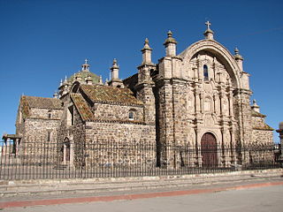
Condesuyos Province is one of eight provinces in the Arequipa Region of Peru. Its seat is Chuquibamba.
Cayarani District is one of eight districts of the province Condesuyos in Peru.
Salamanca District is one of eight districts of the province Condesuyos in Peru.

Condori is a mountain in the Huanzo mountain range in the Andes of Peru, about 5,208-metre (17,087 ft) high. It is situated in the Arequipa Region, Condesuyos Province, Cayarani District, and in the La Unión Province, Puyca District, northeast of the mountain Atunpata. Condori lies south of the river Ojoruro, also known as Sumana or Cotahuasi, which flows to the Cotahuasi Canyon in the southwest.
Sunqu Urqu is a mountain in the Arequipa Region in the Andes of Peru, about 5,191.4 metres (17,032 ft) high. It is situated in the La Unión Province, in the districts Alca and Tomepampa, and in the Condesuyos Province, Salamanca District, east of the mountains Saraqutu and Kuntur Sayana and west of the mountain Phirura (Firura).

Ñawicha is a mountain in the Arequipa Region in the Andes of Peru, about 4,558.3 metres (14,955 ft) high. It is situated in the Condesuyos Province, Chuquibamba District, southwest of the Coropuna volcano and the mountain Minasniyuq.
Hatun K'irawniyuq is a mountain in the Arequipa Region in the Andes of Peru, about 4,731.1 metres (15,522 ft) high. It is situated in the Condesuyos Province, Salamanca District, north of the volcano Coropuna. The peak west of K'irawniyuq is named Quri Qhawana (Ccorecahuana). One of the nearest populated places is Mawk'allaqta in the northeast. The village is situated at the mountain Mawk'a Llaqta (Mauca Llacta).
Saraqutu is a mountain in the Arequipa Region in the Andes of Peru, about 5,200 metres (17,060 ft) high. It is situated in the La Unión Province, in the districts Cotahuasi and Tomepampa, and in the Condesuyos Province, Salamanca District. Saraqutu lies west of the mountains Sunqu Urqu and Kuntur Sayana.
Condorcacha is a mountain in the Chila mountain range in the Andes of Peru, about 5,200 metres (17,060 ft) high. It is located in the Arequipa Region, Castilla Province, Chachas District. Condorcacha lies in a remote, mountainous area east of Orcopampa. It is situated southeast of Huayllatarpuna.
Kuntur Sayana is a mountain in the Andes of Peru, about 5,000 metres (16,404 ft) high. It is located in the Puno Region, Lampa Province, Paratía District.
Kuntur K'uchu is a mountain in the Wansu mountain range in the Andes of Peru, about 5,200 metres (17,060 ft) high. It is situated in the Arequipa Region, La Unión Province, Puyca District, and in the Cusco Region, Chumbivilcas Province, Santo Tomás District. It lies northwest of Qullpa and north of Pichaqani.
Anca Pahuas is a mountain in the Huanzo mountain range in the Andes of Peru, about 5,000 metres (16,000 ft) high. It is situated in the Arequipa Region, Condesuyos Province, Cayarani District, and in the La Unión Province, Puyca District. Anca Pahuas lies between Quelcata in the northeast and Condori in the southwest.

Yuaytacondorsenja is a 5,345-metre-high (17,536 ft) mountain in the Chila mountain range in the Andes of Peru. It is located in the Arequipa Region, Castilla Province, Chachas District. Yuaytacondorsenja lies northwest of Chila and Chila Pillune. It is situated at the end of a valley named Puncuhuaico. Its stream flows to Chachas Lake.
Yuraq Urqu is a 4,985-metre-high (16,355 ft) mountain in the Andes of Peru. It is situated in the Arequipa Region, Condesuyos Province, Salamanca District, and in the La Unión Province, Puyca District. Yuraq Urqu lies northeast of a lake named Tintarqucha (Tintarcocha).
Hatun Q'asa is a mountain in the Wansu mountain range in the Andes of Peru, about 4,800 metres (15,748 ft) high. It is situated in the Arequipa Region, Condesuyos Province, Cayarani District. Hatun Q'asa lies at the Q'illumayu valley.
Kuntur Salla is a 5,003-metre-high (16,414 ft) mountain in the Andes of Peru. It is located in the Arequipa Region, Condesuyos Province, Cayarani District.
T'allani Urqu is a mountain in the Andes of Peru which reaches a height of approximately 4,900 m (16,100 ft). It is located in the Arequipa Region, Caylloma Province, Caylloma District, and in the Condesuyos Province, Cayarani District. T'allani Urqu lies southeast of Kuntur Salla.


