| Kuppe | |
|---|---|
| Highest point | |
| Elevation | 729.1 m (2,392 ft) [1] |
| Prominence | 22 m ↓ Haus Sonnenberg |
| Isolation | 1.5 km → Rehberg |
| Coordinates | 51°43′36″N10°30′31″E / 51.72667°N 10.50861°E Coordinates: 51°43′36″N10°30′31″E / 51.72667°N 10.50861°E |
| Geography | |
| Location | north of St. Andreasberg, Lower Saxony, Germany |
| Parent range | Harz Mountains |
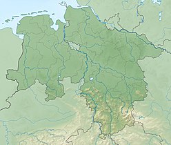
The Kuppe is a mountain in the Harz that lies north of Sankt Andreasberg in the district of Goslar in the German state of Lower Saxony. It is 729.1 metres high [1] and is connected to the Jordanshöhe in the west.

Sankt Andreasberg is a former town in the district of Goslar, in Lower Saxony, Germany. Since 1 November 2011, it is part of the town Braunlage. It is situated in the Harz, approximately 7 km west of Braunlage proper, and 20 km east of Osterode am Harz.

Lower Saxony is a German state (Land) situated in northwestern Germany. It is the second-largest state by land area, with 47,624 km2 (18,388 sq mi), and fourth-largest in population among the 16 Länder federated as the Federal Republic of Germany. In rural areas, Northern Low Saxon and Saterland Frisian are still spoken, but the number of speakers is declining.

The Jordanshöhe is a mountain, roughly 723 m above sea level (NHN), in the Harz in central Germany. It lies north of the town of Sankt Andreasberg in the district of Goslar in Lower Saxony. To the west is the Kuppe. On the mountain there is the Jordanshöhe youth hostel and the Jordanshöhe nature trail.
