
Chittoor is a city and district headquarters in Chittoor district of the Indian state of Andhra Pradesh. It is also the mandal and divisional headquarters of Chittoor mandal and Chittoor revenue division respectively. The city has a population of 153,756 and that of the agglomeration is 175,647.

Kurnool is a city in the state of Andhra Pradesh, India. It formerly served as the capital of Andhra State (1953–1956) and was proposed as the judicial capital of Andhra Pradesh from 2024, although this is awaiting a Supreme Court decision. The city is often referred to as "The Gateway of Rayalaseema". Kurnool is also known as The City of Gem Stones. It also serves as the district headquarters of its Kurnool district. As of 2011 census, it is the fifth most populous city in the state with a population of 484,327. It is located on the banks of the Tungabhadra river. Although the area has been inhabited for thousands of years, modern Kurnool was founded in the 16th century CE with the construction of the Konda Reddy Fort.

Madanapalle is the largest city in Annamayya district and Rajampet Lok Sabha constituency of the Indian state of Andhra Pradesh. It is a Selection Grade Municipal City Council. Madanapalle is headquarters of Madanapalle Mandal,Madanapalle revenue division and PKM Urban Development Authority.

Chittoor district is one of the eight districts in the Rayalaseema region of the Indian state of Andhra Pradesh. It had a population of 18,72,951 at the 2011 census of India. It is a major market centre for mangoes, grains, sugarcane, and peanuts. The district headquarters is at Chittoor City.

Nizamabad district is a district located in the north-western region of the Indian state of Telangana. The city of Nizamabad is the district headquarters. The district share boundaries with Jagtial, Sircilla, Nirmal, Kamareddy districts and with Nanded district of the state boundary of Maharashtra.
Guntakal is a City in Anantapur district of the Indian state of Andhra Pradesh. It is the headquarters of Guntakal mandal and Guntakal revenue division.It is also the headquarters of the Guntakal Railway Division in South Central Railway.

Valmikipuram is a Town in Annamayya district of the Indian state of Andhra Pradesh. It is the mandal headquarters. The town is known for the "Sri Pattabhi Rama temple", built by lord Jambavantha in Treta Yuga. Valmiki, the author of great epic Ramayana 'taposthan'(did tapas here). Kodanda Ramaylam was built by Lord Jambavantha in Treta Yuga as a mark of his respect towards Lord Sri Rama. Uniqueness of this temple is that here Lord Sri Rama will be seen in the coronation ceremony posture as presiding deity flanked by His beloved Goddess Sita Devi and also by his brothers Laxmana, Bharatha, Shatrughna, and Lord Anjaneya. Here SriRama also called as ‘Pratapa Raama’ as he is holding sword. There is also a hill here called 'Veeranna Konda' with the shrine of Veerabhadra. It is said that the sage Valmiki sat on this hill while writing The Ramayana. Another uniqueness of this Temple Idol in this Temple is facing North and Locals says that it is the only Temple in Andhra Pradesh with North facing. Tallapaka Ananmacharya penned as many as 21 ‘sankeertanas’ in praise of the Pattabhirama Swamy deity here. Kodanda Rama Swamy Temple is holding 500 years of history, this temple well managed in Krishna Deva Raya’s period and Chola’s period. In 1997, TTD adopted and from then temple has seen drastic growth.

Gurramkonda is a village in Annamayya district of the Indian state of Andhra Pradesh. It is the Mandal headquarters of Gurramkonda Mandal. Gurramkonda Fort is one of the oldest fort in the district. Gurramkonda (village) is a village in the Gurramkonda Mandal of the state of Andhra Pradesh, Annamayya district. It is located at a distance of 0 km from the center of the zones, Horamkonda. It is 35 km from the nearest town, Madanapalle. Is also in the distance. As per the 2011 census of India, the village is spread over 3111 hectares with 2501 houses and a population of 10642. The number of males in the village is 5480, the number of females is 5162. The Scheduled Castes population is 511 and the Scheduled Tribes population is 126. The census location code of the village is 595648. [1]. 13.7833 ° N 78.5833 ° E. on the road to Kadapa, Kadapa, Bangalore [2] The sea can reach 647 meters. The town is a tourist hotspot. It is also historically known as Jaffarabad. Located on Kadapa-Bengaluru Road, this horse-hill is a popular tourist attraction with its historical background. It is a communal harmony with the Hindu and Muslim cultures of the day.
Kandukur or Kandukuru is a town in SPSR Nellore district of the Indian state of Andhra Pradesh. It is a municipality and the headquarters of Kandukur mandal as well as Kandukur revenue division. Kandukur Mandal is located at the south-east side of the Prakasam District having geographical area around 225 km2.There is only 1 city in the Kandukur Mandal, which is Kandukur Municipality having an area of 37.63 km2.
Punganur is a Municipality city in Chittoor district of the Indian state of Andhra Pradesh. It is the headquarters of Punganur Mandel of Palamaner Revenue Division.

Renigunta is a suburb and neighbourhood of Tirupati located in Tirupati district of the Indian state of Andhra Pradesh. It is a part of Tirupati urban agglomeration. Tirupati Airport is located in Renigunta. It is also one of the mandals in Tirupati district. It also falls in the jurisdictional limit of Tirupati Urban Development Authority.

Tadipatri or Tadpatri is a city in Anantapur district of the Indian state of Andhra Pradesh at the border of Kurnool district and Kadapa district. It is the mandal headquarters of Tadipatri mandal in Anantapur revenue division. The Chintala Venkataramana Temple is located on a five-acre site in Tadipatri. The Bugga Ramalingeswara Temple is located one kilometer from the town, overlooking the Penna River.

Pakala is a town in Tirupati district of the Indian state of Andhra Pradesh. It is the mandal headquarters of Pakala mandal. It comes under Tirupati revenue division.

Pileru is a census town in Annamayya district of Rayalaseema region of the Indian state of Andhra Pradesh. Pileru is located 197 Km North East of Bangalore, The Capital City Of Karnataka and 189 Km North West of Chennai, The Capital City Of Tamil Nadu and 464 Km South To The State Capital Amaravati .It is the mandal headquarters of Pileru mandal in Rayachoti revenue division. The name 'Pileru' means a "small river stream" or "Pilla Eru" in Telugu.

Narasannapeta is a census town in Srikakulam district of the Indian state of Andhra Pradesh. It is the mandal headquarters of Narasannapeta mandal in Srikakulam revenue division. 43 villages are there under the administrative division of Narasannapeta.

Pathapatnam is a town in Srikakulam district of the Indian state of Andhra Pradesh. It is located in Pathapatnam mandal of Palakonda revenue division. Pathapatnam is located on the border of Srikakulam district of Andhra Pradesh and Gajapati district of Odisha. Parlakhemundi, the headquarters of Gajapati District, can be considered as twin town of Pathapatnam because of its close proximity. It is located around 65 km from srikakulam. It was the old capital of Paralakhemundi Gajapati Maharajah of his erstwhile kingdom.
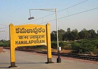
Kamalapuram is a Town in YSR Kadapa district of the Indian state of Andhra Pradesh. It is located in Kamalapuram mandal of Kadapa revenue division and is the Thaluka headquarter of Kamalapuram assembly constituency.
Chilakaluripet is a city in Palnadu district of the Indian state of Andhra Pradesh. It is the Mandal headquarters of Chilakaluripet Mandal in Narasaraopet Revenue Division.

NTR district is a district in coastal Andhra Region in the Indian state of Andhra Pradesh. The district headquarters is located at Vijayawada. The district is named after former Chief Minister of Andhra Pradesh N. T. Rama Rao. The district shares boundaries with Guntur, Palnadu, Krishna, Eluru, Khammam and Suryapet districts
Annamayya district is one of the eight districts in the Rayalaseema region of Andhra Pradesh, established in 2022. Rayachoti is the district administrative headquarters, and Madanapalle is the most populated city in the district.

