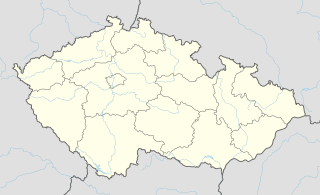
Kněžice is very small village in the Pardubice Region of the Czech Republic. It has around 150 inhabitants.

Hammam Sousse is a coastal town in north-eastern Tunisia. It is located north of Sousse, at around 35°51′32″N10°35′38″E. It has about 42,691 inhabitants. Former President Zine el Abidine Ben Ali and the minister of defense, Kamel Morjane, were born in this town.

This is a list of the extreme points of the Czech Republic: the points that are farther north, south, east or west than any other location.
Öndörkhangai is a sum (district) of Uvs Province in western Mongolia.

Bierzyn is a village in the administrative district of Gmina Boniewo, within Włocławek County, Kuyavian-Pomeranian Voivodeship, in north-central Poland. It lies approximately 27 kilometres (17 mi) south-west of Włocławek and 68 km (42 mi) south of Toruń.

Jadowniki Bielskie is a village in the administrative district of Gmina Żnin, within Żnin County, Kuyavian-Pomeranian Voivodeship, in north-central Poland. It lies approximately 10 kilometres (6 mi) east of Żnin and 31 km (19 mi) south of Bydgoszcz.

Huta Padniewska is a village in the administrative district of Gmina Mogilno, within Mogilno County, Kuyavian-Pomeranian Voivodeship, in north-central Poland. It lies approximately 7 kilometres (4 mi) west of Mogilno and 54 km (34 mi) south of Bydgoszcz.
Zadębce-Kolonia is a village in the administrative district of Gmina Trzeszczany, within Hrubieszów County, Lublin Voivodeship, in eastern Poland.

Orta Ceyrançöl is a village in the Tovuz Rayon of Azerbaijan.

Obiechów is a village in the administrative district of Gmina Słupia, within Jędrzejów County, Świętokrzyskie Voivodeship, in south-central Poland. It lies approximately 9 kilometres (6 mi) west of Słupia, 32 km (20 mi) west of Jędrzejów, and 64 km (40 mi) south-west of the regional capital Kielce.

Huta Podłysica is a village in the administrative district of Gmina Bieliny, within Kielce County, Świętokrzyskie Voivodeship, in south-central Poland. It lies approximately 6 kilometres (4 mi) east of Bieliny and 27 km (17 mi) east of the regional capital Kielce.
Dębówiec is a village in the administrative district of Gmina Koźmin Wielkopolski, within Krotoszyn County, Greater Poland Voivodeship, in west-central Poland.

Kołątajew is a village in the administrative district of Gmina Ostrów Wielkopolski, within Ostrów Wielkopolski County, Greater Poland Voivodeship, in west-central Poland. It lies approximately 12 kilometres (7 mi) east of Ostrów Wielkopolski and 103 km (64 mi) south-east of the regional capital Poznań.

Masłowo is a settlement in the administrative district of Gmina Wyrzysk, within Piła County, Greater Poland Voivodeship, in west-central Poland. It lies approximately 7 kilometres (4 mi) north of Wyrzysk, 38 km (24 mi) east of Piła, and 94 km (58 mi) north of the regional capital Poznań.
Chociszewko is a settlement in the administrative district of Gmina Skoki, within Wągrowiec County, Greater Poland Voivodeship, in west-central Poland.

Gapowo is a village in the administrative district of Gmina Stężyca, within Kartuzy County, Pomeranian Voivodeship, in northern Poland. It lies approximately 4 kilometres (2 mi) west of Stężyca, 24 km (15 mi) south-west of Kartuzy, and 51 km (32 mi) west of the regional capital Gdańsk.

Korne is a village in the administrative district of Gmina Kościerzyna, within Kościerzyna County, Pomeranian Voivodeship, in northern Poland. It lies approximately 9 kilometres (6 mi) west of Kościerzyna and 57 km (35 mi) south-west of the regional capital Gdańsk.
Gomo Station is a railway station on the Gyeongbu Line in South Korea.
Dvory is a village and municipality in Nymburk District in the Central Bohemian Region of the Czech Republic.
Kugalepa is a village in Saaremaa Parish, Saare County in western Estonia.


