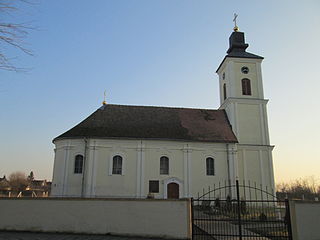
Kućani

Last updated
Kućani
Village
Serbia adm location map.svg
Red pog.svg
Kućani
Coordinates: 43°32′N19°51′E / 43.533°N 19.850°E / 43.533; 19.850
CountryFlag of Serbia.svg  Serbia
District Zlatibor District
Municipality Nova Varoš
 256
Time zone CET (UTC+1)
  Summer (DST) CEST (UTC+2)

Kućani (Serbian : Кућани) is a village in the municipality of Nova Varoš, western Serbia. According to the 2002 census, the village has a population of 256 people. [1]

Serbian language South Slavic language

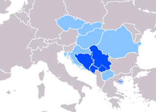
Serbian is the standardized variety of the Serbo-Croatian language mainly used by Serbs. It is the official language of Serbia, co-official in the territory of Kosovo, and one of the three official languages of Bosnia and Herzegovina. In addition, it is a recognized minority language in Montenegro where it is spoken by the relative majority of the population, as well as in Croatia, North Macedonia, Romania, Hungary, Slovakia, and the Czech Republic.

Village Small clustered human settlement smaller than a town

A village is a clustered human settlement or community, larger than a hamlet but smaller than a town, with a population ranging from a few hundred to a few thousand. Though villages are often located in rural areas, the term urban village is also applied to certain urban neighborhoods. Villages are normally permanent, with fixed dwellings; however, transient villages can occur. Further, the dwellings of a village are fairly close to one another, not scattered broadly over the landscape, as a dispersed settlement.

Nova Varoš Town and municipality in Šumadija and Western Serbia, Serbia

Nova Varoš is a town and municipality located in the Zlatibor District of southwestern Serbia. The municipality of Nova Varoš has a population of 16,638, while the town of Nova Varoš itself has a population of 8,795 inhabitants.

Related Research Articles

Sevojno Town and city municipality in Zlatibor, Serbia

The City municipality of Sevojno is a town and one of two city municipalities which constitute the City of Užice. As of 2011, it has 7,101 inhabitants.

Bogojevo Village in Vojvodina, Serbia

Bogojevo is a village in Serbia. It is situated in the Odžaci municipality, West Bačka District, Vojvodina province. The village has an ethnic Hungarian majority and its population numbering 2,120 people.

Bački Sokolac Village in Vojvodina, Serbia

Bački Sokolac is a village in Serbia. It is situated in the Bačka Topola municipality, in the North Bačka District, Vojvodina province. The village has a Serb ethnic majority and its population numbering 609 people.

Subotište Village in Vojvodina, Serbia

Subotište is a village in Serbia. It is situated in the Pećinci municipality, in the Srem District, Vojvodina province. The village has a Serb ethnic majority and its population numbering 942 people.

Zbojštica Village in Serbia

Zbojštica is a village located in the Užice municipality of Serbia. In the 2002 census, the village had a population of 172.

Zaovine Village in Zlatibor District, Serbia

Zaovine is a village near the Zaovine Lake in the municipality of Bajina Bašta, Serbia. According to the 2002 census, the village has a population of 442 people.

Kutleš Village in Jablanica District, Serbia

Kutleš is a village in the municipality of Leskovac, Serbia. According to the 2002 census, the village has a population of 651 people.

Branishte is a village in the municipality of Dobrichka, in Dobrich Province, in northeastern Bulgaria.

Vapa (Čačak) Village in Moravica District, Serbia

Vapa is a village in the municipality of Čačak, Serbia. According to the 2011 census, the village has a population of 695 people.

Vujetinci Village in Moravica District, Serbia

Vujetinci is a village in the municipality of Čačak, Serbia. According to the 2011 census, the village has a population of 395 people.

Ljubiš Village in Zlatibor District, Serbia

Ljubiš is a village in the municipality of Čajetina, western Serbia. According to the 2011 census, the village has a population of 515 people.

Negbina Village in Zlatibor District, Serbia

Negbina is a village in the municipality of Nova Varoš, western Serbia. According to the 2002 census, the village has a population of 475 people.

Seništa Village in Zlatibor District, Serbia

Seništa is a village in the municipality of Nova Varoš, western Serbia. According to the 2002 census, the village has a population of 262 people.

Gradac (Raška) Village in Raška District, Serbia

Gradac is a village in the municipality of Raška, Serbia. According to the 2002 census, the village has a population of 368 people.

Čitluk (Priboj) Village in Zlatibor District, Serbia

Čitluk is a village in the municipality of Priboj, Serbia. According to the 2002 census, the village has a population of 195 people.

Crnugovići Village in Zlatibor District, Serbia

Crnugovići is a village in the municipality of Priboj, Serbia. According to the 2002 census, the village has a population of 93 people.

Kratovo (Priboj) Village in Zlatibor District, Serbia

Kratovo is a village in the municipality of Priboj, Serbia. According to the 2002 census, the village has a population of 305 people.

Miliješ Village in Zlatibor District, Serbia

Miliješ is a village in the municipality of Priboj, Serbia. According to the 2002 census, the village has a population of 644 people.

Požegrmac Village in Zlatibor District, Serbia

Požegrmac is a village in the municipality of Priboj, Serbia. According to the 2002 census, the village has a population of 188 people.

Laktac, is a settlement in the Hrvace municipality in Croatia.

References

  1. Popis stanovništva, domaćinstava i Stanova 2002. Knjiga 1: Nacionalna ili etnička pripadnost po naseljima. Republika Srbija, Republički zavod za statistiku Beograd 2003. ISBN   86-84433-00-9

Coordinates: 43°32′N19°51′E / 43.533°N 19.850°E / 43.533; 19.850

Geographic coordinate system Coordinate system

A geographic coordinate system is a coordinate system that enables every location on Earth to be specified by a set of numbers, letters or symbols. The coordinates are often chosen such that one of the numbers represents a vertical position and two or three of the numbers represent a horizontal position; alternatively, a geographic position may be expressed in a combined three-dimensional Cartesian vector. A common choice of coordinates is latitude, longitude and elevation. To specify a location on a plane requires a map projection.