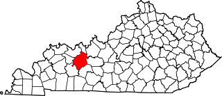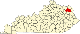
Kenton County is a county located in the northern part of the Commonwealth of Kentucky. As of the 2020 census, the population was 169,064, making it the third most populous county in Kentucky. Its county seats are Covington and Independence. It was, until November 24, 2010, the only county in Kentucky to have two legally recognized county seats. The county was formed in 1840 and is named for Simon Kenton, a frontiersman notable in the early history of the state.

Covington is a home rule-class city in Kenton County, Kentucky, United States. Located at the confluence of the Ohio and Licking rivers, it lies south of Cincinnati, Ohio, across the Ohio and west of Newport, Kentucky, across the Licking. It had a population of 40,691 at the 2020 census, making it the largest city in Northern Kentucky and the fifth-most populous city in the state. A part of the Cincinnati metropolitan area, it is one of Kenton County's two seats, along with Independence.

The Daniel Carter Beard Boyhood Home is a National Historic Landmark located in the Riverside Drive Historic District of Covington, Kentucky, overlooking the Licking River, across the Ohio River from Cincinnati, Ohio. The two-and-one-half story brick domicile, built in 1821 and one of the two oldest buildings in Kenton County, Kentucky, is the boyhood home of Daniel Carter Beard, a founder of the Boy Scouts of America. He was their National Scout Commissioner from its 1910 founding to his death in 1941.

Trinity Episcopal Church is located in Covington, Kentucky, Madison Avenue. This historic church was founded November 24, 1842, in a third floor of a brick building near the Covington market. The cornerstone of the first church was June 24, 1843 and the first service was on June 30, 1844. The church has served the people of Covington and Cincinnati, Ohio through wars and floods. The church is active today, with a large congregation at its Fourth and Madison Avenue location. The Rev. Peter D'Angio is the rector. It is the second largest parish in the Episcopal Diocese of Lexington.

The Licking Riverside Historic District is a historic district in Covington, Kentucky, that is on the National Register of Historic Places. Its boundaries are Fourth Street to the north, Scott Street, Eighth Street to the south, and the Licking River. Bungalow/Craftsman, Second Empire, and Italianate are the primary architectural styles of the district.

This is a list of the National Register of Historic Places listings in Garrard County, Kentucky.

This is a list of the National Register of Historic Places listings in Henderson County, Kentucky.

This is a list of the National Register of Historic Places listings in Fleming County, Kentucky.

This is a list of the National Register of Historic Places listings in Daviess County, Kentucky.

This is a list of the National Register of Historic Places listings in McCracken County, Kentucky.

This is a list of the National Register of Historic Places listings in Ohio County, Kentucky.

This is intended to be a complete list of the properties and districts on the National Register of Historic Places in Kenton County, Kentucky, United States. The locations of National Register properties and districts for which the latitude and longitude coordinates are included below, may be seen in a map.

The Enfield Shaker Museum is an outdoor history museum and historic district in Enfield, New Hampshire, in the United States. It is dedicated to preserving and sharing the history of the Shakers, a Protestant religious denomination, who lived on the site from 1793 to 1923. The museum features exhibitions, artifacts, eight Shaker buildings and restored Shaker gardens. It is located in a valley between Mount Assurance and Mascoma Lake in Enfield.
Lewisburg Historic District may refer to:
Austin Historic District may refer to:

This is a list of the National Register of Historic Places listings in Carlisle County, Kentucky.

This is a list of the National Register of Historic Places listings in Bell County, Kentucky.

This is a list of the National Register of Historic Places listings in Carter County, Kentucky.

Richards, McCarty & Bulford was an American architectural firm. The General Services Administration has called the firm the "preeminent" architectural firm of the city of Columbus, Ohio. A number of the firm's works are listed on the National Register of Historic Places. The firm operated until 1943.

William Grant High School was a public high school for African Americans in Covington, Kentucky. It also served African American students from surrounding areas who were not allowed to attend the whites-only schools in the county. The elementary and secondary schools that became known as Lincoln-Grant School were in a school built on 7th Street until they were relocated to a new building at 824 Greenup. The school closed after desegregation and its students transferred to Holmes High School, The elementary school continued on until 1976. The Northern Kentucky Community Center occupied the school after it clsoed. In 2017 it became the Lincoln Grant Scholar House housing single parents with low incomes. Joseph M. Walton's The Life and Legacy of Lincoln School, Covington, Kentucky, 1866-1976 was published in 2010. He graduated from the school with honors in 1958. The school was listed on the National Register of Historical Places in 2013. It is in the Emery-Price Historic District.


