
The Arctic Archipelago, also known as the Canadian Arctic Archipelago, is an archipelago lying to the north of the Canadian continental mainland, excluding Greenland and Iceland.

USS Bogue (AVG/ACV/CVE/CVHE-9) was the lead ship in the Bogue class of escort carriers in the United States Navy during World War II. The ship was named for Bogue Sound in North Carolina.

This is a list of the extreme points of North America: the points that are highest and lowest, and farther north, south, east or west than any other location on the continent. Some of these points are debatable, given the varying definitions of North America.

The Nimrod Glacier is a major glacier about 85 nautical miles long, flowing from the polar plateau in a northerly direction through the Transantarctic Mountains into the Ross Ice Shelf, Antarctica.
The Prince Olav Mountains is a mountain group in the Queen Maud Mountains in Antarctica stretching from Shackleton Glacier to Liv Glacier at the head of the Ross Ice Shelf.

The Priestley Glacier is a major valley glacier, about 60 nautical miles long, originating at the edge of the Polar Plateau of Victoria Land, Antarctica. The glacier drains southeast between the Deep Freeze Range and Eisenhower Range to enter the northern end of the Nansen Ice Sheet. It was first explored by the Northern Party of the British Antarctic Expedition, 1910–13, and named for Raymond Priestley, a geologist with the Northern Party.
The Mirabito Range is a narrow, northwest-trending mountain range, 64 kilometres (40 mi) long and 6 kilometres (3.7 mi) wide that lies between the upper part of Lillie Glacier and the Greenwell Glacier in northern Victoria Land, Antarctica. The range is part of the Concord Mountains.
This is a list of the extreme points of The Americas, the points that are farther north, south, east or west than any other location on the continent. The continent's southernmost point is often said to be Cape Horn, which is the southernmost point of the Chilean islands. The Americas cross 134° of longitude east to west and 124° of latitude north to south.

Ferrar Glacier is a glacier in Antarctica. It is about 35 nautical miles long, flowing from the plateau of Victoria Land west of the Royal Society Range to New Harbour in McMurdo Sound. The glacier makes a right (east) turn northeast of Knobhead, where it where it is apposed, i.e., joined in Siamese-twin fashion, to Taylor Glacier. From there, it continues east along the south side of Kukri Hills to New Harbor.

Argentine Antarctica is an area on Antarctica claimed by Argentina as part of its national territory. It consists of the Antarctic Peninsula and a triangular section extending to the South Pole, delimited by the 25° West and 74° West meridians and the 60° South parallel. This region overlaps with British and Chilean claims in Antarctica. None of these claims have widespread international recognition.
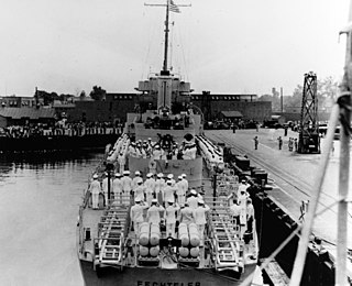
USS Fechteler (DE-157) was a Buckley-class destroyer escort in service with the United States Navy from 1943 to 1944. She was sunk by the German submarine U-967 in the Western Mediterranean on 5 May 1944.

Grenadines is an administrative parish of Saint Vincent and the Grenadines, comprising the islands of the Grenadines other than those belonging to Grenada. The capital is Port Elizabeth. It’s the only parish in the country that’s not located on the main island.
Tlokweng is a peri-urban settlement classified as an urban village located east of the capital of Botswana, Gaborone and falling under the jurisdiction of South East District Council. It can be considered part of the conurbation of Gaborone. Tlokweng stands on the other side of the river, and is on the road to the border with South Africa, the border post being just 15 km to the east. The population was 35,982 at the 2011 census. It is now part of Gaborone agglomeration, home to 421,907 inhabitants at the 2011 census. The tribe originating from Tlokweng is referred to as Batlokwa. Many people from across Botswana have come to seek permanent and sometimes temporary settlement in Tlokweng because of its proximity to the capital city where most jobs are.
Leonardo Glacier is a glacier flowing into Wilhelmina Bay between Sadler Point and Café Point, on the west coast of Graham Land, Antarctica. It was charted by the Belgian Antarctic Expedition under Gerlache, 1897–99, and was named by the UK Antarctic Place-Names Committee in 1960 for Leonardo da Vinci, artist, musician, architect and the first aeronautical scientist.

Villanueva de AzoagueSpanish pronunciation:[biʎaˈnweβaðeaθoˈaɣe]) is a municipality located in the province of Zamora, Castile and León, Spain. According to the 2004 census (INE), the municipality has a population of 315 inhabitants.
Patli is a moderate sized village situated seven kilometres (4.3 mi) from Talwandi Bhai in Firozpur district of Punjab, India.
Nilsen Plateau is a rugged, ice-covered plateau in Antarctica. When including Fram Mesa, the plateau is about 30 nautical miles long and 1 to 12 nautical miles wide, rising to 3,940 metres (12,930 ft) high between the upper reaches of the Amundsen and Scott glaciers, in the Queen Maud Mountains. Discovered in November 1911 by the Norwegian expedition under Roald Amundsen, and named by him for Captain Thorvald Nilsen, commander of the ship Fram.
The La Gorce Mountains are a group of mountains, 20 nautical miles long, standing between the tributary Robison Glacier and Klein Glacier at the east side of the upper reaches of the Scott Glacier, in the Queen Maud Mountains of Antarctica.