La Sierra | |
|---|---|
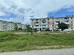 Apartments in La Sierra seen from the Circuito Norte | |
 Map of La Sierra (red) in Encrucijada (orange) in Villa Clara (yellow) | |
 La Sierra 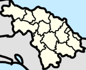 La Sierra  La Sierra | |
| Coordinates: 22°36′11″N79°48′18″W / 22.60306°N 79.80500°W | |
| Country | Cuba |
| Province | Villa Clara |
| Municipality | Encrucijada |
| Area | |
• Total | 0.15 km2 (0.06 sq mi) |
| Population (2012) [1] | |
• Total | 1,158 |
| • Density | 7,700/km2 (20,000/sq mi) |
La Sierra is an urban settlement [1] and ward in Encrucijada, Cuba.