Ancash is a department and region in western Peru. It is bordered by the departments of La Libertad on the north, Huánuco and Pasco on the east, Lima on the south, and the Pacific Ocean on the west. Its capital is the city of Huaraz, and its largest city and port is Chimbote. The name of the region originates from the Quechua word anqash, from anqas ('blue') or from anka ('eagle').

The Inca road system was the most extensive and advanced transportation system in pre-Columbian South America. It was about 40,000 kilometres (25,000 mi) long. The construction of the roads required a large expenditure of time and effort.

Huánuco is a department and region in central Peru. It is bordered by the La Libertad, San Martín, Loreto and Ucayali regions in the north, the Ucayali Region in the east, the Pasco Region in the south and the Lima and Ancash regions in the west. Its capital is the city Huánuco.

Huánuco is a city in central Peru. It had a population of 196,627 as of 2017 and in 2015 it had a population of 175,068. It is the capital of the Huánuco Region and the Huánuco District. It is the seat of the diocese of Huánuco. The metropolitan city of Huanuco is 170,000 hab. It has three districts, Huanuco (head), Amarilis, and Pillco Marca. In this city, the Higueras river meets the Huallaga river, one of the largest rivers in the country.

Huaraz, formerly designated as San Sebastián de Huaraz, is a city in Peru. It is the capital of the Ancash Region and the seat of government of Huaraz Province. The urban area's population is distributed over the districts of Huaraz and Independencia. The city is located in the middle of the Callejon de Huaylas valley and on the right side of the Santa river. The city has an elevation of approximately 3050 meters above sea level. The built-up area covers 8 square kilometers and has a population of 120,000 inhabitants, making it the second largest city in the central Peruvian Andes after the city of Huancayo. It is the 22nd largest city in Peru. Huaraz is the seat of the province's Roman Catholic Bishop and the site of the cathedral.
Huancayo is the capital of the Junín Region and Huancayo Province, in the central highlands of Peru, in the Mantaro Valley and is crossed by the Shullcas, Chilca and Mantaro rivers. It was founded as a reduction by the name Santísima Trinidad de Huancayo on 1 June 1572, by Don Jerónimo de Silva, a Spanish conquistador. It is the fifth largest city in Peru, with a population of 500,000 and is among the highest cities in Peru, with an altitude of 3,256 meters above sea level. It is considered the economic and social center of central Peru
Huallanca or Wallanka may refer to the following:

The Bolognesi Province is one of 20 provinces of the Ancash Region of Peru.
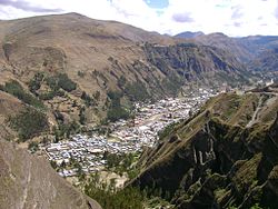
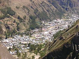
San Martín de Chacas is a Peruvian town, capital of the eponymous district and the Asunción Province, located in the east-central region of Ancash. It has an urban population of 2,082 located at 3,359 meters; and a district of 5,334 people. The district, located in the sub-basin of the Marañon River, has an area of 447.69 km2, which represents 85% of the province.

The Dos de Mayo Province is one of eleven provinces of the Huánuco Region in Peru. The capital of this province is the city of La Unión.
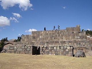
In the Inca Empire the ushnu was an altar for cults to the deities, a throne for the Sapa Inca (emperor), an elevated place for judgment and a reviewing stand of military command. In several cases the ushnu may have been used as a solar observatory. Ushnus mark the center of plazas of the Inca administrative centers all along the highland path of the Inca road system.

A qullqa (Quechua pronunciation:[ˈqʊʎˌqa] "deposit, storehouse"; was a storage building found along roads and near the cities and political centers of the Inca Empire. These were large stone buildings with roofs thatched with "ichu" grass, or what is known as Peruvian feathergrass. To a "prodigious [extent] unprecedented in the annals of world prehistory" the Incas stored food and other commodities which could be distributed to their armies, officials, conscripted laborers, and, in times of need, to the populace. The uncertainty of agriculture at the high altitudes which comprised most of the Inca Empire was among the factors which probably stimulated the construction of large numbers of qullqas.

Pachapaqui is a village in the north of Aquia District in the Bolognesi Province of the Ancash Region, Peru. It has about a thousand inhabitants, mostly engaged in raising cattle and sheep, and small-scale agriculture.

Huánuco Pampa, Huánuco Marka or Huánuco Viejo, Wanako Pampa, Wanuku Pampa or simply Huánuco is a large archaeological site in Peru in the Huánuco Region, Dos de Mayo Province, La Unión District. The ruins of the city lie on a plateau above the Urqumayu or Vizcarra River in the central Andes. The Incas administered their large empire through a small number of administrative centers, such as Huánuco Pampa. The administrative centers were linked by the extensive Inca road system. The most important of the roads, the Qhapaq Ñan, which ran from Cusco to Quito, passed through Huánuco Pampa. The Inca authorities in Huánuco ruled at least five, and perhaps more, ethnic groups. The city is situated on an important commercial trade route and sits on top of a plateau with ravines on all sides in order to allow easy defense of the city. During the Spanish conquest of the Incas, Huánuco Pampa was briefly occupied by Gomez de Alvarado, who founded a Spanish city but it was quickly moved to Pillco because of the harsh climate of Huánuco and the raids of Illa Tupac, one of the captains of Manco Inca.
Auga Punta is an archaeological site in Peru located in the Huánuco Region, Huamalíes Province, Jircan District. It is situated at an elevation of ca. 3,700 m (12,100 ft) on a mountain named Jircán, near the village of Urpish.
Quntayqucha Punta is a mountain in the Wallanka mountain range in the Andes of Peru which reaches an altitude of approximately 4,800 m (15,700 ft). It is located in the Ancash Region, Bolognesi Province, Huasta District, southwest of Chawpi Hanka.
Yuraq Kallapu is a mountain in the Wallanka mountain range in the Andes of Peru which reaches an altitude of approximately 4,800 m (15,700 ft). It is located in the Ancash Region, Bolognesi Province, Huasta District, northwest of Chawpi Hanka.
Rumi Wayin Punta is a mountain in the Andes of Peru which reaches a height of approximately 4,600 m (15,100 ft). It is located in the Ancash Region, Bolognesi Province, Chiquian District, southwest of Chiquian.
Chawpi Punta is a mountain in the Andes of Peru which reaches an altitude of approximately 4,600 m (15,100 ft). It is located in the Ancash Region, Bolognesi Province, Huasta District. Chawpi Punta lies at the Pampa Wayi valley, southwest of Puka Qaqa.

Pampas Grande, founded as San Jerónimo de Pampas, It is a Peruvian town, capital of the homonymous district, located in the central part of the so-called Callejón de Huaylas in the Ancash region, about 4 hours from Huaraz and 9 from Lima. It has an approximate population of 1044 inhabitants, located at an average altitude of 3690 m a.s.l. It has a cold climate with average temperatures of 17 °C in summer and 12 °C in winter.