Lac-Casault | |
|---|---|
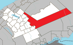 Location within La Matapédia RCM. | |
 Lac-Casault Location in eastern Quebec. | |
| Coordinates: 48°30′N67°09′W / 48.500°N 67.150°W [1] | |
| Country | |
| Province | |
| Region | Bas-Saint-Laurent |
| RCM | La Matapédia |
| Constituted | unspecified |
| Government | |
| • Federal riding | Rimouski—La Matapédia |
| • Prov. riding | Matane-Matapédia |
| Area | |
• Total | 1,423.00 km2 (549.42 sq mi) |
| • Land | 1,428.21 km2 (551.43 sq mi) |
| There is an apparent contradiction between two authoritative sources | |
| Population | |
• Total | 30 |
| • Density | 0/km2 (0/sq mi) |
| • Pop 2016–2021 | |
| • Dwellings | 142 |
| Time zone | UTC−05:00 (EST) |
| • Summer (DST) | UTC−04:00 (EDT) |
| Highways | |
Lac-Casault (French pronunciation: [lakkazo] ) is an unorganized territory in the Bas-Saint-Laurent region of Quebec, Canada.
Contents
The small eponymous Lake Casault is located near the village of St-Alexandre-des-Lacs and was named in honour of Louis-Napoléon Casault (1823–1908). [4]