
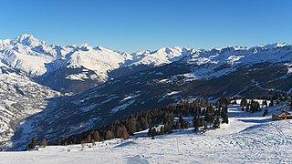
Hautes-Alpes is a department in the Provence-Alpes-Côte d'Azur region of Southeastern France. It is located in the heart of the French Alps, after which it is named. Hautes-Alpes had a population of 141,220 as of 2019, which makes it the third least populated French department. Its prefecture is Gap; its sole subprefecture is Briançon. Its INSEE and postal code is 05.
Savoie is a department in the Auvergne-Rhône-Alpes region, Southeastern France. Located in the French Alps, its prefecture is Chambéry. In 2019, Savoie had a population of 436,434.

Rhône-Alpes was an administrative region of France. Since 1 January 2016, it is part of the new region Auvergne-Rhône-Alpes. It is located on the eastern border of the country, towards the south. The region was named after the river Rhône and the Alps mountain range. Its capital, Lyon, is the second-largest metropolitan area in France after Paris. Rhône-Alpes has the sixth-largest economy of any European region.

The Lac de Serre-Ponçon, known in English as the Lake of Serre-Ponçon, is a reservoir on the border between the Hautes-Alpes and Alpes-de-Haute-Provence departments, in the Provence-Alpes-Côte d'Azur region, Southeastern France, one of the largest in Western Europe. The lake gathers the waters of the Durance and the Ubaye rivers, flowing down through the Hautes-Alpes and the Alpes du Sud to the Rhône. The waters are dammed by the Barrage de Serre-Ponçon, a 123-metre (404 ft) high earth core dam.

Gap is the prefecture of the Hautes-Alpes department in the Provence-Alpes-Côte d'Azur region in Southeastern France. In 2019, the commune had a population of 40,631, making it the most populated city in Hautes-Alpes. At a height of 750 metres above sea level, to the south of the Écrins Massif, it is also France's highest prefecture.

The Verdon Gorge is a river canyon located in the Provence-Alpes-Côte d'Azur region of Southeastern France. It is about 25 km (15.5 mi) long and up to 700 metres (0.4 mi) deep. It was formed by the Verdon River, which is named for its turquoise-green colour, one of the location's distinguishing characteristics. In between the towns of Castellane and Moustiers-Sainte-Marie, the river has cut a ravine to a depth of 700 meters through the limestone mass. At the end of the canyon, the Verdon flows into the artificial Lake of Sainte-Croix.
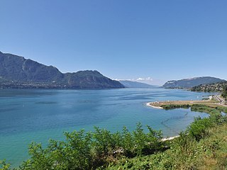
Lac du Bourget, also locally known as Lac Gris or Lac d'Aix, is a lake at the southernmost end of the Jura Mountains in the department of Savoie, France. It is the deepest lake located entirely within France, and either the largest or second largest after Lac de Grand-Lieu depending on season.

Mercantour National Park a French national park located in the Alpes-de-Haute-Provence and Alpes-Maritimes departments. Since it was created in 1979, the park has proven popular, with 800,000 visitors annually enjoying the 600 km (372 mi) of marked footpaths and visiting its villages.

Prunières is a commune in the Hautes Alpes department in southeastern France.

Allos is a commune in the Alpes-de-Haute-Provence department in the Provence-Alpes-Côte d'Azur region of southeastern France.

Sainte-Croix-du-Verdon is a commune in the Alpes-de-Haute-Provence department in southeastern France.

Le Vernet is a commune in the Alpes-de-Haute-Provence department, and in the region of Provence-Alpes-Côte d'Azur, in southeastern France.

Le Sauze-du-Lac is a commune in the Hautes-Alpes department in southeastern France.

Veyrier-du-Lac is a commune in the Haute-Savoie department in the Auvergne-Rhône-Alpes region in south-eastern France.

Montriond is a commune in the Haute-Savoie department in the Auvergne-Rhône-Alpes region in south-eastern France.
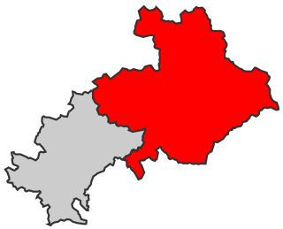
The Canton of Savines-le-Lac is a former canton in the Arrondissement of Gap in the department of Hautes-Alpes in the region Provence-Alpes-Côte d'Azur in France. It was disbanded following the French canton reorganisation which came into effect in March 2015. It consisted of 6 communes, which joined the canton of Chorges in 2015. It had 1,943 inhabitants (2012). Its main town and commune was Savines-le-Lac and its last representative in the conseil général was Victor Berengue.

The Lac de Castillon (English: Lake of Castillon) is a reservoir in the Alpes-de-Haute-Provence department, Southeastern France. At an elevation of 880 m (2,890 ft), the lake's surface area is 5 km² (1.9 sq mi). The Castillon dam holds 150,000,000 m3 (5.3×10⁹ cu ft) of water.
The 2nd constituency of the Hautes-Alpes is a French legislative constituency in the Hautes-Alpes department.

Lac d'Allos is an alpine lake at a height of 2,230 m. It is located in Parc National du Mercantour, departement Alpes-de-Haute-Provence the region Provence-Alpes-Côte d'Azur, France.

The Savines Bridge is a 924m concrete viaduct in Savines-le-Lac, in the Provence Alps and Prealps of south-east France, built in 1960. It crosses a reservoir of the Durance river.

