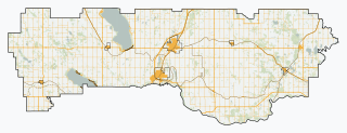
The Municipal District of Taber is a municipal district in southern Alberta, Canada. It is located in Census Division 2.

Chestermere, originally named Chestermere Lake, is a city in the Canadian province of Alberta, within Rocky View County. It is largely a commuter town of Calgary and is a member municipality of the Calgary Regional Partnership. The city, which surrounds Chestermere Lake, was known as Chestermere Lake from 1977 to 1993.

Aldersyde is a hamlet in Alberta, Canada within the Municipal District of Foothills No. 31. Located between Highway 2 and Highway 2A south of Highway 7, the hamlet is approximately 8 kilometres (5.0 mi) southeast of Okotoks, 10 kilometres (6.2 mi) north of High River and 25 kilometres (16 mi) south of Calgary. A Canadian Pacific Railway line runs through the hamlet.

Two Hills is a town in central Alberta, Canada. It is located approximately 137 km (85 mi) east of Edmonton at the junction of Highway 45 and Highway 36. Two Hills is primarily an agriculture-based community.

Hay Lakes is a village in central Alberta, Canada. It is located along Highway 21, approximately 32 km (20 mi) north of Camrose and 50 km (31 mi) southeast of Edmonton. It was known as the Village of Hay Lake between 1928 and 1932.

Yellowhead County is a municipal district in west central Alberta, Canada.

Cardston County is a municipal district in southern Alberta, Canada. It is located in Census Division 3 around the Town of Cardston.

Lacombe County is a municipal district in central Alberta, Canada, located in Census Division No. 8 north of the City of Red Deer. Its municipal office is 4 km (2.5 mi) west of Highway 2 and the City of Lacombe, and 6 km (3.7 mi) east of the Summer Village of Gull Lake, at the intersection of Highway 12 and Spruceville Road.

Mackenzie County is a specialized municipality in northern Alberta, Canada. It is located in Census Division 17, along the Mackenzie Highway. Incorporated as a municipal district in 1995 from the former Improvement District No. 23., its status was changed to specialized municipality in 1999 to address the particularities of managing such a large territory, which is 10% larger than New Brunswick. Mackenzie County municipal office is located in the Hamlet of Fort Vermilion. The name was changed from the Municipal District of Mackenzie No. 23 to Mackenzie County in 2007.

The County of Newell is a municipal district in southern Alberta, Canada. Located in Census Division No. 2, its municipal office is located south of the City of Brooks.

The County of Wetaskiwin No. 10 is a municipal district in central Alberta, Canada, south of Edmonton. Located in Census Division No. 11, its municipal office is in located in the City of Wetaskiwin.

Wandering River is a hamlet in Alberta, Canada within Athabasca County. It is located approximately 95 kilometres (59 mi) north of Athabasca and 200 kilometres (120 mi) south of Fort McMurray on Highway 63.

Breynat is a hamlet in northern Alberta in Athabasca County, located 1 kilometre (0.62 mi) west of Highway 63, 189 kilometres (117 mi) northeast of Edmonton.

Caslan is a hamlet in central Alberta in Athabasca County, located 21 kilometres (13 mi) south of Highway 55, 152 kilometres (94 mi) west of Cold Lake. The first baby in the area was born in 1921.

Ellscott is a hamlet in northern Alberta in Athabasca County, located 3 kilometres (1.9 mi) east of Highway 63, 113 kilometres (70 mi) northeast of Edmonton. It was named after L.G. Scott, a purchasing agent for the Alberta and Great Waterways Railway.


