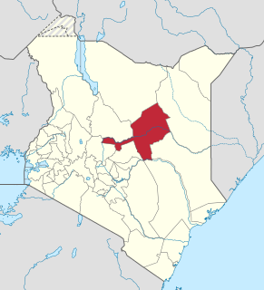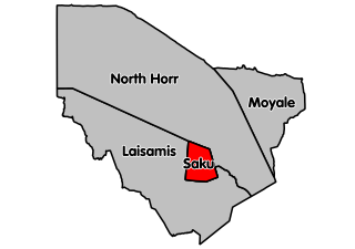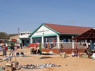
Marsabit is a town in the northern Marsabit County in Kenya. It is situated in the former Eastern Province and is almost surrounded by the Marsabit National Park and Marsabit National Reserve. The town is located 170 km east of the center of the East African Rift, at 37°58' E, 2°19' N at an elevation of between 1300 and 1400 metres. It serves as the capital of Marsabit County, and lies southeast of the Chalbi Desert in a forested area known for its volcanoes and crater lakes and others.

Isiolo is a town in Isiolo County, of which it is the capital. It is located in the middle of Kenya, and lies 285 kilometres north of the capital Nairobi. The town grew around the local military camps, much of the population being descended from former Somali soldiers who had fought in World War I as well as other Cushitic-speaking pastoral communities and the Ameru community. The town has an estimated population of 80,000 people, most of them living in the rural outbacks of the District. There is an increasing urban population in the recent years, especially from as far as Moyale, Marsabit and Mandera. The Isiolo town is also becoming a centre of interest because of its newly acquired status as a resort city cashing in on the popular Samburu and Shaba Game reserves, which have become preferred destinations after the famed Maasai Mara. Isiolo lies along the long A2 Road, leading towards Marsabit and Moyale much farther north.

Loiyangalani is a small town located on the southeastern coast of Lake Turkana in Kenya. The town has a population of 5,117. Loiyangalani means "a place of many trees" in the native Samburu tongue. It is home to Turkana people and was founded near a freshwater spring in the 1960s where the El Molo people live. Its main industries include fishing, tourism and gold panning. It is a popular tourist destination in Northern Kenya, as the surrounding El Molo and Turkana villages offer unique experiences.

Marsabit County is a county of Kenya. Covering a surface area of 66.923,1 square kilometres Marsabit is the largest county in Kenya. Its capital is Marsabit and its largest town Moyale. According to the 2019 census, the county has a population of 459,785. It is bordered to the North by Ethiopia, to the West by Turkana County to the South by Samburu County and Isiolo County, and to the East by Wajir County.

Marsabit is a 6300 km2 basaltic shield volcano in Kenya, located 170 km east of the center of the East African Rift, in Marsabit County near the town of Marsabit. This was primarily built during the Miocene, but some lava flows and explosive maar-forming eruptions have occurred more recently. At least two of the maars host crater lakes.

Isiolo County is a county in the former Eastern Province of Kenya. Its population is 268,002 and its capital is Isiolo. Isiolo County is to be the first county to be developed as part of the Kenya Vision 2030 program. Its capital and largest town is Isiolo. Other upcoming urban centres are: Garbatulla, Modogashe, Kinna, Merti and Oldonyiro.

Wajir County is a county in the former North Eastern Province of Kenya. Its capital and largest town is Wajir. The county has a population of 720,000 and an area of 55,840.6 km2. The county is bordered to the north by Ethiopia, to the northeast by Mandera County, to the east by Somalia, to the south by Garissa County, to the west by Isiolo County and to the northwest by Marsabit County. The county has six constituencies: eldas, Tarbaj, Wajir North, Wajir West, Wajir East, and Wajir South.

The districts of Kenya are divided into 262 divisions (matarafa). Divisions of Kenya are further subdivided into locations. The counties of Kenya are based on the merging of some of the districts on this list and since the divisions are one level under the districts they are the sub-counties. This is because Kenya recently changed its constitution and 47 Counties emerged. Here are the divisions listed below, by district :

The Marsabit National Park is a national park and nature reserve located at Mount Marsabit in northern Kenya, near the town of Marsabit. It is located 560 km north of Nairobi in Marsabit County in the former Eastern Province and its reserve is noted for its zebra population and bird sanctuary.

North Horr Constituency is an electoral constituency in Kenya. It is one of four constituencies in Marsabit County. The entire constituency is located within Marsabit County Council area. The constituency was established for the 1988 elections. It is the largest constituency in Kenya on land coverage and hosts the only true desert in Kenya, Chalbi desert. Kenya's well known politician Godana Bonaya was its first member of parliament, and he represented the constituency until his demise in a Kenya Air Force Y-12 plane crash on 10 April 2006 in which all the legislators from Marsabit county perished.

Laisamis Constituency is an electoral constituency in Kenya. It is one of four constituencies in Marsabit County. The entire constituency is located within Marsabit County Council area. The constituency was established for the 1988 elections. Formally known as Marsabit South, it was represented by Hon. Phillip Kurungu in the 1966 elections. From 1969-1988 Laisamis Constituency was represented by Hon. Haji Kholkhale Adichareh. Hon. Adichareh was a Lancaster House Conference delegate and was a fierce defender of Rendille land. He served 7 years at Shimo La Tewa prison on trumped up charges and emerge to lead his Rendille community for 20 years in parliament.

Marsabit central is an electoral constituency in Kenya. It is one of four constituencies in Marsabit County in Northern Kenya. It borders North Horr Constituency to the North and Laisamis Constituency to the South. The constituency was established for the 1988 elections. Marsabit town which is the county headquarters is in Saku constituency.

Moyale Constituency is an electoral constituency in Kenya. It is one of four constituencies in Marsabit County, and it was the only constituency in the former Moyale District. The constituency has nine wards, all electing councillors to the Moyale County Council. The constituency was established for the 1966 elections.

South Horr is a settlement in Kenya's former Rift Valley Province. It is located in Laisamis Constituency, of Marsabit County. The A4 Road from Maralal and Baragoi to Loyangalani passes through the village.

Sololo is a settlement in Kenya's former Eastern Province, now part of Marsabit County. It is the 4th largest urban centre in Marsabit County with a population of 5,104.

Marsabit Airport is an airport in Marsabit, Kenya.

Sub-counties are the decentralised units through which county governments of Kenya will provide functions and services. Except for the parts which fall under urban areas, sub-counties will coincide with the constituencies created under article 89 of the Constitution of Kenya. Sub-counties will be headed by a sub-county administrator, appointed by a County Public Service Board.
Local elections were held in Marsabit County to elect a Governor and County Assembly on 4 March 2013. Under the new constitution, which was passed in a 2010 referendum, the 2013 general elections were the first in which Governors and members of the County Assemblies for the newly created counties were elected.

Ukur Yattani Kanacho is a Kenyan politician and ambassador, and was appointed as Treasury Secretary on 14 January 2020.

Merille is a village in Marsabit County in northern Kenya. It is an emerging urban centre along the Isiolo-Moyale Highway, 120km south of Marsabit town.


